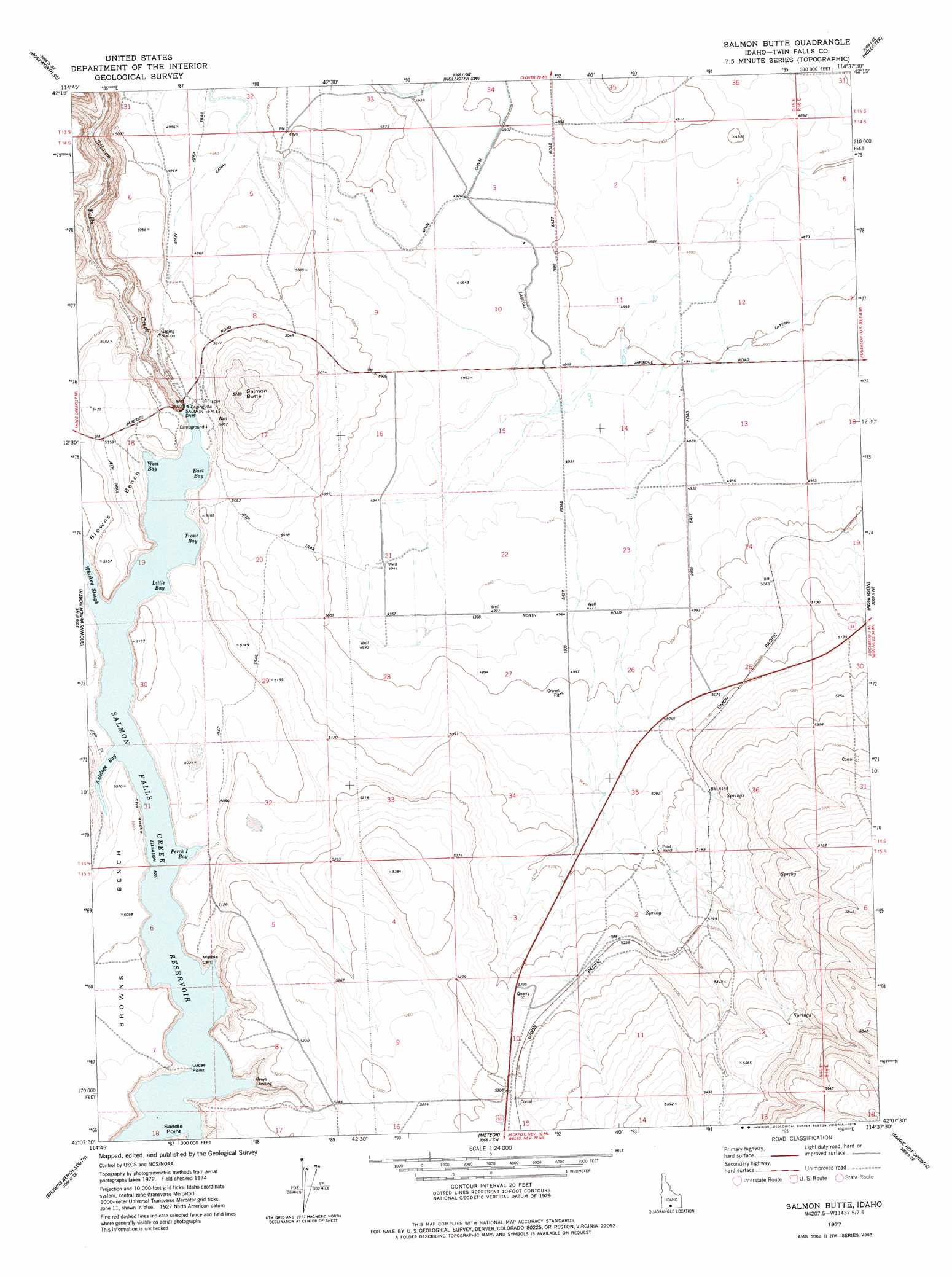
Salmon Butte Topo Map Idaho
To zoom in, hover over the map of Salmon Butte
USGS Topo Quad 42114b6 - 1:24,000 scale
| Topo Map Name: | Salmon Butte |
| USGS Topo Quad ID: | 42114b6 |
| Print Size: | ca. 21 1/4" wide x 27" high |
| Southeast Coordinates: | 42.125° N latitude / 114.625° W longitude |
| Map Center Coordinates: | 42.1875° N latitude / 114.6875° W longitude |
| U.S. State: | ID |
| Filename: | o42114b6.jpg |
| Download Map JPG Image: | Salmon Butte topo map 1:24,000 scale |
| Map Type: | Topographic |
| Topo Series: | 7.5´ |
| Map Scale: | 1:24,000 |
| Source of Map Images: | United States Geological Survey (USGS) |
| Alternate Map Versions: |
Salmon Butte ID 1977, updated 1978 Download PDF Buy paper map Salmon Butte ID 2010 Download PDF Buy paper map Salmon Butte ID 2013 Download PDF Buy paper map |
1:24,000 Topo Quads surrounding Salmon Butte
Tuanna Butte |
Roseworth Ne |
Berger Butte |
Berger |
Hub Butte |
Roseworth |
Roseworth Se |
Hollister Sw |
Hollister |
Mcmullen Basin |
Cedar Creek Reservoir |
Browns Bench North |
Salmon Butte |
Rogerson |
Hopper Gulch |
Taylor Canyon |
Browns Bench South |
Norton Canyon |
Magic Hot Springs |
Big Creek Ranch |
Bear Mountain |
Browns Bench Ranch |
Jackpot |
East Of Jackpot |
Gollaher Mountain |
> Back to 42114a1 at 1:100,000 scale
> Back to 42114a1 at 1:250,000 scale
> Back to U.S. Topo Maps home
Salmon Butte topo map: Gazetteer
Salmon Butte: Dams
Salmon Falls Dam elevation 1528m 5013′Salmon Butte: Populated Places
Greys Landing elevation 1535m 5036′Salmon Butte: Reservoirs
Salmon Falls Creek Reservoir elevation 1528m 5013′Salmon Butte: Summits
Salmon Butte elevation 1641m 5383′Salmon Butte: Valleys
Antelope Canyon elevation 1409m 4622′McCongle Canyon elevation 1579m 5180′
Salmon Butte digital topo map on disk
Buy this Salmon Butte topo map showing relief, roads, GPS coordinates and other geographical features, as a high-resolution digital map file on DVD: