Roseworth Topo Map Idaho
To zoom in, hover over the map of Roseworth
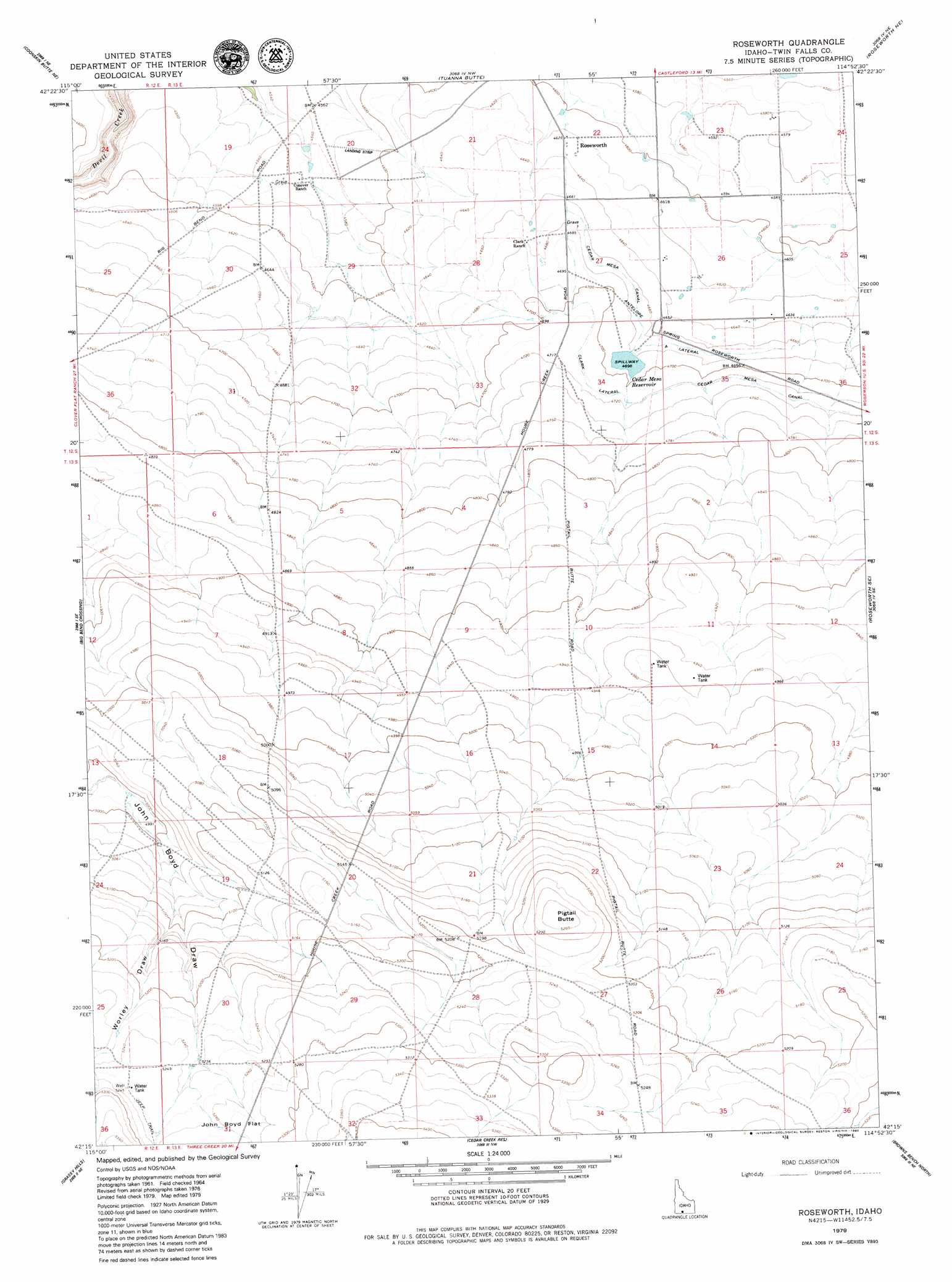
USGS Topo Quad 42114c8 - 1:24,000 scale
| Topo Map Name: | Roseworth |
| USGS Topo Quad ID: | 42114c8 |
| Print Size: | ca. 21 1/4" wide x 27" high |
| Southeast Coordinates: | 42.25° N latitude / 114.875° W longitude |
| Map Center Coordinates: | 42.3125° N latitude / 114.9375° W longitude |
| U.S. State: | ID |
| Filename: | o42114c8.jpg |
| Download Map JPG Image: | Roseworth topo map 1:24,000 scale |
| Map Type: | Topographic |
| Topo Series: | 7.5´ |
| Map Scale: | 1:24,000 |
| Source of Map Images: | United States Geological Survey (USGS) |
| Alternate Map Versions: |
Roseworth ID 1964, updated 1966 Download PDF Buy paper map Roseworth ID 1979, updated 1980 Download PDF Buy paper map Roseworth ID 2010 Download PDF Buy paper map Roseworth ID 2013 Download PDF Buy paper map |
1:24,000 Topo Quads surrounding Roseworth
Crows Nest |
Castleford Butte |
Balanced Rock |
Buhl |
Clover |
Horse Butte |
Coonskin Butte Ne |
Tuanna Butte |
Roseworth Ne |
Berger Butte |
Coonskin Butte |
Big Bend Crossing |
Roseworth |
Roseworth Se |
Hollister Sw |
Salls Crossing |
Grassy Hills |
Cedar Creek Reservoir |
Browns Bench North |
Salmon Butte |
Three Creek |
Curtis Draw |
Taylor Canyon |
Browns Bench South |
Norton Canyon |
> Back to 42114a1 at 1:100,000 scale
> Back to 42114a1 at 1:250,000 scale
> Back to U.S. Topo Maps home
Roseworth topo map: Gazetteer
Roseworth: Canals
Clark Lateral elevation 1437m 4714′Roseworth: Dams
Cedar Creek Holding Dam elevation 1432m 4698′Roseworth: Populated Places
Roseworth elevation 1412m 4632′Roseworth: Reservoirs
Cedar Mesa Reservoir elevation 1433m 4701′Roseworth: Streams
A Lateral elevation 1424m 4671′Roseworth: Summits
Pigtail Butte elevation 1605m 5265′Roseworth: Valleys
Worley Draw elevation 1549m 5082′Roseworth digital topo map on disk
Buy this Roseworth topo map showing relief, roads, GPS coordinates and other geographical features, as a high-resolution digital map file on DVD: