Milner Topo Map Idaho
To zoom in, hover over the map of Milner
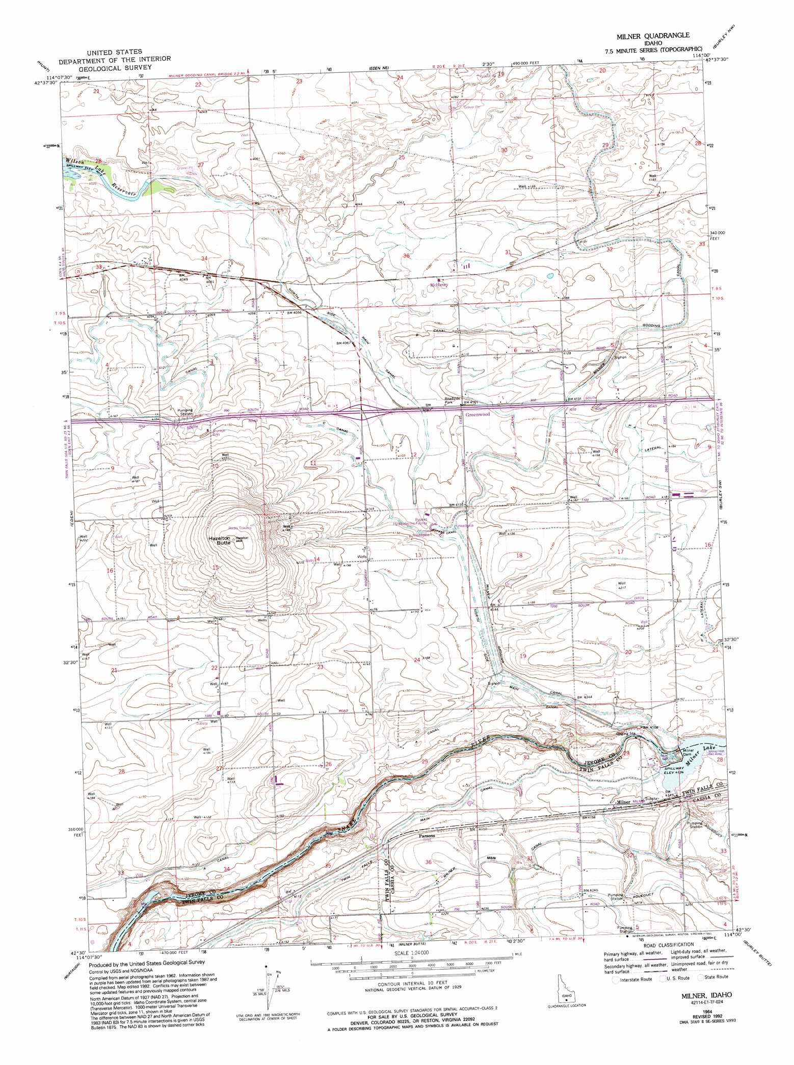
USGS Topo Quad 42114e1 - 1:24,000 scale
| Topo Map Name: | Milner |
| USGS Topo Quad ID: | 42114e1 |
| Print Size: | ca. 21 1/4" wide x 27" high |
| Southeast Coordinates: | 42.5° N latitude / 114° W longitude |
| Map Center Coordinates: | 42.5625° N latitude / 114.0625° W longitude |
| U.S. State: | ID |
| Filename: | o42114e1.jpg |
| Download Map JPG Image: | Milner topo map 1:24,000 scale |
| Map Type: | Topographic |
| Topo Series: | 7.5´ |
| Map Scale: | 1:24,000 |
| Source of Map Images: | United States Geological Survey (USGS) |
| Alternate Map Versions: |
Milner ID 1964, updated 1965 Download PDF Buy paper map Milner ID 1965, updated 1992 Download PDF Buy paper map Milner ID 2010 Download PDF Buy paper map Milner ID 2013 Download PDF Buy paper map |
1:24,000 Topo Quads surrounding Milner
Shoshone Se |
Star Lake |
Owinza Butte |
Kimama Butte |
Kimama |
Twin Falls Ne |
Hunt |
Eden Ne |
Burley Nw |
Burley Ne |
Kimberly |
Eden |
Milner |
Burley Sw |
Burley |
Stricker Butte |
Murtaugh |
Milner Butte |
Burley Butte |
Kenyon |
Grand View Peak |
Rams Horn Ridge |
Buckhorn Canyon |
Marion |
Marion Se |
> Back to 42114e1 at 1:100,000 scale
> Back to 42114a1 at 1:250,000 scale
> Back to U.S. Topo Maps home
Milner topo map: Gazetteer
Milner: Canals
A Canal elevation 1254m 4114′B Canal elevation 1255m 4117′
Bypass Canal elevation 1260m 4133′
C Lateral elevation 1278m 4192′
Hazelton B Spill elevation 1230m 4035′
Lateral C-11 elevation 1251m 4104′
Lateral C-54 elevation 1239m 4064′
Lateral PA elevation 1275m 4183′
Lateral PA1 elevation 1278m 4192′
Lateral PA2 elevation 1278m 4192′
Lateral PA2 Spill elevation 1274m 4179′
Lateral PA4 elevation 1263m 4143′
Lateral PA5 elevation 1278m 4192′
P A Lateral elevation 1280m 4199′
Milner: Dams
Milner Dam elevation 1260m 4133′Milner: Parks
Milner Historical Recreation Area elevation 1264m 4146′Milner: Populated Places
Greenwood elevation 1251m 4104′McHenry elevation 1246m 4087′
Milner elevation 1267m 4156′
Milner: Reservoirs
Milner Lake elevation 1260m 4133′Milner: Summits
Hazelton Butte elevation 1342m 4402′Milner digital topo map on disk
Buy this Milner topo map showing relief, roads, GPS coordinates and other geographical features, as a high-resolution digital map file on DVD: