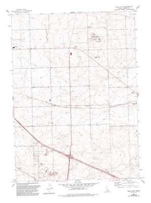
Falls City Topo Map Idaho
To zoom in, hover over the map of Falls City
USGS Topo Quad 42114f4 - 1:24,000 scale
| Topo Map Name: | Falls City |
| USGS Topo Quad ID: | 42114f4 |
| Print Size: | ca. 21 1/4" wide x 27" high |
| Southeast Coordinates: | 42.625° N latitude / 114.375° W longitude |
| Map Center Coordinates: | 42.6875° N latitude / 114.4375° W longitude |
| U.S. State: | ID |
| Filename: | o42114f4.jpg |
| Download Map JPG Image: | Falls City topo map 1:24,000 scale |
| Map Type: | Topographic |
| Topo Series: | 7.5´ |
| Map Scale: | 1:24,000 |
| Source of Map Images: | United States Geological Survey (USGS) |
| Alternate Map Versions: |
Falls City ID 1964, updated 1965 Download PDF Buy paper map Falls City ID 1964, updated 1993 Download PDF Buy paper map Falls City ID 1979, updated 1980 Download PDF Buy paper map Falls City ID 2010 Download PDF Buy paper map Falls City ID 2013 Download PDF Buy paper map |
1:24,000 Topo Quads surrounding Falls City
> Back to 42114e1 at 1:100,000 scale
> Back to 42114a1 at 1:250,000 scale
> Back to U.S. Topo Maps home
Falls City topo map: Gazetteer
Falls City: Airports
Jerome County Airport elevation 1224m 4015′Falls City: Canals
D Five Ditch elevation 1209m 3966′K Canal elevation 1168m 3832′
L Canal elevation 1193m 3914′
Lateral H-1 elevation 1165m 3822′
Lateral K-2 elevation 1106m 3628′
Lateral L-1 elevation 1172m 3845′
Lateral L-16 elevation 1178m 3864′
Lateral L-17 elevation 1149m 3769′
Lateral L-18 elevation 1160m 3805′
Lateral L-2 elevation 1161m 3809′
Lateral L-21 elevation 1147m 3763′
Lateral L-23 elevation 1152m 3779′
Lateral L-24 elevation 1188m 3897′
Lateral L-26 elevation 1157m 3795′
Lateral L-26 elevation 1169m 3835′
Lateral L-28 elevation 1173m 3848′
Lateral L-29 elevation 1133m 3717′
Lateral L-3 elevation 1162m 3812′
Lateral L-4 elevation 1147m 3763′
Lateral L-5 elevation 1149m 3769′
Lateral L-7 elevation 1178m 3864′
Lateral LA-4 elevation 1152m 3779′
Lateral M-10 elevation 1185m 3887′
Lateral M-9 elevation 1173m 3848′
PD-4 Ditch elevation 1205m 3953′
PD-5 Ditch elevation 1208m 3963′
Falls City: Populated Places
Barrymore elevation 1158m 3799′Falls City elevation 1171m 3841′
Sugar Loaf elevation 1171m 3841′
Falls City: Summits
Flat Top Butte elevation 1295m 4248′Falls City digital topo map on disk
Buy this Falls City topo map showing relief, roads, GPS coordinates and other geographical features, as a high-resolution digital map file on DVD:


