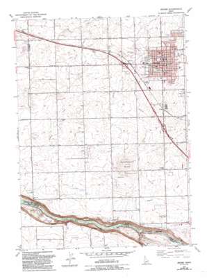
Jerome Topo Map Idaho
To zoom in, hover over the map of Jerome
USGS Topo Quad 42114f5 - 1:24,000 scale
| Topo Map Name: | Jerome |
| USGS Topo Quad ID: | 42114f5 |
| Print Size: | ca. 21 1/4" wide x 27" high |
| Southeast Coordinates: | 42.625° N latitude / 114.5° W longitude |
| Map Center Coordinates: | 42.6875° N latitude / 114.5625° W longitude |
| U.S. State: | ID |
| Filename: | o42114f5.jpg |
| Download Map JPG Image: | Jerome topo map 1:24,000 scale |
| Map Type: | Topographic |
| Topo Series: | 7.5´ |
| Map Scale: | 1:24,000 |
| Source of Map Images: | United States Geological Survey (USGS) |
| Alternate Map Versions: |
Jerome ID 1950, updated 1959 Download PDF Buy paper map Jerome ID 1950, updated 1959 Download PDF Buy paper map Jerome ID 1979, updated 1980 Download PDF Buy paper map Jerome ID 1979, updated 1993 Download PDF Buy paper map Jerome ID 2010 Download PDF Buy paper map Jerome ID 2013 Download PDF Buy paper map |
1:24,000 Topo Quads surrounding Jerome
> Back to 42114e1 at 1:100,000 scale
> Back to 42114a1 at 1:250,000 scale
> Back to U.S. Topo Maps home
Jerome topo map: Gazetteer
Jerome: Canals
Lateral J-17 elevation 1123m 3684′Lateral J-2 elevation 1121m 3677′
Lateral J-3 elevation 1075m 3526′
Lateral L-10 elevation 1144m 3753′
Lateral L-11 elevation 1133m 3717′
Lateral L-12 elevation 1147m 3763′
Lateral L-13 elevation 1165m 3822′
Lateral L-14 elevation 1133m 3717′
Lateral L-15 elevation 1169m 3835′
Lateral L-31 elevation 1141m 3743′
Lateral L-34 elevation 1132m 3713′
Lateral L-37 elevation 1163m 3815′
Lateral L-8 elevation 1124m 3687′
Lateral L-9 elevation 1111m 3645′
Lateral M-2 elevation 1159m 3802′
Lateral M-3 elevation 1144m 3753′
Lateral M-4 elevation 1163m 3815′
Lateral M-5 elevation 1145m 3756′
Lateral N-1 elevation 1113m 3651′
Lateral N-15 elevation 1093m 3585′
Lateral N-17 elevation 1101m 3612′
Lateral N-20 elevation 1114m 3654′
Lateral N-22 elevation 1114m 3654′
Lateral N-24 elevation 1081m 3546′
Lateral N-25 elevation 1102m 3615′
Lateral N-29 elevation 1070m 3510′
Lateral N-3 elevation 1106m 3628′
Lateral N-30 elevation 1090m 3576′
Lateral N32 elevation 1097m 3599′
Lateral N-33 elevation 1103m 3618′
Lateral N-34 elevation 1092m 3582′
Lateral N-37 elevation 1095m 3592′
Lateral N-4 elevation 1101m 3612′
Lateral N-41 elevation 1098m 3602′
Lateral N-43 elevation 1110m 3641′
Lateral N-44 elevation 1115m 3658′
Lateral N-45 elevation 1116m 3661′
Lateral N-5 elevation 1090m 3576′
Lateral N-7 elevation 1085m 3559′
Lateral N-8 elevation 1077m 3533′
Lateral N-9 elevation 1068m 3503′
Lateral S-1 elevation 1121m 3677′
Lateral S-14 elevation 1092m 3582′
Lateral S-15 elevation 1098m 3602′
Lateral S-17 elevation 1081m 3546′
Lateral S-18 elevation 1081m 3546′
Lateral S-43 elevation 1132m 3713′
Lateral S-6 elevation 1077m 3533′
M Canal Waste elevation 1145m 3756′
N Canal elevation 1120m 3674′
Jerome: Falls
Auger Falls elevation 921m 3021′Jerome: Parks
Camozzi Park elevation 1149m 3769′Candlelight Park elevation 1154m 3786′
Gayle Forsyth Memorial Park elevation 1159m 3802′
Jerome: Populated Places
Haytown (historical) elevation 1149m 3769′Hydra elevation 1139m 3736′
Jerome elevation 1147m 3763′
Jerome: Springs
Ellisons Spring elevation 940m 3083′Jerome: Streams
Alpheus Creek elevation 936m 3070′Rock Creek elevation 913m 2995′
Warm Creek elevation 941m 3087′
Jerome: Summits
Sonnickson Butte elevation 1141m 3743′Jerome digital topo map on disk
Buy this Jerome topo map showing relief, roads, GPS coordinates and other geographical features, as a high-resolution digital map file on DVD:


