Niagara Springs Topo Map Idaho
To zoom in, hover over the map of Niagara Springs
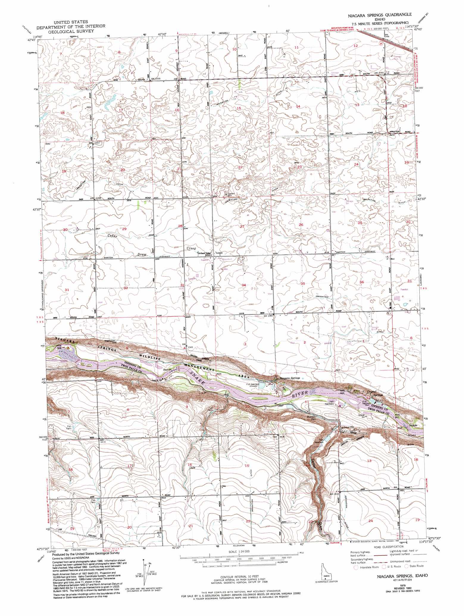
USGS Topo Quad 42114f6 - 1:24,000 scale
| Topo Map Name: | Niagara Springs |
| USGS Topo Quad ID: | 42114f6 |
| Print Size: | ca. 21 1/4" wide x 27" high |
| Southeast Coordinates: | 42.625° N latitude / 114.625° W longitude |
| Map Center Coordinates: | 42.6875° N latitude / 114.6875° W longitude |
| U.S. State: | ID |
| Filename: | o42114f6.jpg |
| Download Map JPG Image: | Niagara Springs topo map 1:24,000 scale |
| Map Type: | Topographic |
| Topo Series: | 7.5´ |
| Map Scale: | 1:24,000 |
| Source of Map Images: | United States Geological Survey (USGS) |
| Alternate Map Versions: |
Niagara Springs ID 1950, updated 1952 Download PDF Buy paper map Niagara Springs ID 1950, updated 1975 Download PDF Buy paper map Niagara Springs ID 1979, updated 1980 Download PDF Buy paper map Niagara Springs ID 1979, updated 1992 Download PDF Buy paper map Niagara Springs ID 2010 Download PDF Buy paper map Niagara Springs ID 2013 Download PDF Buy paper map |
1:24,000 Topo Quads surrounding Niagara Springs
Bliss |
Gooding Butte |
Gooding |
Tunupa |
Shoshone |
Hagerman |
Tuttle |
Wendell |
Gooding Se |
Shoshone Sw |
Yahoo Creek |
Thousand Springs |
Niagara Springs |
Jerome |
Falls City |
Balanced Rock |
Buhl |
Clover |
Filer |
Twin Falls |
Tuanna Butte |
Roseworth Ne |
Berger Butte |
Berger |
Hub Butte |
> Back to 42114e1 at 1:100,000 scale
> Back to 42114a1 at 1:250,000 scale
> Back to U.S. Topo Maps home
Niagara Springs topo map: Gazetteer
Niagara Springs: Canals
J-11 Pipeline elevation 1012m 3320′Lateral J-8 elevation 1029m 3375′
Lateral N-10 elevation 1042m 3418′
Lateral N-23 elevation 1044m 3425′
Lateral S-10 elevation 1031m 3382′
Lateral S-20 elevation 1064m 3490′
Lateral S-23 elevation 1026m 3366′
Lateral S-25 elevation 1023m 3356′
Lateral S-8 elevation 1061m 3480′
Waste Ditch elevation 1063m 3487′
Niagara Springs: Parks
Niagara Springs Wildlife Management Area elevation 918m 3011′Niagara Springs: Populated Places
Appleton elevation 1058m 3471′Niagara Springs: Slopes
Crystal Springs Grade elevation 995m 3264′Niagara Springs Grade elevation 947m 3106′
Niagara Springs: Springs
Crystal Springs elevation 949m 3113′Niagara Springs elevation 976m 3202′
Niagara Springs: Valleys
Cedar Draw elevation 907m 2975′Niagara Springs digital topo map on disk
Buy this Niagara Springs topo map showing relief, roads, GPS coordinates and other geographical features, as a high-resolution digital map file on DVD: