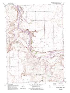
Thousand Springs Topo Map Idaho
To zoom in, hover over the map of Thousand Springs
USGS Topo Quad 42114f7 - 1:24,000 scale
| Topo Map Name: | Thousand Springs |
| USGS Topo Quad ID: | 42114f7 |
| Print Size: | ca. 21 1/4" wide x 27" high |
| Southeast Coordinates: | 42.625° N latitude / 114.75° W longitude |
| Map Center Coordinates: | 42.6875° N latitude / 114.8125° W longitude |
| U.S. State: | ID |
| Filename: | o42114f7.jpg |
| Download Map JPG Image: | Thousand Springs topo map 1:24,000 scale |
| Map Type: | Topographic |
| Topo Series: | 7.5´ |
| Map Scale: | 1:24,000 |
| Source of Map Images: | United States Geological Survey (USGS) |
| Alternate Map Versions: |
Thousand Springs ID 1949, updated 1960 Download PDF Buy paper map Thousand Springs ID 1949, updated 1962 Download PDF Buy paper map Thousand Springs ID 1949, updated 1965 Download PDF Buy paper map Thousand Springs ID 1949, updated 1965 Download PDF Buy paper map Thousand Springs ID 1949, updated 1966 Download PDF Buy paper map Thousand Springs ID 1949, updated 1986 Download PDF Buy paper map Thousand Springs ID 1949, updated 1993 Download PDF Buy paper map Thousand Springs ID 1951 Download PDF Buy paper map Thousand Springs ID 1954 Download PDF Buy paper map Thousand Springs ID 2010 Download PDF Buy paper map Thousand Springs ID 2013 Download PDF Buy paper map |
1:24,000 Topo Quads surrounding Thousand Springs
> Back to 42114e1 at 1:100,000 scale
> Back to 42114a1 at 1:250,000 scale
> Back to U.S. Topo Maps home
Thousand Springs topo map: Gazetteer
Thousand Springs: Basins
Melon Valley elevation 978m 3208′Thousand Springs: Canals
Lateral S-19 elevation 979m 3211′Lateral S-22 elevation 1000m 3280′
Lateral S-27 elevation 994m 3261′
Lateral S-29 elevation 978m 3208′
Lateral S-31 elevation 986m 3234′
Lateral S-39 elevation 988m 3241′
Lateral W-14 elevation 998m 3274′
Lateral W-15 elevation 985m 3231′
Lateral W-18 elevation 987m 3238′
Lateral W-28 elevation 1000m 3280′
Lateral W-56 elevation 998m 3274′
Lateral W-58 elevation 988m 3241′
Thousand Springs: Cliffs
Eagle Bluff elevation 1004m 3293′Thousand Springs: Dams
Clear Lake Dam elevation 905m 2969′Thousand Springs: Falls
Devils Washboard Falls elevation 903m 2962′Thousand Springs: Populated Places
Abbey (historical) elevation 1098m 3602′Austin (historical) elevation 1019m 3343′
Thousand Springs: Rapids
Kanaka Rapids elevation 882m 2893′Thousand Springs: Reservoirs
Clear Lake elevation 905m 2969′Clear Lakes elevation 905m 2969′
Thousand Springs: Springs
Banbury Springs elevation 912m 2992′Blue Heart Springs elevation 877m 2877′
Hot Sulphur Springs elevation 884m 2900′
Sand Springs elevation 884m 2900′
Thousand Springs elevation 890m 2919′
Thousand Springs: Streams
Briggs Creek elevation 880m 2887′Cedar Draw Creek elevation 877m 2877′
Clear Creek elevation 993m 3257′
Deep Creek elevation 883m 2896′
Mud Creek elevation 884m 2900′
Salmon Falls Creek elevation 879m 2883′
Sand Springs Creek elevation 878m 2880′
Thousand Springs: Valleys
Blind Canyon elevation 883m 2896′Box Canyon elevation 894m 2933′
Thousand Springs digital topo map on disk
Buy this Thousand Springs topo map showing relief, roads, GPS coordinates and other geographical features, as a high-resolution digital map file on DVD:


