Curtis Draw Topo Map Idaho
To zoom in, hover over the map of Curtis Draw
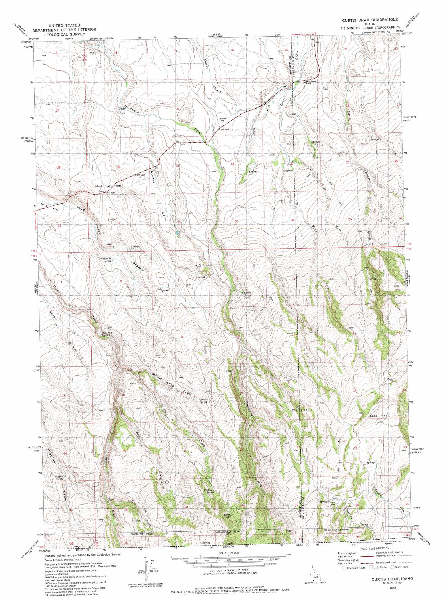
USGS Topo Quad 42115a1 - 1:24,000 scale
| Topo Map Name: | Curtis Draw |
| USGS Topo Quad ID: | 42115a1 |
| Print Size: | ca. 21 1/4" wide x 27" high |
| Southeast Coordinates: | 42° N latitude / 115° W longitude |
| Map Center Coordinates: | 42.0625° N latitude / 115.0625° W longitude |
| U.S. State: | ID |
| Filename: | o42115a1.jpg |
| Download Map JPG Image: | Curtis Draw topo map 1:24,000 scale |
| Map Type: | Topographic |
| Topo Series: | 7.5´ |
| Map Scale: | 1:24,000 |
| Source of Map Images: | United States Geological Survey (USGS) |
| Alternate Map Versions: |
Curtis Draw ID 1980, updated 1980 Download PDF Buy paper map Curtis Draw ID 1980, updated 1986 Download PDF Buy paper map Curtis Draw ID 2011 Download PDF Buy paper map Curtis Draw ID 2013 Download PDF Buy paper map |
1:24,000 Topo Quads surrounding Curtis Draw
Juniper Butte |
Coonskin Butte |
Big Bend Crossing |
Roseworth |
Roseworth Se |
Mosquito Lake Butte |
Salls Crossing |
Grassy Hills |
Cedar Creek Reservoir |
Browns Bench North |
Murphy Hot Springs |
Three Creek |
Curtis Draw |
Taylor Canyon |
Browns Bench South |
Robinson Creek |
Caudle Creek |
Elk Mountain |
Bear Mountain |
Browns Bench Ranch |
Gods Pocket Peak |
Goat Creek |
Buckhorn Ridge |
Twin Meadows Ranch |
Contact |
> Back to 42115a1 at 1:100,000 scale
> Back to 42114a1 at 1:250,000 scale
> Back to U.S. Topo Maps home
Curtis Draw topo map: Gazetteer
Curtis Draw: Crossings
Three Mile Crossing elevation 1803m 5915′Curtis Draw: Springs
Basque Spring elevation 1887m 6190′Granite Spring elevation 2013m 6604′
Higgins Spring elevation 1894m 6213′
Pinkston Spring elevation 2119m 6952′
Whiteside Spring elevation 1790m 5872′
Curtis Draw: Streams
Axe Creek elevation 1863m 6112′Cave Creek elevation 1941m 6368′
East Fork Devil Creek elevation 1783m 5849′
Middle Fork Devil Creek elevation 1788m 5866′
Pole Creek elevation 1875m 6151′
West Fork Devil Creek elevation 1759m 5770′
Curtis Draw: Summits
Mud Flat Hill elevation 1831m 6007′Curtis Draw: Valleys
Curtis Draw elevation 1754m 5754′Granite Spring Draw elevation 1834m 6017′
Curtis Draw digital topo map on disk
Buy this Curtis Draw topo map showing relief, roads, GPS coordinates and other geographical features, as a high-resolution digital map file on DVD: