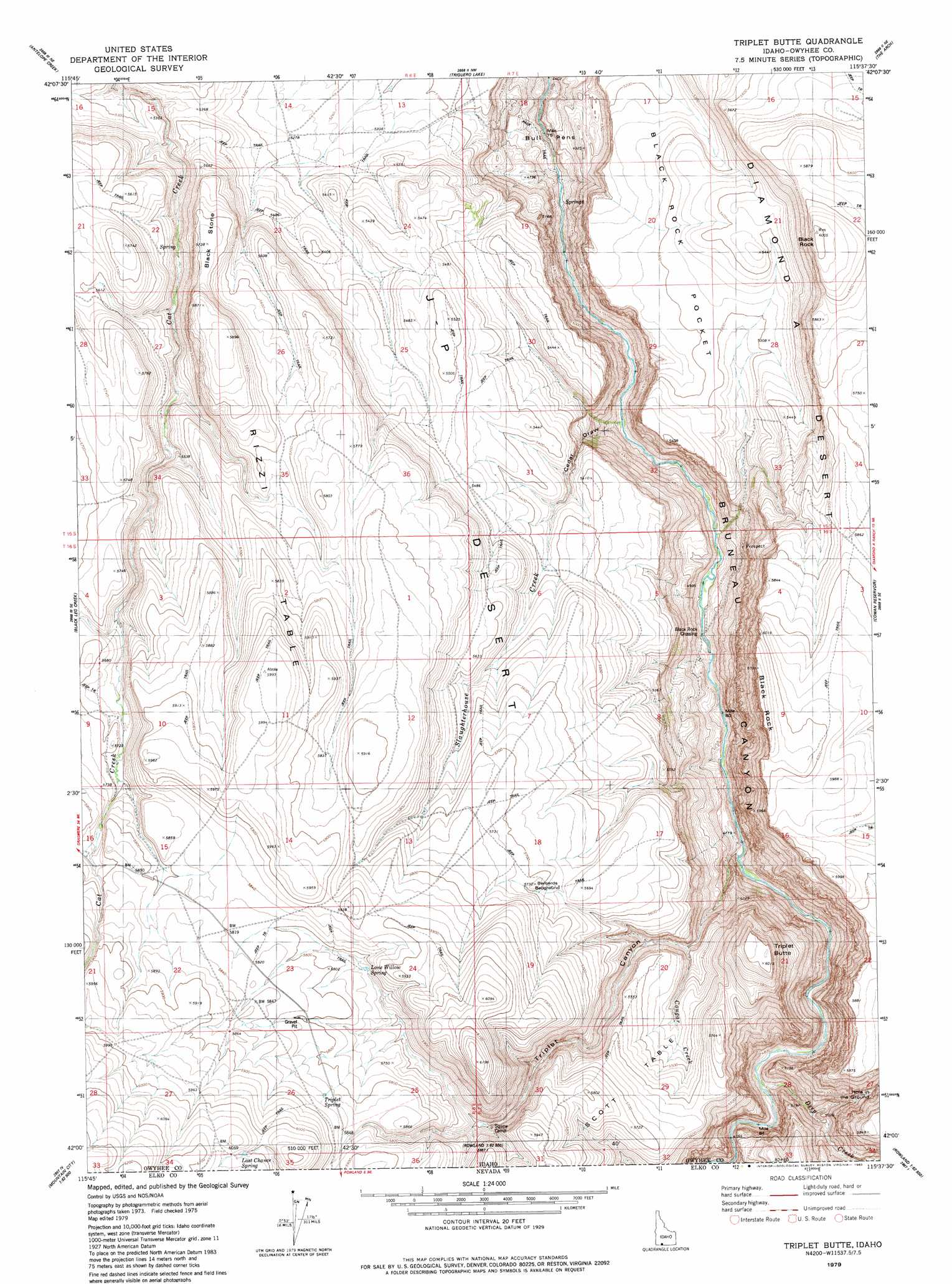
Triplet Butte Topo Map Idaho
To zoom in, hover over the map of Triplet Butte
USGS Topo Quad 42115a6 - 1:24,000 scale
| Topo Map Name: | Triplet Butte |
| USGS Topo Quad ID: | 42115a6 |
| Print Size: | ca. 21 1/4" wide x 27" high |
| Southeast Coordinates: | 42° N latitude / 115.625° W longitude |
| Map Center Coordinates: | 42.0625° N latitude / 115.6875° W longitude |
| U.S. State: | ID |
| Filename: | o42115a6.jpg |
| Download Map JPG Image: | Triplet Butte topo map 1:24,000 scale |
| Map Type: | Topographic |
| Topo Series: | 7.5´ |
| Map Scale: | 1:24,000 |
| Source of Map Images: | United States Geological Survey (USGS) |
| Alternate Map Versions: |
Triplet Butte ID 1979, updated 1980 Download PDF Buy paper map Triplet Butte ID 2010 Download PDF Buy paper map Triplet Butte ID 2013 Download PDF Buy paper map |
1:24,000 Topo Quads surrounding Triplet Butte
Grasmere Reservoir |
Buster Butte |
Indian Hot Springs |
Inside Lakes |
Clover Butte South |
Buckhorn |
Antelope Creek |
Triguero Lake |
The Arch |
Poison Butte |
Indian Hay Meadows |
Black Leg Creek |
Triplet Butte |
Cowan Reservoir |
Dishpan |
Winter Ridge |
Hicks Mountain |
Big Table |
Bearpaw Mountain |
Jarbidge North |
Mountain City |
Merritt Mountain |
Tennessee Mountain |
Coon Creek |
Jarbidge South |
> Back to 42115a1 at 1:100,000 scale
> Back to 42114a1 at 1:250,000 scale
> Back to U.S. Topo Maps home
Triplet Butte topo map: Gazetteer
Triplet Butte: Basins
Black Rock Pocket elevation 1604m 5262′Triplet Butte: Crossings
Black Rock Crossing elevation 1402m 4599′Triplet Butte: Flats
Bernards Bedground elevation 1729m 5672′Triplet Butte: Springs
Lone Willow Spring elevation 1753m 5751′Triplet Spring elevation 1786m 5859′
Triplet Butte: Streams
Cougar Creek elevation 1586m 5203′Deep Creek elevation 1444m 4737′
Deep Creek elevation 1444m 4737′
Slaughterhouse Creek elevation 1386m 4547′
Triplet Butte: Summits
Black Rock elevation 1830m 6003′Black Stone elevation 1746m 5728′
Rizzi Table elevation 1826m 5990′
Triplet Butte elevation 1833m 6013′
Triplet Butte: Valleys
Cedar Draw elevation 1386m 4547′Hole in the Ground elevation 1500m 4921′
Triplet Canyon elevation 1440m 4724′
Triplet Canyon elevation 1427m 4681′
Triplet Butte digital topo map on disk
Buy this Triplet Butte topo map showing relief, roads, GPS coordinates and other geographical features, as a high-resolution digital map file on DVD: