Big Bend Crossing Topo Map Idaho
To zoom in, hover over the map of Big Bend Crossing
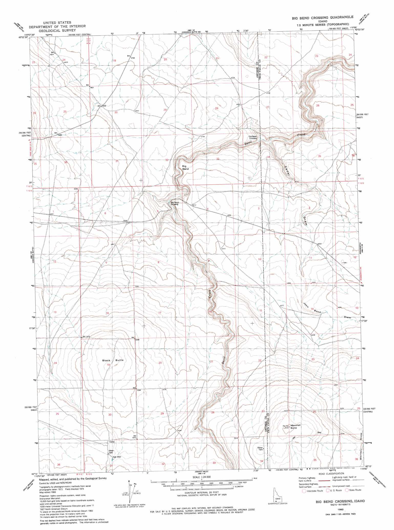
USGS Topo Quad 42115c1 - 1:24,000 scale
| Topo Map Name: | Big Bend Crossing |
| USGS Topo Quad ID: | 42115c1 |
| Print Size: | ca. 21 1/4" wide x 27" high |
| Southeast Coordinates: | 42.25° N latitude / 115° W longitude |
| Map Center Coordinates: | 42.3125° N latitude / 115.0625° W longitude |
| U.S. State: | ID |
| Filename: | o42115c1.jpg |
| Download Map JPG Image: | Big Bend Crossing topo map 1:24,000 scale |
| Map Type: | Topographic |
| Topo Series: | 7.5´ |
| Map Scale: | 1:24,000 |
| Source of Map Images: | United States Geological Survey (USGS) |
| Alternate Map Versions: |
Big Bend Crossing ID 1980, updated 1980 Download PDF Buy paper map Big Bend Crossing ID 2010 Download PDF Buy paper map Big Bend Crossing ID 2013 Download PDF Buy paper map |
1:24,000 Topo Quads surrounding Big Bend Crossing
Crows Nest Butte |
Crows Nest |
Castleford Butte |
Balanced Rock |
Buhl |
Juniper Ranch |
Horse Butte |
Coonskin Butte Ne |
Tuanna Butte |
Roseworth Ne |
Juniper Butte |
Coonskin Butte |
Big Bend Crossing |
Roseworth |
Roseworth Se |
Mosquito Lake Butte |
Salls Crossing |
Grassy Hills |
Cedar Creek Reservoir |
Browns Bench North |
Murphy Hot Springs |
Three Creek |
Curtis Draw |
Taylor Canyon |
Browns Bench South |
> Back to 42115a1 at 1:100,000 scale
> Back to 42114a1 at 1:250,000 scale
> Back to U.S. Topo Maps home
Big Bend Crossing topo map: Gazetteer
Big Bend Crossing: Crossings
Big Bend Crossing elevation 1439m 4721′Old Bend Crossing elevation 1387m 4550′
Big Bend Crossing: Summits
Black Butte elevation 1641m 5383′Marshall Butte elevation 1680m 5511′
Big Bend Crossing: Valleys
Cedar Draw elevation 1386m 4547′John Boyd Draw elevation 1467m 4812′
Big Bend Crossing: Wells
Heil Well elevation 1636m 5367′Big Bend Crossing digital topo map on disk
Buy this Big Bend Crossing topo map showing relief, roads, GPS coordinates and other geographical features, as a high-resolution digital map file on DVD: