Broken Wagon Flat Topo Map Idaho
To zoom in, hover over the map of Broken Wagon Flat
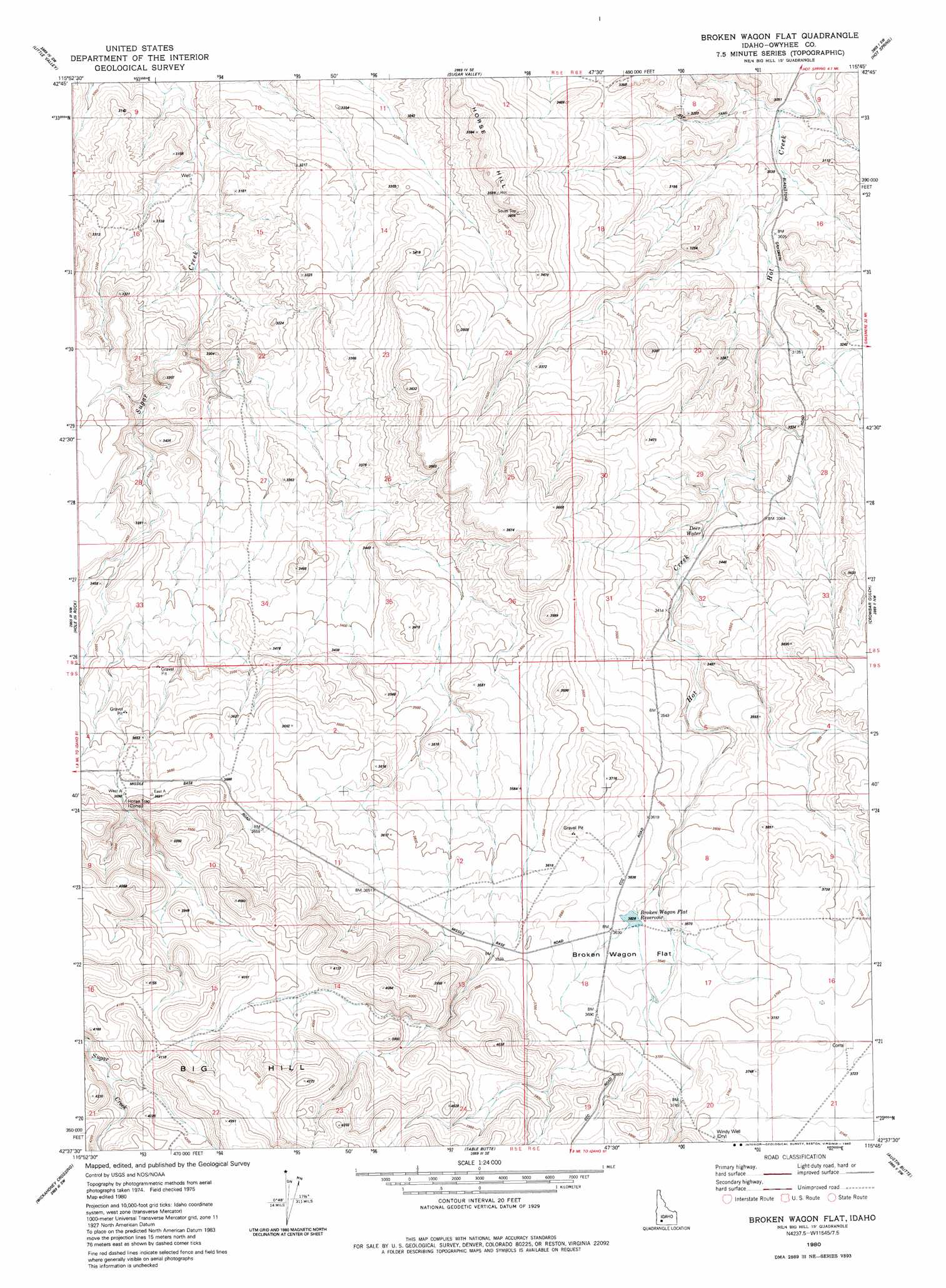
USGS Topo Quad 42115f7 - 1:24,000 scale
| Topo Map Name: | Broken Wagon Flat |
| USGS Topo Quad ID: | 42115f7 |
| Print Size: | ca. 21 1/4" wide x 27" high |
| Southeast Coordinates: | 42.625° N latitude / 115.75° W longitude |
| Map Center Coordinates: | 42.6875° N latitude / 115.8125° W longitude |
| U.S. State: | ID |
| Filename: | o42115f7.jpg |
| Download Map JPG Image: | Broken Wagon Flat topo map 1:24,000 scale |
| Map Type: | Topographic |
| Topo Series: | 7.5´ |
| Map Scale: | 1:24,000 |
| Source of Map Images: | United States Geological Survey (USGS) |
| Alternate Map Versions: |
Broken Wagon Flat ID 1980, updated 1980 Download PDF Buy paper map Broken Wagon Flat ID 2010 Download PDF Buy paper map Broken Wagon Flat ID 2013 Download PDF Buy paper map |
1:24,000 Topo Quads surrounding Broken Wagon Flat
Grand View |
C J Strike Dam |
Bruneau |
Bruneau Dunes |
Indian Cove |
Chalk Hills |
Little Valley |
Sugar Valley |
Hot Spring |
Pence Butte |
Big Horse Basin Gap |
Hole In Rock |
Broken Wagon Flat |
Crowbar Gulch |
Pot Hole Butte |
Hill Pasture |
Wickahoney Crossing |
Table Butte |
Austin Butte |
Winter Camp |
Wickahoney Point |
Grasmere |
Blackstone Reservoir |
Cave Draw |
Stiff Tree Draw |
> Back to 42115e1 at 1:100,000 scale
> Back to 42114a1 at 1:250,000 scale
> Back to U.S. Topo Maps home
Broken Wagon Flat topo map: Gazetteer
Broken Wagon Flat: Flats
Broken Wagon Flat elevation 1118m 3667′Broken Wagon Flat: Reservoirs
Broken Wagon Flat Reservoir elevation 1103m 3618′Broken Wagon Flat: Springs
Deer Water elevation 1007m 3303′Broken Wagon Flat: Summits
Horse Hill elevation 1095m 3592′Broken Wagon Flat digital topo map on disk
Buy this Broken Wagon Flat topo map showing relief, roads, GPS coordinates and other geographical features, as a high-resolution digital map file on DVD: