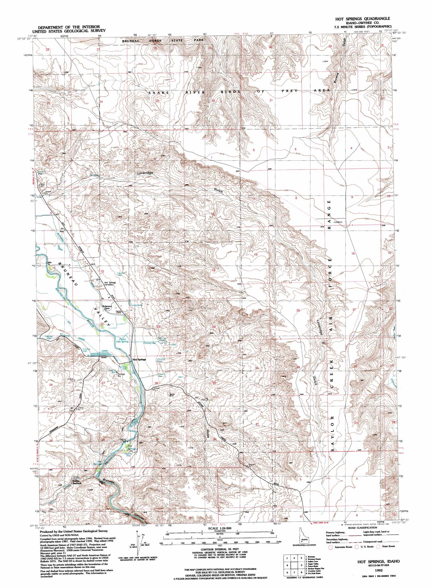
Hot Spring Topo Map Idaho
To zoom in, hover over the map of Hot Spring
USGS Topo Quad 42115g6 - 1:24,000 scale
| Topo Map Name: | Hot Spring |
| USGS Topo Quad ID: | 42115g6 |
| Print Size: | ca. 21 1/4" wide x 27" high |
| Southeast Coordinates: | 42.75° N latitude / 115.625° W longitude |
| Map Center Coordinates: | 42.8125° N latitude / 115.6875° W longitude |
| U.S. State: | ID |
| Filename: | o42115g6.jpg |
| Download Map JPG Image: | Hot Spring topo map 1:24,000 scale |
| Map Type: | Topographic |
| Topo Series: | 7.5´ |
| Map Scale: | 1:24,000 |
| Source of Map Images: | United States Geological Survey (USGS) |
| Alternate Map Versions: |
Hot Spring ID 1947, updated 1970 Download PDF Buy paper map Hot Spring ID 1949 Download PDF Buy paper map Hot Springs ID 1992, updated 1992 Download PDF Buy paper map Hot Springs ID 2010 Download PDF Buy paper map Hot Springs ID 2013 Download PDF Buy paper map |
1:24,000 Topo Quads surrounding Hot Spring
Crater Rings Sw |
Crater Rings Se |
Mountain Home South |
Reverse |
Hot Springs Creek Reservoir |
C J Strike Dam |
Bruneau |
Bruneau Dunes |
Indian Cove |
Hammett |
Little Valley |
Sugar Valley |
Hot Spring |
Pence Butte |
Pot Hole Canyon |
Hole In Rock |
Broken Wagon Flat |
Crowbar Gulch |
Pot Hole Butte |
Black Butte West |
Wickahoney Crossing |
Table Butte |
Austin Butte |
Winter Camp |
Hodge Station |
> Back to 42115e1 at 1:100,000 scale
> Back to 42114a1 at 1:250,000 scale
> Back to U.S. Topo Maps home
Hot Spring topo map: Gazetteer
Hot Spring: Airports
Owen Ranches Inc Airport elevation 793m 2601′Hot Spring: Canals
Hot Spring Canal elevation 790m 2591′Hot Spring: Dams
Buckaroo Dam elevation 791m 2595′Harris Dam elevation 797m 2614′
Hot Spring: Populated Places
Hot Springs elevation 789m 2588′Hot Spring: Springs
Bat Hot Spring (historical) elevation 786m 2578′Falls Hot Springs elevation 827m 2713′
Pence Hot Spring elevation 789m 2588′
Hot Spring: Streams
Hot Creek elevation 803m 2634′Hot Spring: Valleys
Bruneau Canyon elevation 791m 2595′Loveridge Gulch elevation 791m 2595′
Seventy One Gulch elevation 815m 2673′
Hot Spring digital topo map on disk
Buy this Hot Spring topo map showing relief, roads, GPS coordinates and other geographical features, as a high-resolution digital map file on DVD: