Bruneau Dunes Topo Map Idaho
To zoom in, hover over the map of Bruneau Dunes
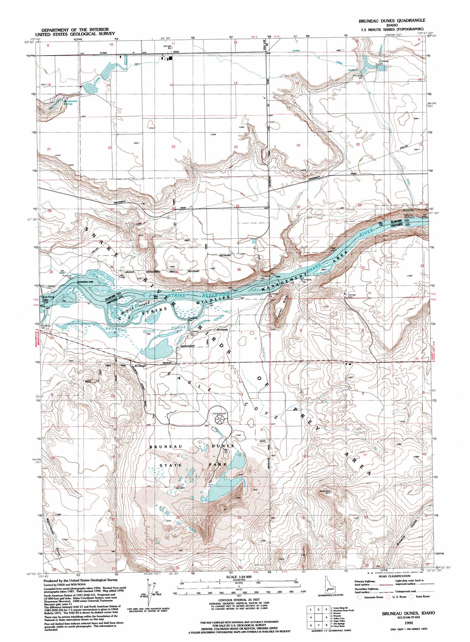
USGS Topo Quad 42115h6 - 1:24,000 scale
| Topo Map Name: | Bruneau Dunes |
| USGS Topo Quad ID: | 42115h6 |
| Print Size: | ca. 21 1/4" wide x 27" high |
| Southeast Coordinates: | 42.875° N latitude / 115.625° W longitude |
| Map Center Coordinates: | 42.9375° N latitude / 115.6875° W longitude |
| U.S. State: | ID |
| Filename: | o42115h6.jpg |
| Download Map JPG Image: | Bruneau Dunes topo map 1:24,000 scale |
| Map Type: | Topographic |
| Topo Series: | 7.5´ |
| Map Scale: | 1:24,000 |
| Source of Map Images: | United States Geological Survey (USGS) |
| Alternate Map Versions: |
Sand Dunes ID 1947, updated 1966 Download PDF Buy paper map Sand Dunes ID 1947, updated 1977 Download PDF Buy paper map Sand Dunes ID 1947, updated 1978 Download PDF Buy paper map Bruneau Dunes ID 1947, updated 1986 Download PDF Buy paper map Sand Dunes ID 1948 Download PDF Buy paper map Bruneau Dunes ID 1992, updated 1992 Download PDF Buy paper map Bruneau Dunes ID 2010 Download PDF Buy paper map Bruneau Dunes ID 2013 Download PDF Buy paper map |
1:24,000 Topo Quads surrounding Bruneau Dunes
Cinder Cone Butte |
Crater Rings |
Mountain Home North |
Teapot Dome |
Bennett Mountain |
Crater Rings Sw |
Crater Rings Se |
Mountain Home South |
Reverse |
Hot Springs Creek Reservoir |
C J Strike Dam |
Bruneau |
Bruneau Dunes |
Indian Cove |
Hammett |
Little Valley |
Sugar Valley |
Hot Spring |
Pence Butte |
Pot Hole Canyon |
Hole In Rock |
Broken Wagon Flat |
Crowbar Gulch |
Pot Hole Butte |
Black Butte West |
> Back to 42115e1 at 1:100,000 scale
> Back to 42114a1 at 1:250,000 scale
> Back to U.S. Topo Maps home
Bruneau Dunes topo map: Gazetteer
Bruneau Dunes: Areas
Bruneau Duck Ponds elevation 750m 2460′Bruneau Dunes: Canals
Flying H Canal elevation 927m 3041′Bruneau Dunes: Dams
Watson Dam elevation 922m 3024′Bruneau Dunes: Islands
Blacks Island (historical) elevation 749m 2457′Wilkins Island elevation 751m 2463′
Bruneau Dunes: Lakes
Dunes Lake elevation 758m 2486′Bruneau Dunes: Parks
Bruneau Dunes State Park elevation 761m 2496′Snake River Birds of Prey Area elevation 923m 3028′
Bruneau Dunes: Springs
Rattlesnake Springs elevation 886m 2906′Bruneau Dunes: Summits
Flatiron Butte elevation 863m 2831′Bruneau Dunes: Valleys
Eagle Cove elevation 757m 2483′Bruneau Dunes digital topo map on disk
Buy this Bruneau Dunes topo map showing relief, roads, GPS coordinates and other geographical features, as a high-resolution digital map file on DVD: