Coyote Hole Topo Map Idaho
To zoom in, hover over the map of Coyote Hole
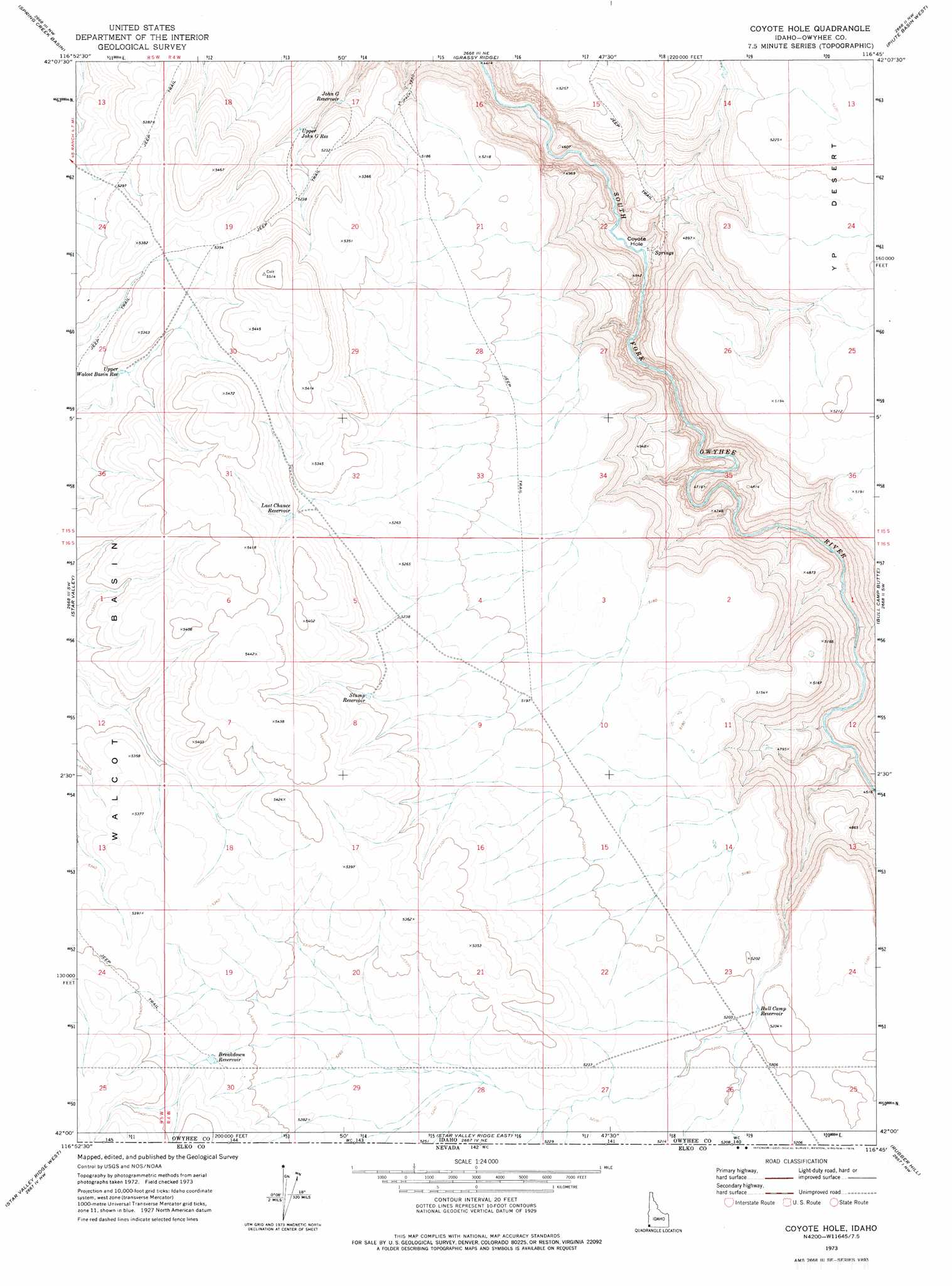
USGS Topo Quad 42116a7 - 1:24,000 scale
| Topo Map Name: | Coyote Hole |
| USGS Topo Quad ID: | 42116a7 |
| Print Size: | ca. 21 1/4" wide x 27" high |
| Southeast Coordinates: | 42° N latitude / 116.75° W longitude |
| Map Center Coordinates: | 42.0625° N latitude / 116.8125° W longitude |
| U.S. State: | ID |
| Filename: | o42116a7.jpg |
| Download Map JPG Image: | Coyote Hole topo map 1:24,000 scale |
| Map Type: | Topographic |
| Topo Series: | 7.5´ |
| Map Scale: | 1:24,000 |
| Source of Map Images: | United States Geological Survey (USGS) |
| Alternate Map Versions: |
Coyote Hole ID 1973, updated 1976 Download PDF Buy paper map Coyote Hole ID 2010 Download PDF Buy paper map Coyote Hole ID 2013 Download PDF Buy paper map |
1:24,000 Topo Quads surrounding Coyote Hole
Beaver Charlie Breaks |
Bull Basin Camp |
Red Basin |
Brace Flat |
Dickshooter Ridge |
Defeat Butte |
Spring Creek Basin |
Grassy Ridge |
Piute Basin West |
Piute Basin East |
Star Valley Knoll |
Star Valley |
Coyote Hole |
Bull Camp Butte |
Four Corners |
Nadine Butte |
Star Valley Ridge West |
Star Valley Ridge East |
Rubber Hill |
State Line Camp |
Maiden Butte Se |
Star Valley Ridge Sw |
Star Valley Ridge Se |
Twelvemile Flat |
Peterson Table West |
> Back to 42116a1 at 1:100,000 scale
> Back to 42116a1 at 1:250,000 scale
> Back to U.S. Topo Maps home
Coyote Hole topo map: Gazetteer
Coyote Hole: Basins
Walcot Basin elevation 1610m 5282′Coyote Hole: Bends
Coyote Hole elevation 1358m 4455′Coyote Hole: Reservoirs
Breakdown Reservoir elevation 1627m 5337′Bull Camp Reservoir elevation 1586m 5203′
John G Reservoir elevation 1536m 5039′
Last Chance Reservoir elevation 1619m 5311′
Stump Reservoir elevation 1613m 5291′
Upper John G Reservoir elevation 1577m 5173′
Upper Walcot Basin Reservoir elevation 1605m 5265′
Coyote Hole: Trails
Forty-Four Trail elevation 1506m 4940′Coyote Hole digital topo map on disk
Buy this Coyote Hole topo map showing relief, roads, GPS coordinates and other geographical features, as a high-resolution digital map file on DVD: