Peacock Lake Topo Map Oregon
To zoom in, hover over the map of Peacock Lake
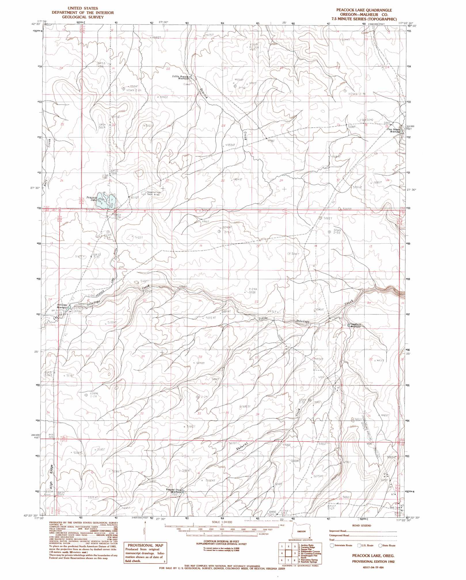
USGS Topo Quad 42117d4 - 1:24,000 scale
| Topo Map Name: | Peacock Lake |
| USGS Topo Quad ID: | 42117d4 |
| Print Size: | ca. 21 1/4" wide x 27" high |
| Southeast Coordinates: | 42.375° N latitude / 117.375° W longitude |
| Map Center Coordinates: | 42.4375° N latitude / 117.4375° W longitude |
| U.S. State: | OR |
| Filename: | o42117d4.jpg |
| Download Map JPG Image: | Peacock Lake topo map 1:24,000 scale |
| Map Type: | Topographic |
| Topo Series: | 7.5´ |
| Map Scale: | 1:24,000 |
| Source of Map Images: | United States Geological Survey (USGS) |
| Alternate Map Versions: |
Peacock Lake OR 1982, updated 1983 Download PDF Buy paper map Peacock Lake OR 2011 Download PDF Buy paper map Peacock Lake OR 2014 Download PDF Buy paper map |
1:24,000 Topo Quads surrounding Peacock Lake
The Basin |
Rockhouse Reservoir |
Indian Fort |
Skull Creek |
Whitehorse Butte |
Bowden Ranch |
Jackies Butte |
Caviatta Ridge |
Squaw Flat |
Three Forks |
Battle Creek Ranch |
Rattlesnake Canyon |
Peacock Lake |
No Crossing Crossing |
Drummond Basin |
Battle Mountain |
Grasshopper Flat North |
Starvation Spring |
Rawhide Springs |
Rawhide Pocket |
Jackson Summit |
Grasshopper Flat South |
Chipmunk Basin |
Guadalupe Meadows |
Stoney Corral |
> Back to 42117a1 at 1:100,000 scale
> Back to 42116a1 at 1:250,000 scale
> Back to U.S. Topo Maps home
Peacock Lake topo map: Gazetteer
Peacock Lake: Lakes
Peacock Lake elevation 1553m 5095′Peacock Lake: Reservoirs
Antelope Reservoir elevation 1561m 5121′Bay Duke Reservoir elevation 1516m 4973′
Campbell Reservoir elevation 1501m 4924′
Five Points Reservoir elevation 1524m 5000′
Red Tank elevation 1557m 5108′
Varment Creek Reservoir elevation 1572m 5157′
Peacock Lake digital topo map on disk
Buy this Peacock Lake topo map showing relief, roads, GPS coordinates and other geographical features, as a high-resolution digital map file on DVD: