Rattlesnake Canyon Topo Map Oregon
To zoom in, hover over the map of Rattlesnake Canyon
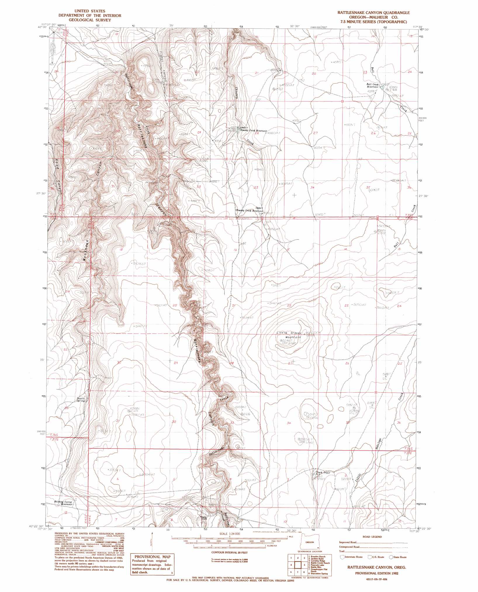
USGS Topo Quad 42117d5 - 1:24,000 scale
| Topo Map Name: | Rattlesnake Canyon |
| USGS Topo Quad ID: | 42117d5 |
| Print Size: | ca. 21 1/4" wide x 27" high |
| Southeast Coordinates: | 42.375° N latitude / 117.5° W longitude |
| Map Center Coordinates: | 42.4375° N latitude / 117.5625° W longitude |
| U.S. State: | OR |
| Filename: | o42117d5.jpg |
| Download Map JPG Image: | Rattlesnake Canyon topo map 1:24,000 scale |
| Map Type: | Topographic |
| Topo Series: | 7.5´ |
| Map Scale: | 1:24,000 |
| Source of Map Images: | United States Geological Survey (USGS) |
| Alternate Map Versions: |
Rattlesnake Canyon OR 1982, updated 1983 Download PDF Buy paper map Rattlesnake Canyon OR 1982, updated 1983 Download PDF Buy paper map Rattlesnake Canyon OR 2011 Download PDF Buy paper map Rattlesnake Canyon OR 2014 Download PDF Buy paper map |
1:24,000 Topo Quads surrounding Rattlesnake Canyon
Anderson Reservoir |
The Basin |
Rockhouse Reservoir |
Indian Fort |
Skull Creek |
Flat Top Mountain Se |
Bowden Ranch |
Jackies Butte |
Caviatta Ridge |
Squaw Flat |
Basque |
Battle Creek Ranch |
Rattlesnake Canyon |
Peacock Lake |
No Crossing Crossing |
Blue Mountain Pass |
Battle Mountain |
Grasshopper Flat North |
Starvation Spring |
Rawhide Springs |
Bowden Waterhole |
Jackson Summit |
Grasshopper Flat South |
Chipmunk Basin |
Guadalupe Meadows |
> Back to 42117a1 at 1:100,000 scale
> Back to 42116a1 at 1:250,000 scale
> Back to U.S. Topo Maps home
Rattlesnake Canyon topo map: Gazetteer
Rattlesnake Canyon: Reservoirs
Bull Creek Reservoir elevation 1514m 4967′Holding Corral Reservoir elevation 1574m 5164′
Lower Chimney Creek Reservoir elevation 1476m 4842′
Truck Trail Pit elevation 1586m 5203′
Upper Chimney Creek Reservoir elevation 1518m 4980′
Rattlesnake Canyon: Springs
Coyote Spring elevation 1529m 5016′Rattlesnake Canyon: Streams
Little Rattlesnake Creek elevation 1537m 5042′Rattlesnake Canyon: Summits
Little Grassy Mountain elevation 1624m 5328′Rattlesnake Canyon: Valleys
Pistol Canyon elevation 1343m 4406′Rattlesnake Canyon elevation 1278m 4192′
Woolhawk Canyon elevation 1296m 4251′
Rattlesnake Canyon digital topo map on disk
Buy this Rattlesnake Canyon topo map showing relief, roads, GPS coordinates and other geographical features, as a high-resolution digital map file on DVD: