Bowden Ranch Topo Map Oregon
To zoom in, hover over the map of Bowden Ranch
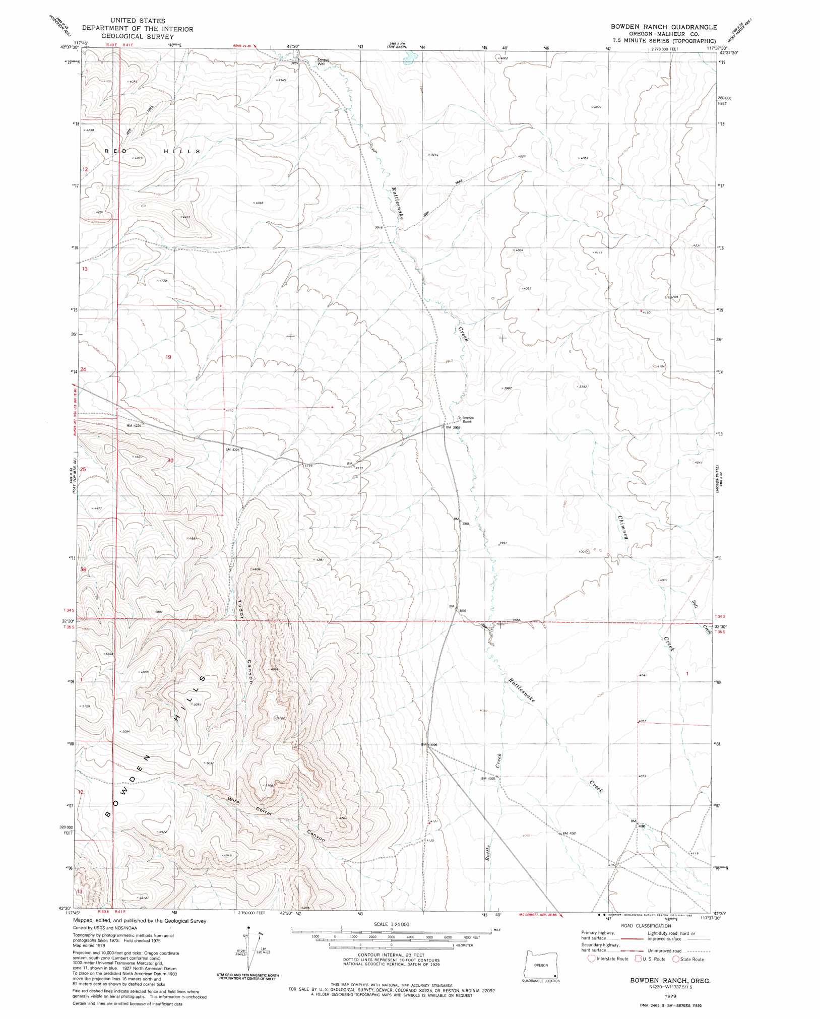
USGS Topo Quad 42117e6 - 1:24,000 scale
| Topo Map Name: | Bowden Ranch |
| USGS Topo Quad ID: | 42117e6 |
| Print Size: | ca. 21 1/4" wide x 27" high |
| Southeast Coordinates: | 42.5° N latitude / 117.625° W longitude |
| Map Center Coordinates: | 42.5625° N latitude / 117.6875° W longitude |
| U.S. State: | OR |
| Filename: | o42117e6.jpg |
| Download Map JPG Image: | Bowden Ranch topo map 1:24,000 scale |
| Map Type: | Topographic |
| Topo Series: | 7.5´ |
| Map Scale: | 1:24,000 |
| Source of Map Images: | United States Geological Survey (USGS) |
| Alternate Map Versions: |
Bowden Ranch OR 1979, updated 1980 Download PDF Buy paper map Bowden Ranch OR 2011 Download PDF Buy paper map Bowden Ranch OR 2014 Download PDF Buy paper map |
1:24,000 Topo Quads surrounding Bowden Ranch
Palomino Hills |
Burns Junction |
Rome |
Scott Reservoir |
Dry Creek Rim |
Flat Top Mountain |
Anderson Reservoir |
The Basin |
Rockhouse Reservoir |
Indian Fort |
Rome State Airport |
Flat Top Mountain Se |
Bowden Ranch |
Jackies Butte |
Caviatta Ridge |
Three Man Butte Well |
Basque |
Battle Creek Ranch |
Rattlesnake Canyon |
Peacock Lake |
Blue Mountain Basin |
Blue Mountain Pass |
Battle Mountain |
Grasshopper Flat North |
Starvation Spring |
> Back to 42117e1 at 1:100,000 scale
> Back to 42116a1 at 1:250,000 scale
> Back to U.S. Topo Maps home
Bowden Ranch topo map: Gazetteer
Bowden Ranch: Streams
Battle Creek elevation 1223m 4012′Bull Creek elevation 1223m 4012′
Chimney Creek elevation 1211m 3973′
Bowden Ranch: Summits
Bowden Hills elevation 1571m 5154′Red Hills elevation 1290m 4232′
Bowden Ranch: Valleys
Tudor Canyon elevation 1309m 4294′Wire Corral Canyon elevation 1299m 4261′
Bowden Ranch: Wells
Echave Well elevation 1186m 3891′Bowden Ranch digital topo map on disk
Buy this Bowden Ranch topo map showing relief, roads, GPS coordinates and other geographical features, as a high-resolution digital map file on DVD: