Rome Topo Map Oregon
To zoom in, hover over the map of Rome
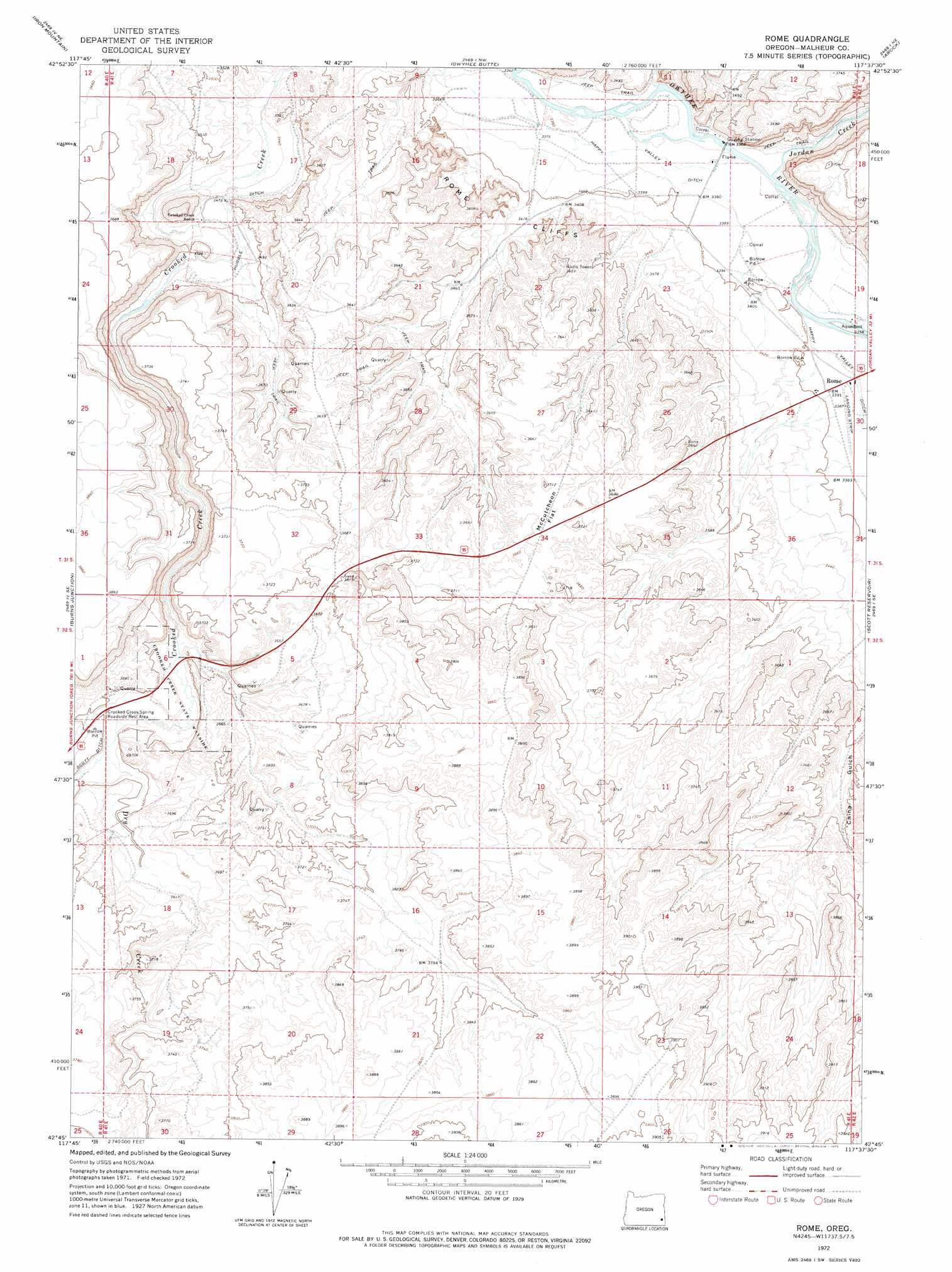
USGS Topo Quad 42117g6 - 1:24,000 scale
| Topo Map Name: | Rome |
| USGS Topo Quad ID: | 42117g6 |
| Print Size: | ca. 21 1/4" wide x 27" high |
| Southeast Coordinates: | 42.75° N latitude / 117.625° W longitude |
| Map Center Coordinates: | 42.8125° N latitude / 117.6875° W longitude |
| U.S. State: | OR |
| Filename: | o42117g6.jpg |
| Download Map JPG Image: | Rome topo map 1:24,000 scale |
| Map Type: | Topographic |
| Topo Series: | 7.5´ |
| Map Scale: | 1:24,000 |
| Source of Map Images: | United States Geological Survey (USGS) |
| Alternate Map Versions: |
Rome OR 1972, updated 1975 Download PDF Buy paper map Rome OR 2011 Download PDF Buy paper map Rome OR 2014 Download PDF Buy paper map |
1:24,000 Topo Quads surrounding Rome
Saddle Butte |
Wrangle Butte |
Lambert Rocks |
Bogus Bench |
Jordan Craters South |
Palomino Lake |
Iron Mountain |
Owyhee Butte |
Arock |
Threemile Hill |
Palomino Hills |
Burns Junction |
Rome |
Scott Reservoir |
Dry Creek Rim |
Flat Top Mountain |
Anderson Reservoir |
The Basin |
Rockhouse Reservoir |
Indian Fort |
Rome State Airport |
Flat Top Mountain Se |
Bowden Ranch |
Jackies Butte |
Caviatta Ridge |
> Back to 42117e1 at 1:100,000 scale
> Back to 42116a1 at 1:250,000 scale
> Back to U.S. Topo Maps home
Rome topo map: Gazetteer
Rome: Canals
Happy Valley Ditch elevation 1031m 3382′Hubble Ditch elevation 1058m 3471′
Scott Ditch elevation 1092m 3582′
Rome: Cliffs
Rome Cliffs elevation 1066m 3497′Rome: Flats
McCutcheon Flat elevation 1118m 3667′Rome: Parks
Crooked Creek State Park elevation 1093m 3585′Rome: Populated Places
Rome elevation 1032m 3385′Rome: Post Offices
Bar Post Office (historical) elevation 1025m 3362′Rome Post Office (historical) elevation 1032m 3385′
Rome: Streams
Dry Creek elevation 1088m 3569′Jordan Creek elevation 1025m 3362′
Rome: Valleys
Happy Valley elevation 1025m 3362′Rome digital topo map on disk
Buy this Rome topo map showing relief, roads, GPS coordinates and other geographical features, as a high-resolution digital map file on DVD: