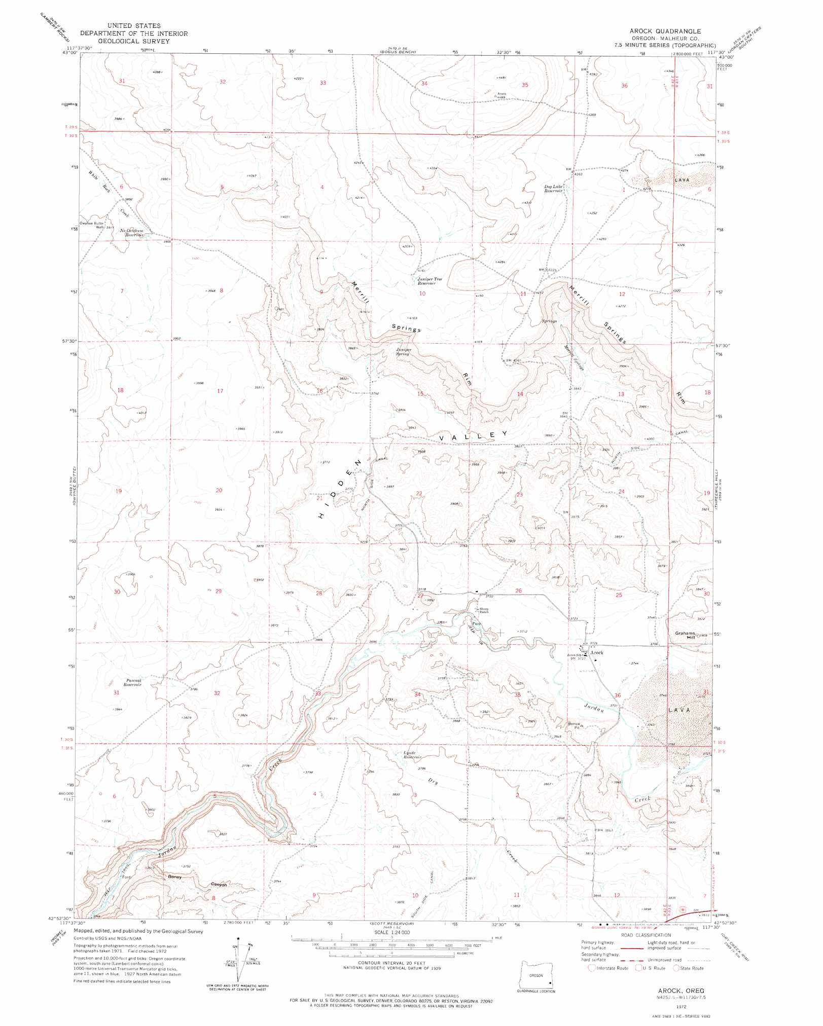
Arock Topo Map Oregon
To zoom in, hover over the map of Arock
USGS Topo Quad 42117h5 - 1:24,000 scale
| Topo Map Name: | Arock |
| USGS Topo Quad ID: | 42117h5 |
| Print Size: | ca. 21 1/4" wide x 27" high |
| Southeast Coordinates: | 42.875° N latitude / 117.5° W longitude |
| Map Center Coordinates: | 42.9375° N latitude / 117.5625° W longitude |
| U.S. State: | OR |
| Filename: | o42117h5.jpg |
| Download Map JPG Image: | Arock topo map 1:24,000 scale |
| Map Type: | Topographic |
| Topo Series: | 7.5´ |
| Map Scale: | 1:24,000 |
| Source of Map Images: | United States Geological Survey (USGS) |
| Alternate Map Versions: |
Arock OR 1972, updated 1975 Download PDF Buy paper map Arock OR 2011 Download PDF Buy paper map Arock OR 2014 Download PDF Buy paper map |
1:24,000 Topo Quads surrounding Arock
Sacramento Butte |
Rinehart Canyon |
The Hole In The Ground |
Jordan Craters North |
Mccain Creek |
Wrangle Butte |
Lambert Rocks |
Bogus Bench |
Jordan Craters South |
Cow Lakes |
Iron Mountain |
Owyhee Butte |
Arock |
Threemile Hill |
Danner |
Burns Junction |
Rome |
Scott Reservoir |
Dry Creek Rim |
Little Grassy Mountain |
Anderson Reservoir |
The Basin |
Rockhouse Reservoir |
Indian Fort |
Skull Creek |
> Back to 42117e1 at 1:100,000 scale
> Back to 42116a1 at 1:250,000 scale
> Back to U.S. Topo Maps home
Arock topo map: Gazetteer
Arock: Canals
North Side Canal elevation 1216m 3989′Arock: Cliffs
Merrill Springs Rim elevation 1308m 4291′Arock: Populated Places
Arock elevation 1136m 3727′Arock: Post Offices
Arock Post Office elevation 1136m 3727′Arock: Reservoirs
Dog Lake Reservoir elevation 1299m 4261′Juniper Tree Reservoir elevation 1269m 4163′
Lynde Reservoir elevation 1153m 3782′
No Catchum Reservoir elevation 1190m 3904′
Pascual Reservoir elevation 1163m 3815′
Arock: Springs
Juniper Spring elevation 1174m 3851′Merrill Springs elevation 1175m 3854′
Arock: Streams
Dry Creek elevation 1069m 3507′Arock: Summits
Grahams Hill elevation 1191m 3907′Arock: Valleys
Boney Canyon elevation 1048m 3438′Hidden Valley elevation 1130m 3707′
Arock: Wells
Owyhee Butte Well elevation 1192m 3910′Arock digital topo map on disk
Buy this Arock topo map showing relief, roads, GPS coordinates and other geographical features, as a high-resolution digital map file on DVD: