Whitehorse Ranch Topo Map Oregon
To zoom in, hover over the map of Whitehorse Ranch
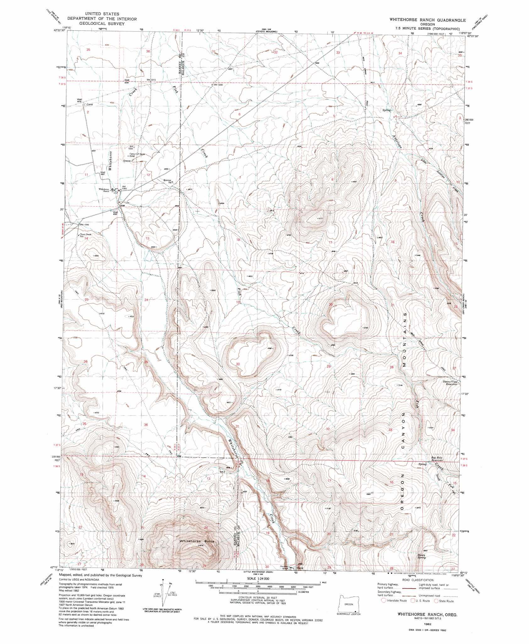
USGS Topo Quad 42118c2 - 1:24,000 scale
| Topo Map Name: | Whitehorse Ranch |
| USGS Topo Quad ID: | 42118c2 |
| Print Size: | ca. 21 1/4" wide x 27" high |
| Southeast Coordinates: | 42.25° N latitude / 118.125° W longitude |
| Map Center Coordinates: | 42.3125° N latitude / 118.1875° W longitude |
| U.S. State: | OR |
| Filename: | o42118c2.jpg |
| Download Map JPG Image: | Whitehorse Ranch topo map 1:24,000 scale |
| Map Type: | Topographic |
| Topo Series: | 7.5´ |
| Map Scale: | 1:24,000 |
| Source of Map Images: | United States Geological Survey (USGS) |
| Alternate Map Versions: |
Whitehorse Ranch OR 1982, updated 1982 Download PDF Buy paper map Whitehorse Ranch OR 2011 Download PDF Buy paper map Whitehorse Ranch OR 2014 Download PDF Buy paper map |
1:24,000 Topo Quads surrounding Whitehorse Ranch
Miranda Flat Sw |
Miranda Flat Se |
Coyote Lake West |
Coyote Lake East |
Rome State Airport |
Tule Springs |
Tule Springs Ne |
Coyote Meadows |
Twelvemile Ridge |
Three Man Butte Well |
Red Lookout Butte |
Red Mountain |
Whitehorse Ranch |
Dry Creek Bench |
Blue Mountain Basin |
Trout Creek Canyon |
Pole Canyon |
Little Whitehorse Creek |
Doolittle Creek |
Oregon Canyon Ranch |
Windy Point |
The V |
Chicken Spring |
Payne Creek |
Bretz Mine |
> Back to 42118a1 at 1:100,000 scale
> Back to 42118a1 at 1:250,000 scale
> Back to U.S. Topo Maps home
Whitehorse Ranch topo map: Gazetteer
Whitehorse Ranch: Airports
Whitehorse Ranch Airstrip elevation 1340m 4396′Whitehorse Ranch: Post Offices
White Horse Post Office (historical) elevation 1336m 4383′Whitehorse Ranch: Reservoirs
Bog Hole Reservoir elevation 1604m 5262′Steens View Reservoir elevation 1617m 5305′
Whitehorse Ranch: Springs
Boney Spring elevation 1671m 5482′Whitehorse Ranch: Streams
Little Antelope Creek elevation 1411m 4629′Little Whitehorse Creek elevation 1451m 4760′
South Fork Fish Creek elevation 1615m 5298′
Whitehorse Ranch: Summits
Whitehorse Butte elevation 1825m 5987′Whitehorse Ranch digital topo map on disk
Buy this Whitehorse Ranch topo map showing relief, roads, GPS coordinates and other geographical features, as a high-resolution digital map file on DVD: