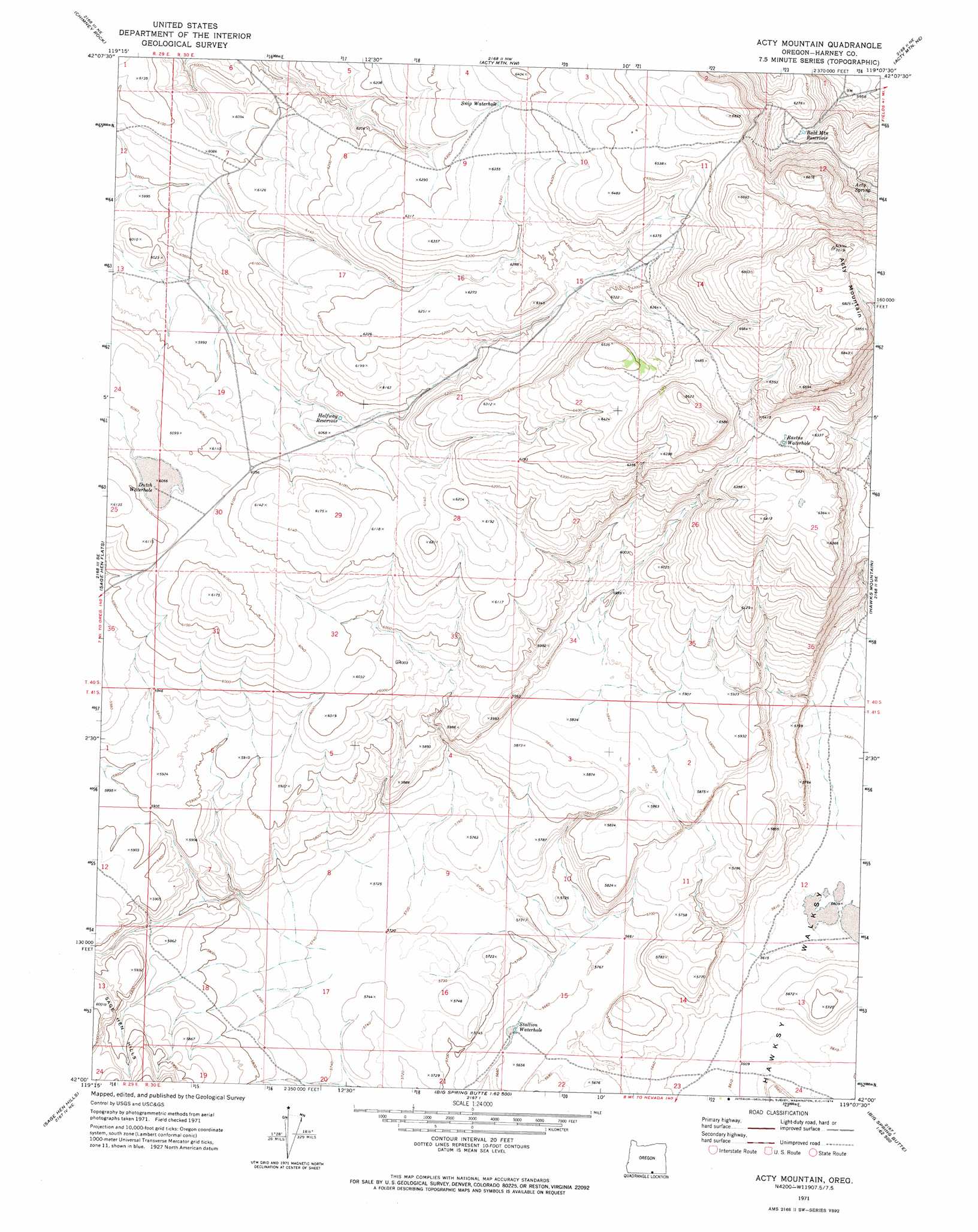
Acty Mountain Topo Map Oregon
To zoom in, hover over the map of Acty Mountain
USGS Topo Quad 42119a2 - 1:24,000 scale
| Topo Map Name: | Acty Mountain |
| USGS Topo Quad ID: | 42119a2 |
| Print Size: | ca. 21 1/4" wide x 27" high |
| Southeast Coordinates: | 42° N latitude / 119.125° W longitude |
| Map Center Coordinates: | 42.0625° N latitude / 119.1875° W longitude |
| U.S. State: | OR |
| Filename: | o42119a2.jpg |
| Download Map JPG Image: | Acty Mountain topo map 1:24,000 scale |
| Map Type: | Topographic |
| Topo Series: | 7.5´ |
| Map Scale: | 1:24,000 |
| Source of Map Images: | United States Geological Survey (USGS) |
| Alternate Map Versions: |
Acty Mountain OR 1971, updated 1974 Download PDF Buy paper map Acty Mountain OR 2011 Download PDF Buy paper map Acty Mountain OR 2014 Download PDF Buy paper map |
1:24,000 Topo Quads surrounding Acty Mountain
Lone Grave Butte |
Mahogany Butte |
Surveyors Lake |
Coyote Gap Se |
Square Mountain |
Rocky Canyon |
Chimney Rock |
Acty Mountain Nw |
Acty Mountain Ne |
Robbers Roost |
Antelope Butte |
Sage Hen Flats |
Acty Mountain |
Hawks Mountain |
Black Rock Springs |
Catnip Canyon |
Sage Hen Hills |
Big Spring Butte |
Thousand Creek Spring |
Thousand Creek Gorge |
Swan Lake |
Catnip Mountain Se |
Gooch Lake |
Virgin Valley |
Mcgee Mountain |
> Back to 42119a1 at 1:100,000 scale
> Back to 42118a1 at 1:250,000 scale
> Back to U.S. Topo Maps home
Acty Mountain topo map: Gazetteer
Acty Mountain: Lakes
Dutch Waterhole elevation 1844m 6049′Rastus Waterhole elevation 1920m 6299′
Snip Waterhole elevation 1940m 6364′
Stallion Waterhole elevation 1724m 5656′
Acty Mountain: Reservoirs
Bald Mountain Reservoir elevation 1873m 6145′Halfway Reservoir elevation 1846m 6056′
Acty Mountain: Springs
Acty Spring elevation 1915m 6282′Acty Mountain: Summits
Acty Mountain elevation 2136m 7007′Bald Mountain elevation 2017m 6617′
Acty Mountain digital topo map on disk
Buy this Acty Mountain topo map showing relief, roads, GPS coordinates and other geographical features, as a high-resolution digital map file on DVD: