Acty Mountain Ne Topo Map Oregon
To zoom in, hover over the map of Acty Mountain Ne
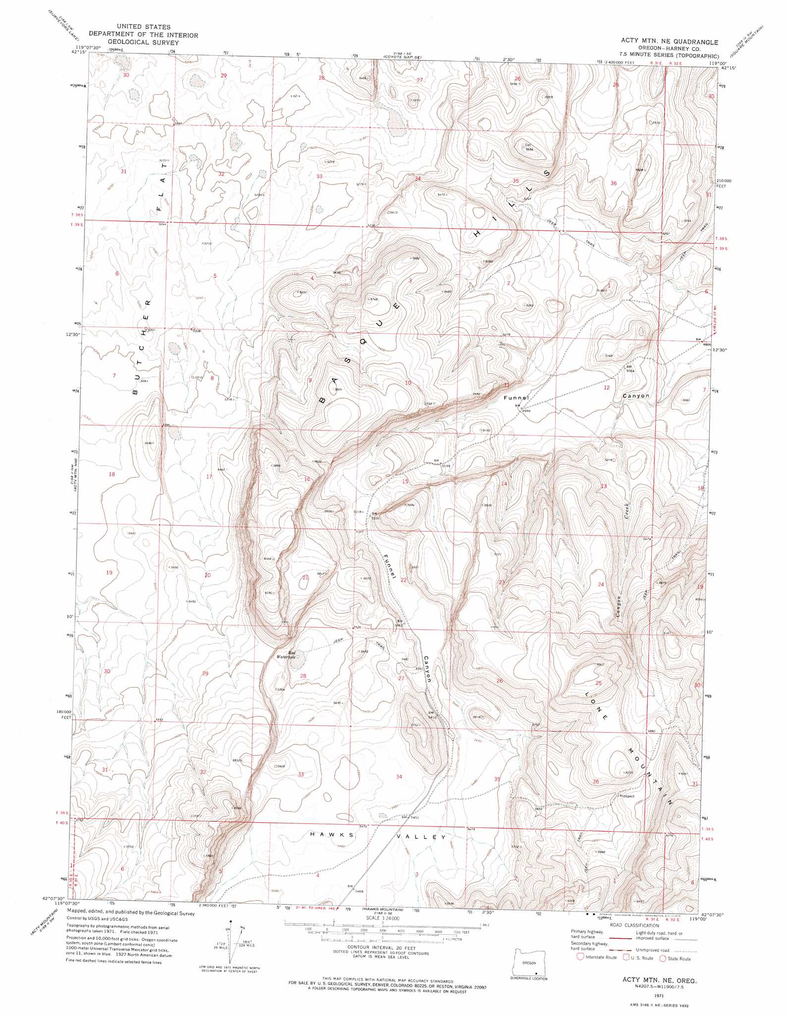
USGS Topo Quad 42119b1 - 1:24,000 scale
| Topo Map Name: | Acty Mountain Ne |
| USGS Topo Quad ID: | 42119b1 |
| Print Size: | ca. 21 1/4" wide x 27" high |
| Southeast Coordinates: | 42.125° N latitude / 119° W longitude |
| Map Center Coordinates: | 42.1875° N latitude / 119.0625° W longitude |
| U.S. State: | OR |
| Filename: | o42119b1.jpg |
| Download Map JPG Image: | Acty Mountain Ne topo map 1:24,000 scale |
| Map Type: | Topographic |
| Topo Series: | 7.5´ |
| Map Scale: | 1:24,000 |
| Source of Map Images: | United States Geological Survey (USGS) |
| Alternate Map Versions: |
Acty Mountain NE OR 1971, updated 1974 Download PDF Buy paper map Acty Mountain NE OR 2011 Download PDF Buy paper map Acty Mountain NE OR 2014 Download PDF Buy paper map |
1:24,000 Topo Quads surrounding Acty Mountain Ne
Beatys Butte |
Fish Fin Rim |
Coyote Gap |
Garrison Lake |
Skull Creek Butte |
Mahogany Butte |
Surveyors Lake |
Coyote Gap Se |
Square Mountain |
Fields Basin |
Chimney Rock |
Acty Mountain Nw |
Acty Mountain Ne |
Robbers Roost |
Rincon Flat |
Sage Hen Flats |
Acty Mountain |
Hawks Mountain |
Black Rock Springs |
Oregon End Table |
Sage Hen Hills |
Big Spring Butte |
Thousand Creek Spring |
Thousand Creek Gorge |
Bog Hot Springs |
> Back to 42119a1 at 1:100,000 scale
> Back to 42118a1 at 1:250,000 scale
> Back to U.S. Topo Maps home
Acty Mountain Ne topo map: Gazetteer
Acty Mountain Ne: Lakes
Red Waterhole elevation 1633m 5357′Acty Mountain Ne: Streams
Canyon Creek elevation 1516m 4973′Acty Mountain Ne: Summits
Basque Hills elevation 1678m 5505′Acty Mountain Ne digital topo map on disk
Buy this Acty Mountain Ne topo map showing relief, roads, GPS coordinates and other geographical features, as a high-resolution digital map file on DVD: