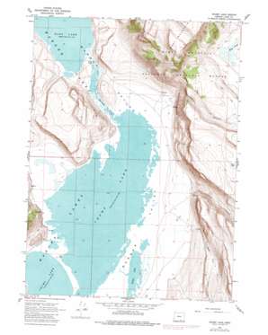
Crump Lake Topo Map Oregon
To zoom in, hover over the map of Crump Lake
USGS Topo Quad 42119c7 - 1:24,000 scale
| Topo Map Name: | Crump Lake |
| USGS Topo Quad ID: | 42119c7 |
| Print Size: | ca. 21 1/4" wide x 27" high |
| Southeast Coordinates: | 42.25° N latitude / 119.75° W longitude |
| Map Center Coordinates: | 42.3125° N latitude / 119.8125° W longitude |
| U.S. State: | OR |
| Filename: | o42119c7.jpg |
| Download Map JPG Image: | Crump Lake topo map 1:24,000 scale |
| Map Type: | Topographic |
| Topo Series: | 7.5´ |
| Map Scale: | 1:24,000 |
| Source of Map Images: | United States Geological Survey (USGS) |
| Alternate Map Versions: |
Crump Lake OR 1967, updated 1970 Download PDF Buy paper map Crump Lake OR 1967, updated 1978 Download PDF Buy paper map Crump Lake OR 1967, updated 1980 Download PDF Buy paper map Crump Lake OR 2011 Download PDF Buy paper map Crump Lake OR 2014 Download PDF Buy paper map |
1:24,000 Topo Quads surrounding Crump Lake
> Back to 42119a1 at 1:100,000 scale
> Back to 42118a1 at 1:250,000 scale
> Back to U.S. Topo Maps home
Crump Lake topo map: Gazetteer
Crump Lake: Bridges
Stone Bridge elevation 1365m 4478′Crump Lake: Dams
Priday Dam elevation 1434m 4704′Crump Lake: Gaps
The Narrows elevation 1365m 4478′Crump Lake: Lakes
Crump Lake elevation 1364m 4475′Fisher Lake elevation 1364m 4475′
Crump Lake: Springs
Hot Springs elevation 1380m 4527′Crump Lake: Streams
Fish Creek elevation 1367m 4484′Crump Lake: Valleys
Fisher Canyon elevation 1366m 4481′Riffle Canyon elevation 1367m 4484′
Crump Lake digital topo map on disk
Buy this Crump Lake topo map showing relief, roads, GPS coordinates and other geographical features, as a high-resolution digital map file on DVD:


