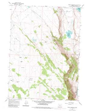
Priday Reservoir Topo Map Oregon
To zoom in, hover over the map of Priday Reservoir
USGS Topo Quad 42119c8 - 1:24,000 scale
| Topo Map Name: | Priday Reservoir |
| USGS Topo Quad ID: | 42119c8 |
| Print Size: | ca. 21 1/4" wide x 27" high |
| Southeast Coordinates: | 42.25° N latitude / 119.875° W longitude |
| Map Center Coordinates: | 42.3125° N latitude / 119.9375° W longitude |
| U.S. State: | OR |
| Filename: | o42119c8.jpg |
| Download Map JPG Image: | Priday Reservoir topo map 1:24,000 scale |
| Map Type: | Topographic |
| Topo Series: | 7.5´ |
| Map Scale: | 1:24,000 |
| Source of Map Images: | United States Geological Survey (USGS) |
| Alternate Map Versions: |
Priday Reservoir OR 1967, updated 1969 Download PDF Buy paper map Priday Reservoir OR 1967, updated 1980 Download PDF Buy paper map Priday Reservoir OR 2011 Download PDF Buy paper map Priday Reservoir OR 2014 Download PDF Buy paper map |
1:24,000 Topo Quads surrounding Priday Reservoir
> Back to 42119a1 at 1:100,000 scale
> Back to 42118a1 at 1:250,000 scale
> Back to U.S. Topo Maps home
Priday Reservoir topo map: Gazetteer
Priday Reservoir: Flats
Ballew Lake elevation 1760m 5774′Monument Flat elevation 1932m 6338′
Priday Reservoir: Lakes
Elmers Waterhole elevation 1717m 5633′Fish Lake elevation 1649m 5410′
Priday Reservoir: Reservoirs
Ballew Reservoir elevation 1746m 5728′Boulder Waterhole elevation 1782m 5846′
Bull Lake elevation 1724m 5656′
Good Seep Waterhole elevation 1849m 6066′
Lassie Waterhole elevation 1976m 6482′
Priday Reservoir elevation 1419m 4655′
Sidewinder Waterhole elevation 2000m 6561′
Wickiup Reservoir elevation 1849m 6066′
Priday Reservoir: Springs
Antelope Spring elevation 1763m 5784′Anthony Springs elevation 1823m 5980′
Ballet Spring elevation 1827m 5994′
Ballew Lake Spring elevation 1776m 5826′
Cleland Spring elevation 1943m 6374′
Cox Spring elevation 1872m 6141′
Fang Spring elevation 1860m 6102′
Finucane Spring elevation 1758m 5767′
Horn Spring elevation 1775m 5823′
Lynch Spring elevation 1750m 5741′
Noonan Springs elevation 1769m 5803′
Priday Reservoir: Streams
Fish Creek elevation 1419m 4655′Priday Reservoir digital topo map on disk
Buy this Priday Reservoir topo map showing relief, roads, GPS coordinates and other geographical features, as a high-resolution digital map file on DVD:


