Coyote Gap Topo Map Oregon
To zoom in, hover over the map of Coyote Gap
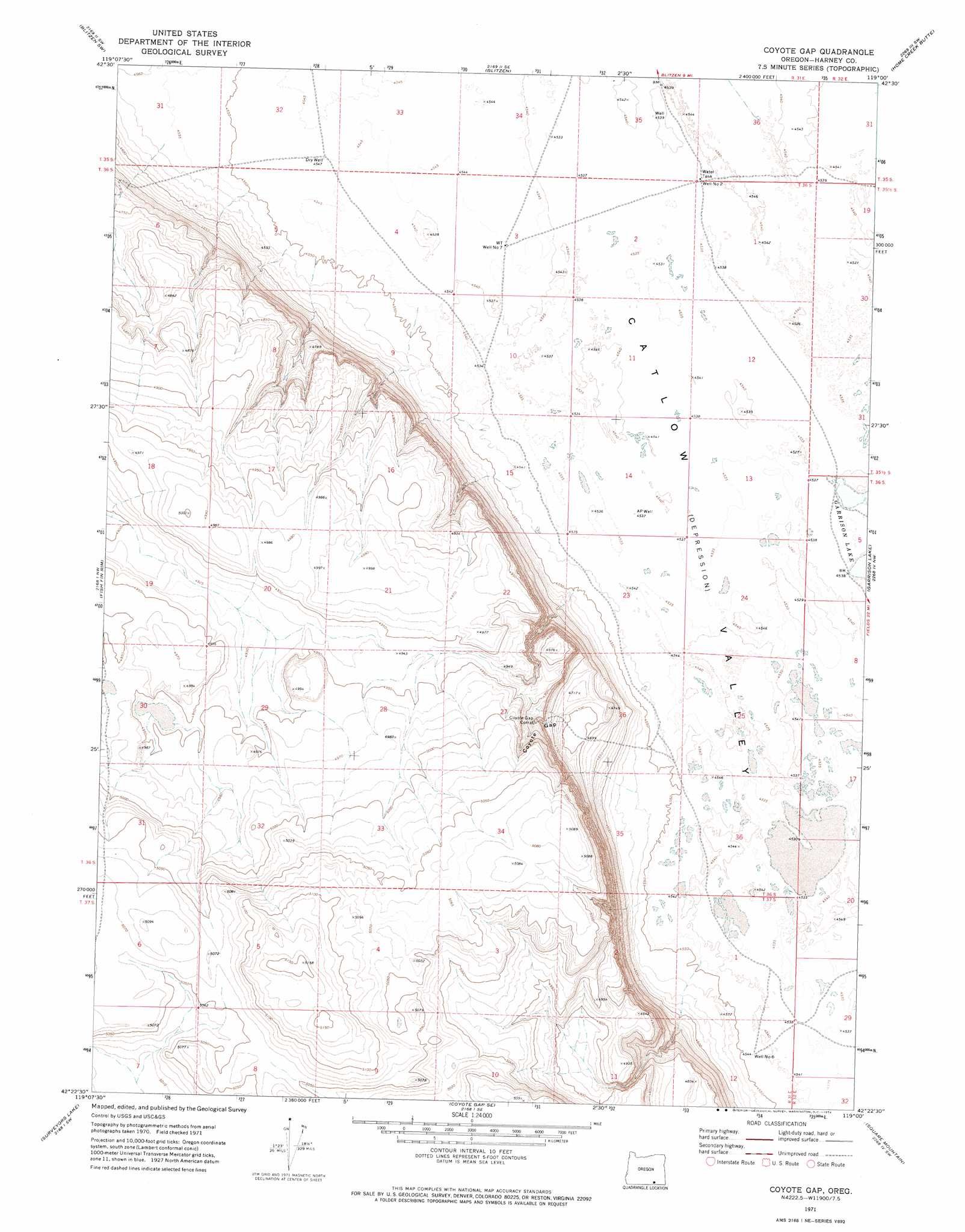
USGS Topo Quad 42119d1 - 1:24,000 scale
| Topo Map Name: | Coyote Gap |
| USGS Topo Quad ID: | 42119d1 |
| Print Size: | ca. 21 1/4" wide x 27" high |
| Southeast Coordinates: | 42.375° N latitude / 119° W longitude |
| Map Center Coordinates: | 42.4375° N latitude / 119.0625° W longitude |
| U.S. State: | OR |
| Filename: | o42119d1.jpg |
| Download Map JPG Image: | Coyote Gap topo map 1:24,000 scale |
| Map Type: | Topographic |
| Topo Series: | 7.5´ |
| Map Scale: | 1:24,000 |
| Source of Map Images: | United States Geological Survey (USGS) |
| Alternate Map Versions: |
Coyote Gap OR 1971, updated 1974 Download PDF Buy paper map Coyote Gap OR 2011 Download PDF Buy paper map Coyote Gap OR 2014 Download PDF Buy paper map |
1:24,000 Topo Quads surrounding Coyote Gap
Murphy Waterholes Ne |
Blitzen Nw |
Butler Hill |
Roaring Springs |
Tombstone Canyon |
Guano Reservoir |
Blitzen Sw |
Blitzen |
Home Creek Butte |
Roaring Springs Se |
Beatys Butte |
Fish Fin Rim |
Coyote Gap |
Garrison Lake |
Skull Creek Butte |
Mahogany Butte |
Surveyors Lake |
Coyote Gap Se |
Square Mountain |
Fields Basin |
Chimney Rock |
Acty Mountain Nw |
Acty Mountain Ne |
Robbers Roost |
Rincon Flat |
> Back to 42119a1 at 1:100,000 scale
> Back to 42118a1 at 1:250,000 scale
> Back to U.S. Topo Maps home
Coyote Gap topo map: Gazetteer
Coyote Gap: Valleys
Coyote Gap elevation 1433m 4701′Coyote Gap: Wells
AP Well elevation 1384m 4540′Dry Well elevation 1386m 4547′
Well Number Seven elevation 1386m 4547′
Well Number Six elevation 1387m 4550′
Well Number Two elevation 1384m 4540′
Coyote Gap digital topo map on disk
Buy this Coyote Gap topo map showing relief, roads, GPS coordinates and other geographical features, as a high-resolution digital map file on DVD: