Blitzen Topo Map Oregon
To zoom in, hover over the map of Blitzen
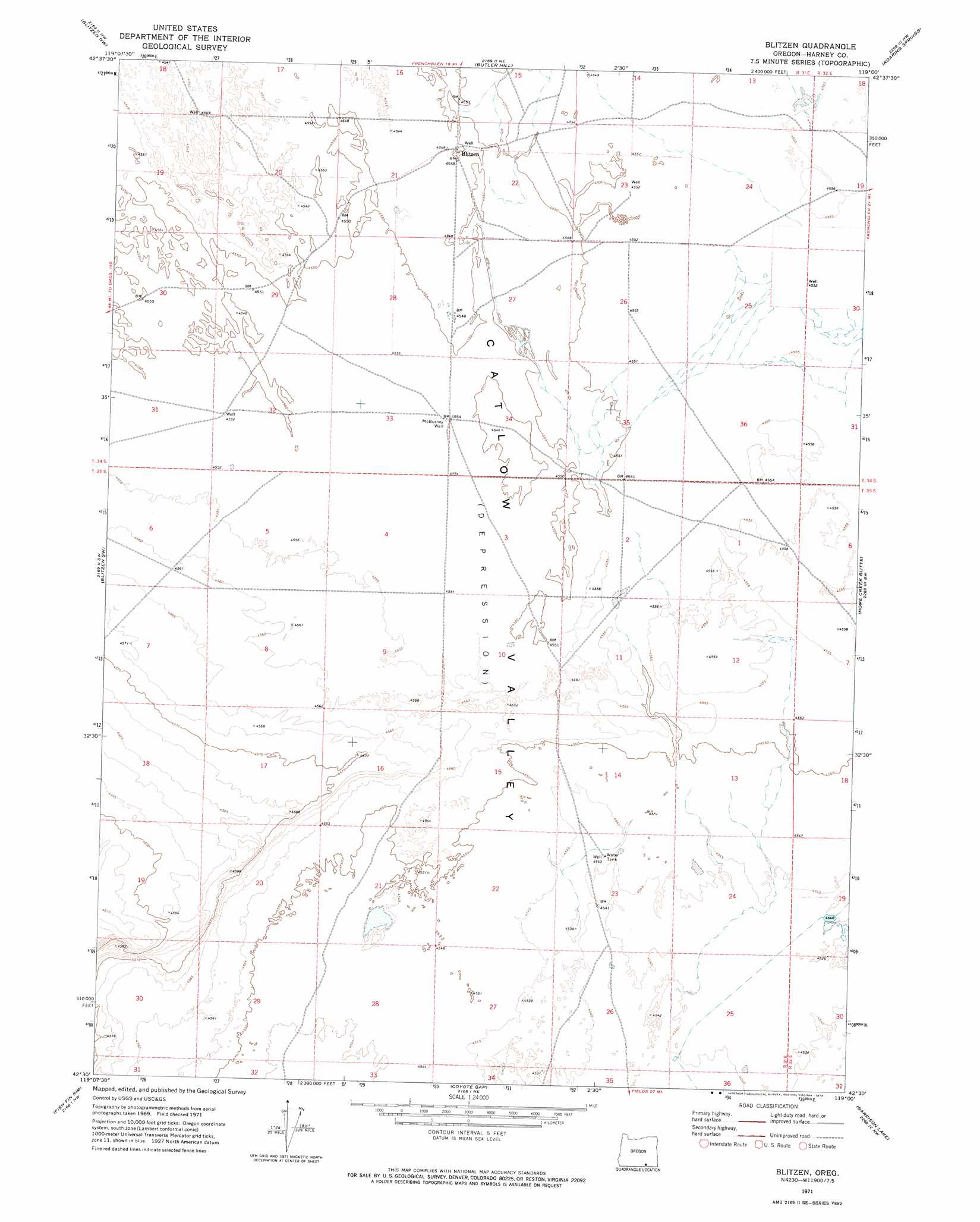
USGS Topo Quad 42119e1 - 1:24,000 scale
| Topo Map Name: | Blitzen |
| USGS Topo Quad ID: | 42119e1 |
| Print Size: | ca. 21 1/4" wide x 27" high |
| Southeast Coordinates: | 42.5° N latitude / 119° W longitude |
| Map Center Coordinates: | 42.5625° N latitude / 119.0625° W longitude |
| U.S. State: | OR |
| Filename: | o42119e1.jpg |
| Download Map JPG Image: | Blitzen topo map 1:24,000 scale |
| Map Type: | Topographic |
| Topo Series: | 7.5´ |
| Map Scale: | 1:24,000 |
| Source of Map Images: | United States Geological Survey (USGS) |
| Alternate Map Versions: |
Blitzen OR 1971, updated 1974 Download PDF Buy paper map Blitzen OR 2011 Download PDF Buy paper map Blitzen OR 2014 Download PDF Buy paper map |
1:24,000 Topo Quads surrounding Blitzen
Duhaime Flat West |
Duhaime Flat East |
Walls Lake |
Frenchglen |
Page Springs |
Murphy Waterholes Ne |
Blitzen Nw |
Butler Hill |
Roaring Springs |
Tombstone Canyon |
Guano Reservoir |
Blitzen Sw |
Blitzen |
Home Creek Butte |
Roaring Springs Se |
Beatys Butte |
Fish Fin Rim |
Coyote Gap |
Garrison Lake |
Skull Creek Butte |
Mahogany Butte |
Surveyors Lake |
Coyote Gap Se |
Square Mountain |
Fields Basin |
> Back to 42119e1 at 1:100,000 scale
> Back to 42118a1 at 1:250,000 scale
> Back to U.S. Topo Maps home
Blitzen topo map: Gazetteer
Blitzen: Basins
Catlow Valley elevation 1388m 4553′Blitzen: Post Offices
Blitzen Post Office (historical) elevation 1388m 4553′Blitzen: Wells
McBurney Well elevation 1388m 4553′Blitzen digital topo map on disk
Buy this Blitzen topo map showing relief, roads, GPS coordinates and other geographical features, as a high-resolution digital map file on DVD: