Murphy Waterholes Topo Map Oregon
To zoom in, hover over the map of Murphy Waterholes
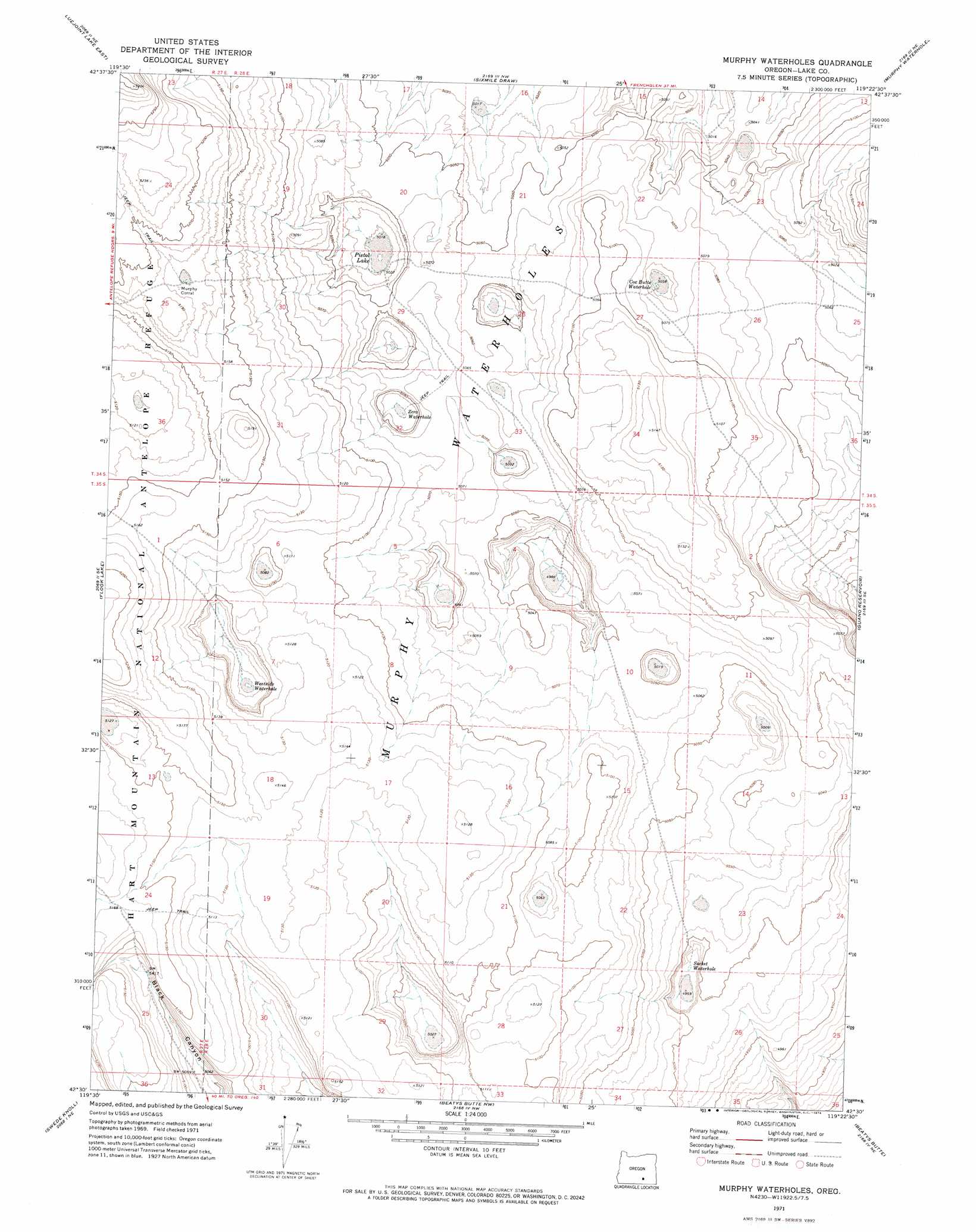
USGS Topo Quad 42119e4 - 1:24,000 scale
| Topo Map Name: | Murphy Waterholes |
| USGS Topo Quad ID: | 42119e4 |
| Print Size: | ca. 21 1/4" wide x 27" high |
| Southeast Coordinates: | 42.5° N latitude / 119.375° W longitude |
| Map Center Coordinates: | 42.5625° N latitude / 119.4375° W longitude |
| U.S. State: | OR |
| Filename: | o42119e4.jpg |
| Download Map JPG Image: | Murphy Waterholes topo map 1:24,000 scale |
| Map Type: | Topographic |
| Topo Series: | 7.5´ |
| Map Scale: | 1:24,000 |
| Source of Map Images: | United States Geological Survey (USGS) |
| Alternate Map Versions: |
Murphy Waterholes OR 1971, updated 1974 Download PDF Buy paper map Murphy Waterholes OR 2011 Download PDF Buy paper map Murphy Waterholes OR 2014 Download PDF Buy paper map |
1:24,000 Topo Quads surrounding Murphy Waterholes
Corporation Rim |
Steamboat Point |
Orejana Canyon |
Duhaime Flat West |
Duhaime Flat East |
Bluejoint Lake West |
Bluejoint Lake East |
Sixmile Draw |
Murphy Waterholes Ne |
Blitzen Nw |
Campbell Lake |
Flook Lake |
Murphy Waterholes |
Guano Reservoir |
Blitzen Sw |
Warner Peak |
Swede Knoll |
Beatys Butte Nw |
Beatys Butte |
Fish Fin Rim |
Jacobs Reservoir |
Alger Lake |
Lone Grave Butte |
Mahogany Butte |
Surveyors Lake |
> Back to 42119e1 at 1:100,000 scale
> Back to 42118a1 at 1:250,000 scale
> Back to U.S. Topo Maps home
Murphy Waterholes topo map: Gazetteer
Murphy Waterholes: Flats
Pistol Lake elevation 1530m 5019′Murphy Waterholes: Lakes
Murphy Waterhole elevation 1533m 5029′Murphy Waterholes elevation 1547m 5075′
Zero Waterhole elevation 1535m 5036′
Murphy Waterholes: Reservoirs
Cox Butte Waterhole elevation 1543m 5062′Socket Waterhole elevation 1514m 4967′
Westside Waterhole elevation 1542m 5059′
Murphy Waterholes digital topo map on disk
Buy this Murphy Waterholes topo map showing relief, roads, GPS coordinates and other geographical features, as a high-resolution digital map file on DVD: