Bluejoint Lake West Topo Map Oregon
To zoom in, hover over the map of Bluejoint Lake West
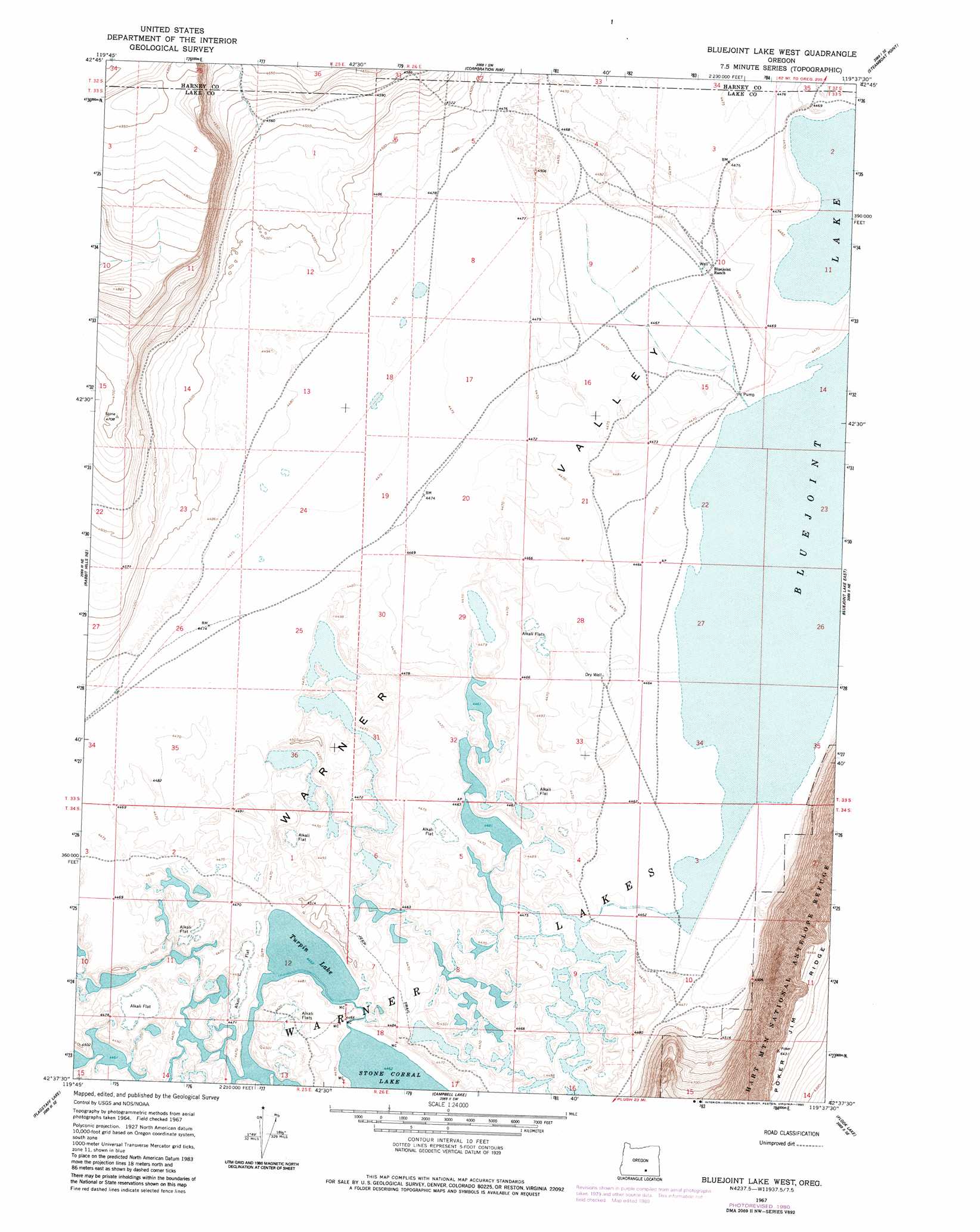
USGS Topo Quad 42119f6 - 1:24,000 scale
| Topo Map Name: | Bluejoint Lake West |
| USGS Topo Quad ID: | 42119f6 |
| Print Size: | ca. 21 1/4" wide x 27" high |
| Southeast Coordinates: | 42.625° N latitude / 119.625° W longitude |
| Map Center Coordinates: | 42.6875° N latitude / 119.6875° W longitude |
| U.S. State: | OR |
| Filename: | o42119f6.jpg |
| Download Map JPG Image: | Bluejoint Lake West topo map 1:24,000 scale |
| Map Type: | Topographic |
| Topo Series: | 7.5´ |
| Map Scale: | 1:24,000 |
| Source of Map Images: | United States Geological Survey (USGS) |
| Alternate Map Versions: |
Bluejoint Lake West OR 1967, updated 1969 Download PDF Buy paper map Bluejoint Lake West OR 1967, updated 1980 Download PDF Buy paper map Bluejoint Lake West OR 2011 Download PDF Buy paper map Bluejoint Lake West OR 2014 Download PDF Buy paper map |
1:24,000 Topo Quads surrounding Bluejoint Lake West
Juniper Mountain |
Turpin Knoll |
Red Bank Lakes |
Rock Camp Draw |
Balls Lake |
Sagebrush Knoll |
Corn Lake |
Corporation Rim |
Steamboat Point |
Orejana Canyon |
Rabbit Hills Nw |
Rabbit Hills Ne |
Bluejoint Lake West |
Bluejoint Lake East |
Sixmile Draw |
Rabbit Hills Sw |
Flagstaff Lake |
Campbell Lake |
Flook Lake |
Murphy Waterholes |
Plush |
Hart Lake |
Warner Peak |
Swede Knoll |
Beatys Butte Nw |
> Back to 42119e1 at 1:100,000 scale
> Back to 42118a1 at 1:250,000 scale
> Back to U.S. Topo Maps home
Bluejoint Lake West topo map: Gazetteer
Bluejoint Lake West: Lakes
Turpin Lake elevation 1361m 4465′Bluejoint Lake West: Reservoirs
Bluejoint Lake elevation 1362m 4468′Bluejoint Lake West: Ridges
Poker Jim Ridge elevation 1962m 6437′Bluejoint Lake West digital topo map on disk
Buy this Bluejoint Lake West topo map showing relief, roads, GPS coordinates and other geographical features, as a high-resolution digital map file on DVD: