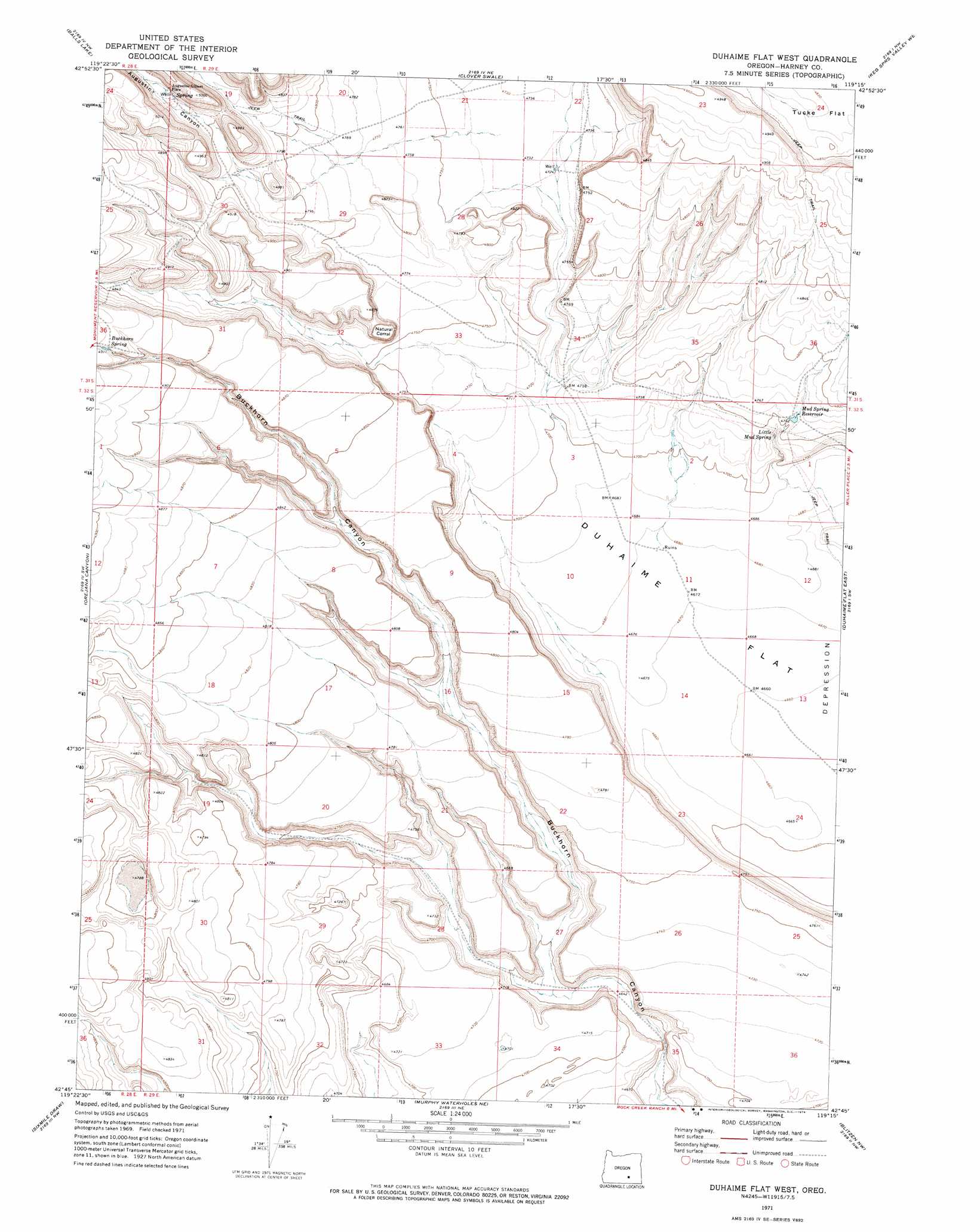
Duhaime Flat West Topo Map Oregon
To zoom in, hover over the map of Duhaime Flat West
USGS Topo Quad 42119g3 - 1:24,000 scale
| Topo Map Name: | Duhaime Flat West |
| USGS Topo Quad ID: | 42119g3 |
| Print Size: | ca. 21 1/4" wide x 27" high |
| Southeast Coordinates: | 42.75° N latitude / 119.25° W longitude |
| Map Center Coordinates: | 42.8125° N latitude / 119.3125° W longitude |
| U.S. State: | OR |
| Filename: | o42119g3.jpg |
| Download Map JPG Image: | Duhaime Flat West topo map 1:24,000 scale |
| Map Type: | Topographic |
| Topo Series: | 7.5´ |
| Map Scale: | 1:24,000 |
| Source of Map Images: | United States Geological Survey (USGS) |
| Alternate Map Versions: |
Duhaime Flat West OR 1971, updated 1974 Download PDF Buy paper map Duhaime Flat West OR 2011 Download PDF Buy paper map Duhaime Flat West OR 2014 Download PDF Buy paper map |
1:24,000 Topo Quads surrounding Duhaime Flat West
Rawhide Canyon |
Flybee Lake |
Meadow Lake |
Weed Lake Butte |
Twin Buttes |
Rock Camp Draw |
Balls Lake |
Clover Swale |
Keg Sprs Valley West |
Keg Sprs Valley East |
Steamboat Point |
Orejana Canyon |
Duhaime Flat West |
Duhaime Flat East |
Walls Lake |
Bluejoint Lake East |
Sixmile Draw |
Murphy Waterholes Ne |
Blitzen Nw |
Butler Hill |
Flook Lake |
Murphy Waterholes |
Guano Reservoir |
Blitzen Sw |
Blitzen |
> Back to 42119e1 at 1:100,000 scale
> Back to 42118a1 at 1:250,000 scale
> Back to U.S. Topo Maps home
Duhaime Flat West topo map: Gazetteer
Duhaime Flat West: Flats
Duhaime Flat elevation 1424m 4671′Duhaime Flat West: Reservoirs
Mud Spring Reservoir elevation 1452m 4763′Duhaime Flat West: Springs
Buckhorn Spring elevation 1502m 4927′Little Mud Spring elevation 1446m 4744′
Duhaime Flat West: Valleys
Augustine Canyon elevation 1473m 4832′Duhaime Flat West digital topo map on disk
Buy this Duhaime Flat West topo map showing relief, roads, GPS coordinates and other geographical features, as a high-resolution digital map file on DVD: