Corporation Rim Topo Map Oregon
To zoom in, hover over the map of Corporation Rim
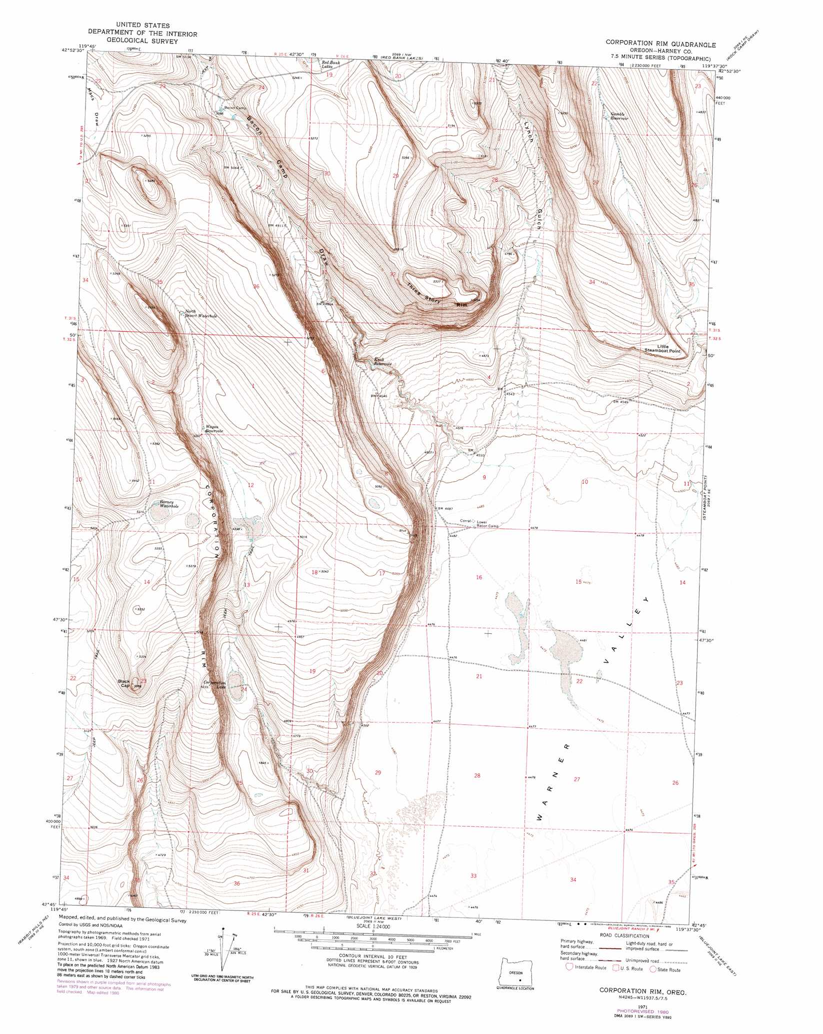
USGS Topo Quad 42119g6 - 1:24,000 scale
| Topo Map Name: | Corporation Rim |
| USGS Topo Quad ID: | 42119g6 |
| Print Size: | ca. 21 1/4" wide x 27" high |
| Southeast Coordinates: | 42.75° N latitude / 119.625° W longitude |
| Map Center Coordinates: | 42.8125° N latitude / 119.6875° W longitude |
| U.S. State: | OR |
| Filename: | o42119g6.jpg |
| Download Map JPG Image: | Corporation Rim topo map 1:24,000 scale |
| Map Type: | Topographic |
| Topo Series: | 7.5´ |
| Map Scale: | 1:24,000 |
| Source of Map Images: | United States Geological Survey (USGS) |
| Alternate Map Versions: |
Corporation Rim OR 1971, updated 1974 Download PDF Buy paper map Corporation Rim OR 1971, updated 1980 Download PDF Buy paper map Corporation Rim OR 2011 Download PDF Buy paper map Corporation Rim OR 2014 Download PDF Buy paper map |
1:24,000 Topo Quads surrounding Corporation Rim
Venator Canyon |
Cox Canyon |
Dry Valley Rim |
Rawhide Canyon |
Flybee Lake |
Juniper Mountain |
Turpin Knoll |
Red Bank Lakes |
Rock Camp Draw |
Balls Lake |
Sagebrush Knoll |
Corn Lake |
Corporation Rim |
Steamboat Point |
Orejana Canyon |
Rabbit Hills Nw |
Rabbit Hills Ne |
Bluejoint Lake West |
Bluejoint Lake East |
Sixmile Draw |
Rabbit Hills Sw |
Flagstaff Lake |
Campbell Lake |
Flook Lake |
Murphy Waterholes |
> Back to 42119e1 at 1:100,000 scale
> Back to 42118a1 at 1:250,000 scale
> Back to U.S. Topo Maps home
Corporation Rim topo map: Gazetteer
Corporation Rim: Cliffs
Three Story Rim elevation 1595m 5232′Corporation Rim: Flats
Corporation Lake elevation 1453m 4767′Corporation Rim: Lakes
Barney Waterhole elevation 1618m 5308′Corporation Rim: Reservoirs
Bacon Camp Waterhole elevation 1546m 5072′Gamble Reservoir elevation 1492m 4895′
Knob Reservoir elevation 1419m 4655′
Wagon Reservoir elevation 1526m 5006′
Corporation Rim: Ridges
Corporation Rim elevation 1565m 5134′Corporation Rim: Springs
North Desert Waterhole elevation 1555m 5101′Corporation Rim: Summits
Black Cap elevation 1637m 5370′Little Steamboat Point elevation 1469m 4819′
Corporation Rim: Valleys
Bacon Camp Draw elevation 1375m 4511′Lynch Gulch elevation 1514m 4967′
Corporation Rim digital topo map on disk
Buy this Corporation Rim topo map showing relief, roads, GPS coordinates and other geographical features, as a high-resolution digital map file on DVD: