Clover Swale Topo Map Oregon
To zoom in, hover over the map of Clover Swale
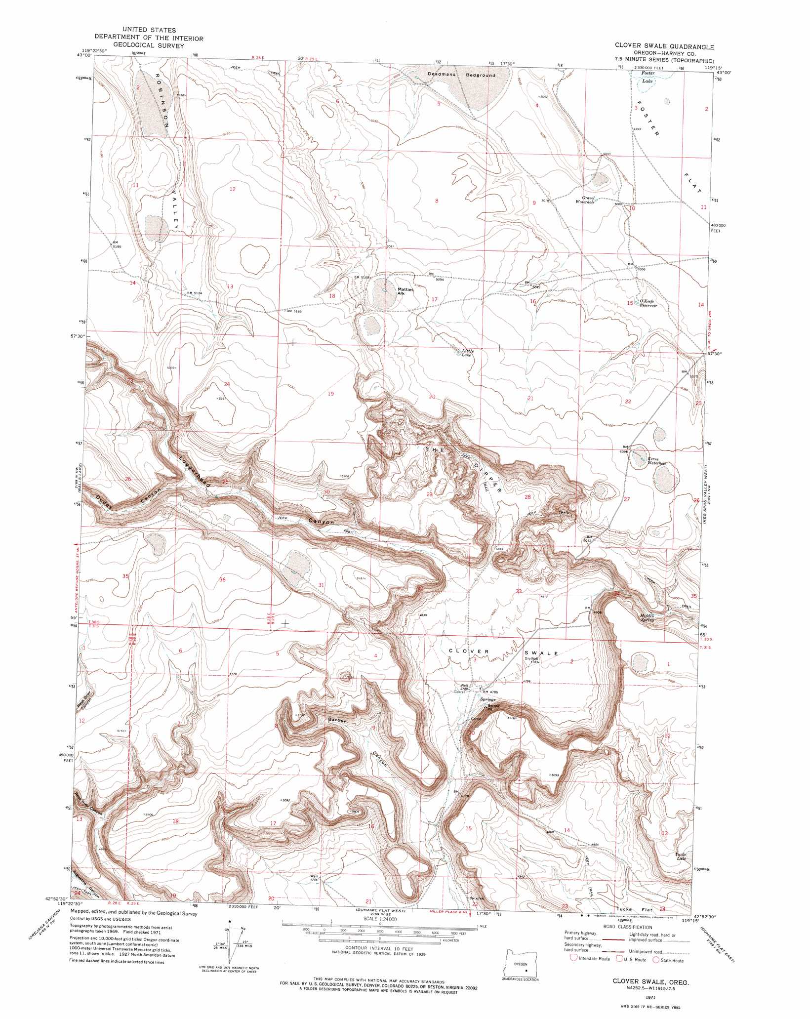
USGS Topo Quad 42119h3 - 1:24,000 scale
| Topo Map Name: | Clover Swale |
| USGS Topo Quad ID: | 42119h3 |
| Print Size: | ca. 21 1/4" wide x 27" high |
| Southeast Coordinates: | 42.875° N latitude / 119.25° W longitude |
| Map Center Coordinates: | 42.9375° N latitude / 119.3125° W longitude |
| U.S. State: | OR |
| Filename: | o42119h3.jpg |
| Download Map JPG Image: | Clover Swale topo map 1:24,000 scale |
| Map Type: | Topographic |
| Topo Series: | 7.5´ |
| Map Scale: | 1:24,000 |
| Source of Map Images: | United States Geological Survey (USGS) |
| Alternate Map Versions: |
Clover Swale OR 1971, updated 1974 Download PDF Buy paper map Clover Swale OR 2011 Download PDF Buy paper map Clover Swale OR 2014 Download PDF Buy paper map |
1:24,000 Topo Quads surrounding Clover Swale
Wilson Butte |
Lunch Lake |
Hughet Spring |
Southwest Harney Lake |
Southeast Harney Lake |
Rawhide Canyon |
Flybee Lake |
Meadow Lake |
Weed Lake Butte |
Twin Buttes |
Rock Camp Draw |
Balls Lake |
Clover Swale |
Keg Sprs Valley West |
Keg Sprs Valley East |
Steamboat Point |
Orejana Canyon |
Duhaime Flat West |
Duhaime Flat East |
Walls Lake |
Bluejoint Lake East |
Sixmile Draw |
Murphy Waterholes Ne |
Blitzen Nw |
Butler Hill |
> Back to 42119e1 at 1:100,000 scale
> Back to 42118a1 at 1:250,000 scale
> Back to U.S. Topo Maps home
Clover Swale topo map: Gazetteer
Clover Swale: Basins
Clover Swale elevation 1464m 4803′Clover Swale: Flats
Foster Flat elevation 1524m 5000′Matties Ark elevation 1558m 5111′
Clover Swale: Lakes
Gravel Waterhole elevation 1527m 5009′Kerns Waterhole elevation 1556m 5104′
Little Lake elevation 1556m 5104′
Clover Swale: Post Offices
Hiddensprings Post Office (historical) elevation 1469m 4819′Clover Swale: Reservoirs
O'Keefe Reservoir elevation 1531m 5022′Clover Swale: Springs
Hidden Spring elevation 1506m 4940′Clover Swale: Valleys
Barber Canyon elevation 1445m 4740′Dudes Canyon elevation 1516m 4973′
Loggerhead Canyon elevation 1476m 4842′
The Dipper elevation 1473m 4832′
Clover Swale digital topo map on disk
Buy this Clover Swale topo map showing relief, roads, GPS coordinates and other geographical features, as a high-resolution digital map file on DVD: