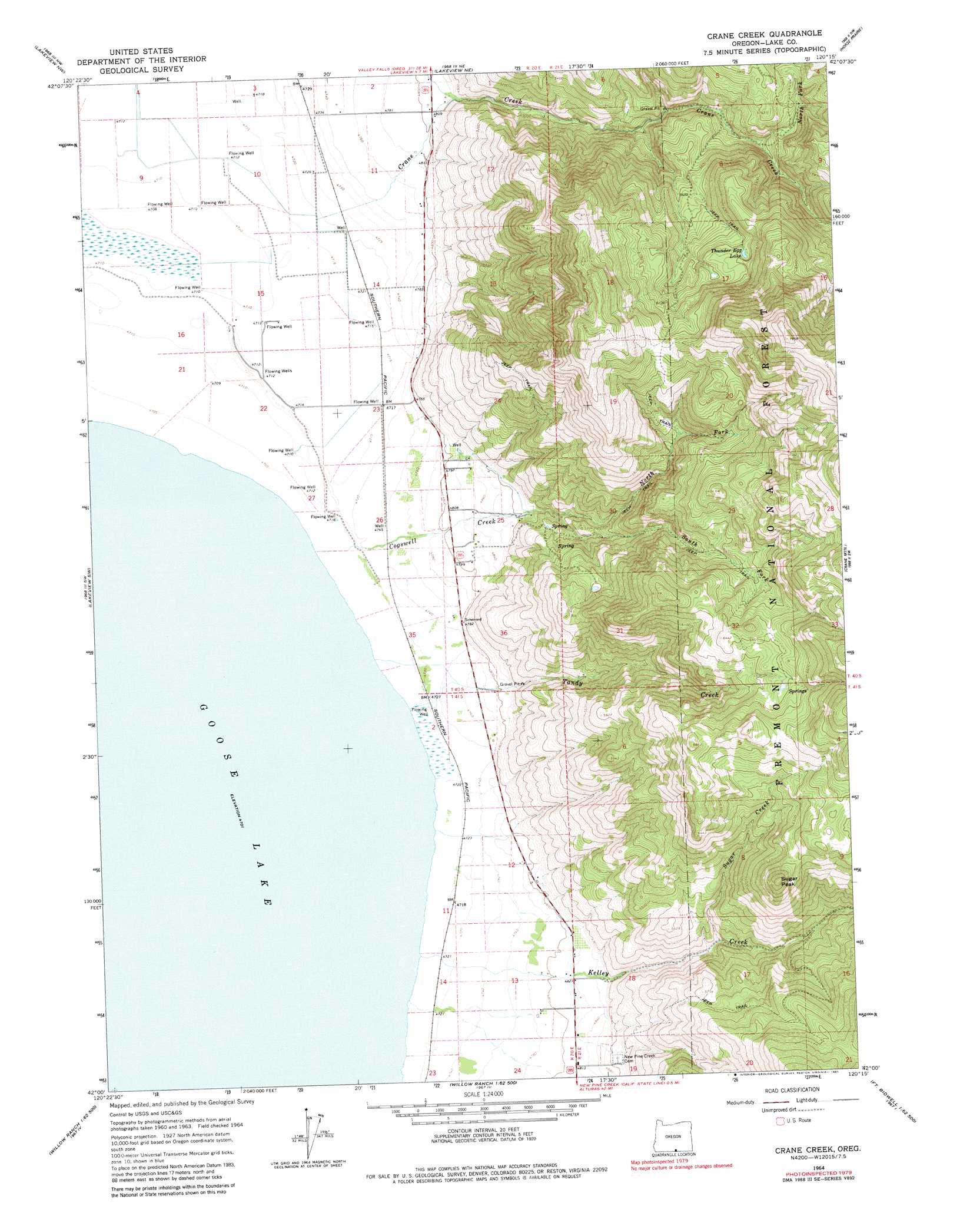
Crane Creek Topo Map Oregon
To zoom in, hover over the map of Crane Creek
USGS Topo Quad 42120a3 - 1:24,000 scale
| Topo Map Name: | Crane Creek |
| USGS Topo Quad ID: | 42120a3 |
| Print Size: | ca. 21 1/4" wide x 27" high |
| Southeast Coordinates: | 42° N latitude / 120.25° W longitude |
| Map Center Coordinates: | 42.0625° N latitude / 120.3125° W longitude |
| U.S. State: | OR |
| Filename: | o42120a3.jpg |
| Download Map JPG Image: | Crane Creek topo map 1:24,000 scale |
| Map Type: | Topographic |
| Topo Series: | 7.5´ |
| Map Scale: | 1:24,000 |
| Source of Map Images: | United States Geological Survey (USGS) |
| Alternate Map Versions: |
Crane Creek OR 1964, updated 1966 Download PDF Buy paper map Crane Creek OR 1964, updated 1981 Download PDF Buy paper map Crane Creek OR 2004, updated 2007 Download PDF Buy paper map Crane Creek OR 2011 Download PDF Buy paper map Crane Creek OR 2014 Download PDF Buy paper map |
| FStopo: | US Forest Service topo Crane Creek is available: Download FStopo PDF Download FStopo TIF |
1:24,000 Topo Quads surrounding Crane Creek
Cox Flat |
Big Baldy |
Crooked Creek Valley |
Crook Peak |
Drake Peak |
Drews Gap |
Lakeview Airport |
Lakeview |
Horse Prairie |
Sage Hen Butte |
Fitzwater Point |
West Side |
Crane Creek |
Crane Mountain |
Collins Rim |
Pease Flat |
West Of Willow Ranch |
Willow Ranch |
Mount Bidwell |
Lake Annie |
Mcginty Reservoir |
Mcginty Point |
Sugar Hill |
Fort Bidwell |
Larkspur Hills |
> Back to 42120a1 at 1:100,000 scale
> Back to 42120a1 at 1:250,000 scale
> Back to U.S. Topo Maps home
Crane Creek topo map: Gazetteer
Crane Creek: Lakes
Thunder Egg Lake elevation 1846m 6056′Crane Creek: Populated Places
Hot Springs (historical) elevation 1456m 4776′Crane Creek: Post Offices
Goose Lake Post Office (historical) elevation 1456m 4776′Hot Springs Post Office (historical) elevation 1456m 4776′
Crane Creek: Streams
Church Creek elevation 1466m 4809′Cogswell Creek elevation 1434m 4704′
Crane Creek elevation 1439m 4721′
Duke Creek elevation 1489m 4885′
Kelley Creek elevation 1434m 4704′
North Fork Cogswell Creek elevation 1529m 5016′
North Fork Crane Creek elevation 1625m 5331′
South Fork Cogswell Creek elevation 1533m 5029′
Sugar Creek elevation 1562m 5124′
Tandy Creek elevation 1434m 4704′
Crane Creek: Summits
Sugar Peak elevation 2063m 6768′Crane Creek digital topo map on disk
Buy this Crane Creek topo map showing relief, roads, GPS coordinates and other geographical features, as a high-resolution digital map file on DVD: