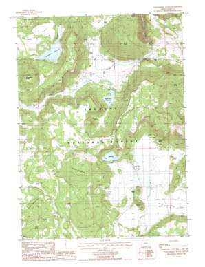
Strawberry Butte Topo Map Oregon
To zoom in, hover over the map of Strawberry Butte
USGS Topo Quad 42120a7 - 1:24,000 scale
| Topo Map Name: | Strawberry Butte |
| USGS Topo Quad ID: | 42120a7 |
| Print Size: | ca. 21 1/4" wide x 27" high |
| Southeast Coordinates: | 42° N latitude / 120.75° W longitude |
| Map Center Coordinates: | 42.0625° N latitude / 120.8125° W longitude |
| U.S. State: | OR |
| Filename: | o42120a7.jpg |
| Download Map JPG Image: | Strawberry Butte topo map 1:24,000 scale |
| Map Type: | Topographic |
| Topo Series: | 7.5´ |
| Map Scale: | 1:24,000 |
| Source of Map Images: | United States Geological Survey (USGS) |
| Alternate Map Versions: |
Strawberry Butte OR 1988, updated 1988 Download PDF Buy paper map Strawberry Butte OR 2004, updated 2007 Download PDF Buy paper map Strawberry Butte OR 2011 Download PDF Buy paper map Strawberry Butte OR 2014 Download PDF Buy paper map |
| FStopo: | US Forest Service topo Strawberry Butte is available: Download FStopo PDF Download FStopo TIF |
1:24,000 Topo Quads surrounding Strawberry Butte
> Back to 42120a1 at 1:100,000 scale
> Back to 42120a1 at 1:250,000 scale
> Back to U.S. Topo Maps home
Strawberry Butte topo map: Gazetteer
Strawberry Butte: Basins
The Pothole elevation 1648m 5406′Yocum Valley elevation 1634m 5360′
Strawberry Butte: Dams
Albertson Dam elevation 1642m 5387′Devaul Dam elevation 1700m 5577′
South Arm Dam elevation 1616m 5301′
Strawberry Butte: Flats
Strawberry Flat elevation 1723m 5652′Strawberry Butte: Populated Places
Yocum (historical) elevation 1637m 5370′Strawberry Butte: Post Offices
Yocum Post Office (historical) elevation 1637m 5370′Strawberry Butte: Reservoirs
Albertson Reservoir elevation 1643m 5390′South Arm Reservoir elevation 1628m 5341′
Strawberry Reservoir elevation 1696m 5564′
Strawberry Butte: Springs
Adams Spring elevation 1676m 5498′Cedar Spring elevation 1754m 5754′
Gober Spring elevation 1667m 5469′
Green Valley Spring elevation 1672m 5485′
Harp Spring elevation 1647m 5403′
Kenny Spring elevation 1614m 5295′
Melix Spring elevation 1647m 5403′
Sage Spring elevation 1614m 5295′
South Arm Spring elevation 1627m 5337′
Squaw Spring elevation 1658m 5439′
Strawberry Spring elevation 1769m 5803′
Willow Camp Spring elevation 1669m 5475′
Strawberry Butte: Streams
East Willow Creek elevation 1632m 5354′Strawberry Butte: Summits
Barry Point elevation 1885m 6184′Brushy Mountain elevation 1781m 5843′
Center Peak elevation 1694m 5557′
Harp Mountain elevation 1715m 5626′
Onion Knoll elevation 1662m 5452′
South Peak elevation 1700m 5577′
Strawberry Butte elevation 1840m 6036′
Strawberry Butte: Valleys
Long Valley elevation 1602m 5255′Strawberry Butte digital topo map on disk
Buy this Strawberry Butte topo map showing relief, roads, GPS coordinates and other geographical features, as a high-resolution digital map file on DVD:


