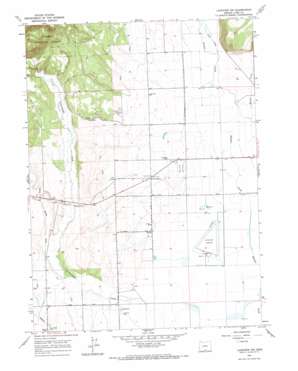
Lakeview Airport Topo Map Oregon
To zoom in, hover over the map of Lakeview Airport
USGS Topo Quad 42120b4 - 1:24,000 scale
| Topo Map Name: | Lakeview Airport |
| USGS Topo Quad ID: | 42120b4 |
| Print Size: | ca. 21 1/4" wide x 27" high |
| Southeast Coordinates: | 42.125° N latitude / 120.375° W longitude |
| Map Center Coordinates: | 42.1875° N latitude / 120.4375° W longitude |
| U.S. State: | OR |
| Filename: | o42120b4.jpg |
| Download Map JPG Image: | Lakeview Airport topo map 1:24,000 scale |
| Map Type: | Topographic |
| Topo Series: | 7.5´ |
| Map Scale: | 1:24,000 |
| Source of Map Images: | United States Geological Survey (USGS) |
| Alternate Map Versions: |
Lakeview NW OR 1964, updated 1965 Download PDF Buy paper map Lakeview Airport OR 2004, updated 2007 Download PDF Buy paper map Lakeview Airport OR 2011 Download PDF Buy paper map Lakeview Airport OR 2014 Download PDF Buy paper map |
| FStopo: | US Forest Service topo Lakeview Airport is available: Download FStopo PDF Download FStopo TIF |
1:24,000 Topo Quads surrounding Lakeview Airport
> Back to 42120a1 at 1:100,000 scale
> Back to 42120a1 at 1:250,000 scale
> Back to U.S. Topo Maps home
Lakeview Airport topo map: Gazetteer
Lakeview Airport: Airports
Lake County-Lakeview Airport elevation 1441m 4727′Lakeview Airport: Canals
Baldwin Ditch elevation 1481m 4858′Gray Lateral elevation 1454m 4770′
Lakeview Airport: Populated Places
Five Corners elevation 1452m 4763′Lakeview Airport: Post Offices
Cottonwood Post Office (historical) elevation 1455m 4773′Lakeview Airport: Reservoirs
Farleighs Reservoir elevation 1443m 4734′Lakeview Airport: Streams
Bullard Creek elevation 1437m 4714′Camp Creek elevation 1452m 4763′
East Branch Thomas Creek elevation 1438m 4717′
Muddy Creek elevation 1455m 4773′
Warner Creek elevation 1446m 4744′
Lakeview Airport: Valleys
Goose Swale elevation 1442m 4730′Lakeview Airport digital topo map on disk
Buy this Lakeview Airport topo map showing relief, roads, GPS coordinates and other geographical features, as a high-resolution digital map file on DVD:


