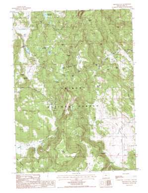
Arkansas Flat Topo Map Oregon
To zoom in, hover over the map of Arkansas Flat
USGS Topo Quad 42120b7 - 1:24,000 scale
| Topo Map Name: | Arkansas Flat |
| USGS Topo Quad ID: | 42120b7 |
| Print Size: | ca. 21 1/4" wide x 27" high |
| Southeast Coordinates: | 42.125° N latitude / 120.75° W longitude |
| Map Center Coordinates: | 42.1875° N latitude / 120.8125° W longitude |
| U.S. State: | OR |
| Filename: | o42120b7.jpg |
| Download Map JPG Image: | Arkansas Flat topo map 1:24,000 scale |
| Map Type: | Topographic |
| Topo Series: | 7.5´ |
| Map Scale: | 1:24,000 |
| Source of Map Images: | United States Geological Survey (USGS) |
| Alternate Map Versions: |
Arkansas Flat OR 1988, updated 1988 Download PDF Buy paper map Arkansas Flat OR 2004, updated 2007 Download PDF Buy paper map Arkansas Flat OR 2011 Download PDF Buy paper map Arkansas Flat OR 2014 Download PDF Buy paper map |
| FStopo: | US Forest Service topo Arkansas Flat is available: Download FStopo PDF Download FStopo TIF |
1:24,000 Topo Quads surrounding Arkansas Flat
> Back to 42120a1 at 1:100,000 scale
> Back to 42120a1 at 1:250,000 scale
> Back to U.S. Topo Maps home
Arkansas Flat topo map: Gazetteer
Arkansas Flat: Basins
Big Cove elevation 1568m 5144′Dry Valley elevation 1544m 5065′
Arkansas Flat: Bends
Hoyts Hole elevation 1834m 6017′Arkansas Flat: Cliffs
Barnes Rim elevation 1892m 6207′Arkansas Flat: Dams
Arkansas Dam elevation 1646m 5400′Big Swamp Dam elevation 1779m 5836′
Lapham Dam elevation 1645m 5396′
Pitt Lake Dam elevation 1778m 5833′
Arkansas Flat: Flats
Arkansas Flat elevation 1635m 5364′Bear Wallows elevation 1609m 5278′
Creed Field elevation 1637m 5370′
Squaw Flat elevation 1665m 5462′
Arkansas Flat: Lakes
Davis Lake elevation 1812m 5944′Lower Pitt Lake elevation 1770m 5807′
Pitt Lake elevation 1778m 5833′
Walker Lake elevation 1811m 5941′
Arkansas Flat: Reservoirs
Arkansas Reservoir elevation 1646m 5400′Big Swamp Reservoir elevation 1783m 5849′
Lapham Reservoir elevation 1664m 5459′
Arkansas Flat: Springs
Albertson Spring elevation 1809m 5935′Arkansas Spring elevation 1668m 5472′
Blue Monday Spring elevation 1781m 5843′
Buzzard Roost Spring elevation 1608m 5275′
Court Spring elevation 1790m 5872′
Deer Spring elevation 1879m 6164′
Harry Spring elevation 1636m 5367′
Horsehead Spring elevation 1584m 5196′
July Spring elevation 1624m 5328′
June Spring elevation 1687m 5534′
Lookout Spring elevation 1905m 6250′
Red Rock Spring elevation 1596m 5236′
Road Bend Spring elevation 1773m 5816′
Sullivan Spring elevation 1707m 5600′
Upset Spring elevation 1600m 5249′
Arkansas Flat: Streams
Bachelor Creek elevation 1580m 5183′Big Swamp Creek elevation 1651m 5416′
Strawberry Creek elevation 1585m 5200′
Wilson Creek elevation 1615m 5298′
Arkansas Flat: Summits
Juniper Mountain elevation 1823m 5980′Arkansas Flat: Swamps
Holmes Meadow elevation 1702m 5583′Long Prairie elevation 1811m 5941′
Arkansas Flat: Valleys
Secret Valley elevation 1601m 5252′Arkansas Flat digital topo map on disk
Buy this Arkansas Flat topo map showing relief, roads, GPS coordinates and other geographical features, as a high-resolution digital map file on DVD:


