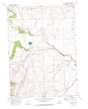
Drake Peak Ne Topo Map Oregon
To zoom in, hover over the map of Drake Peak Ne
USGS Topo Quad 42120d1 - 1:24,000 scale
| Topo Map Name: | Drake Peak Ne |
| USGS Topo Quad ID: | 42120d1 |
| Print Size: | ca. 21 1/4" wide x 27" high |
| Southeast Coordinates: | 42.375° N latitude / 120° W longitude |
| Map Center Coordinates: | 42.4375° N latitude / 120.0625° W longitude |
| U.S. State: | OR |
| Filename: | o42120d1.jpg |
| Download Map JPG Image: | Drake Peak Ne topo map 1:24,000 scale |
| Map Type: | Topographic |
| Topo Series: | 7.5´ |
| Map Scale: | 1:24,000 |
| Source of Map Images: | United States Geological Survey (USGS) |
| Alternate Map Versions: |
Drake Peak NE OR 1968, updated 1972 Download PDF Buy paper map Drake Peak NE OR 2011 Download PDF Buy paper map Drake Peak NE OR 2014 Download PDF Buy paper map |
1:24,000 Topo Quads surrounding Drake Peak Ne
> Back to 42120a1 at 1:100,000 scale
> Back to 42120a1 at 1:250,000 scale
> Back to U.S. Topo Maps home
Drake Peak Ne topo map: Gazetteer
Drake Peak Ne: Canals
Allen Ditch elevation 1609m 5278′Fitzgerald Ditches elevation 1622m 5321′
Priday Ditch elevation 1598m 5242′
Drake Peak Ne: Reservoirs
Luce Reservoir elevation 1706m 5597′North Coyote Hills Reservoir elevation 1656m 5433′
Drake Peak Ne: Streams
Benefiel Creek elevation 1603m 5259′Clover Creek elevation 1592m 5223′
Colvin Creek elevation 1611m 5285′
Dent Creek elevation 1588m 5209′
Deppy Creek elevation 1548m 5078′
Fort Creek elevation 1586m 5203′
McDowell Creek elevation 1611m 5285′
Snyder Creek elevation 1579m 5180′
Drake Peak Ne digital topo map on disk
Buy this Drake Peak Ne topo map showing relief, roads, GPS coordinates and other geographical features, as a high-resolution digital map file on DVD:


