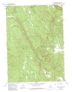
Coffeepot Creek Topo Map Oregon
To zoom in, hover over the map of Coffeepot Creek
USGS Topo Quad 42120e6 - 1:24,000 scale
| Topo Map Name: | Coffeepot Creek |
| USGS Topo Quad ID: | 42120e6 |
| Print Size: | ca. 21 1/4" wide x 27" high |
| Southeast Coordinates: | 42.5° N latitude / 120.625° W longitude |
| Map Center Coordinates: | 42.5625° N latitude / 120.6875° W longitude |
| U.S. State: | OR |
| Filename: | o42120e6.jpg |
| Download Map JPG Image: | Coffeepot Creek topo map 1:24,000 scale |
| Map Type: | Topographic |
| Topo Series: | 7.5´ |
| Map Scale: | 1:24,000 |
| Source of Map Images: | United States Geological Survey (USGS) |
| Alternate Map Versions: |
Coffeepot Creek OR 1966, updated 1968 Download PDF Buy paper map Coffeepot Creek OR 1966, updated 1982 Download PDF Buy paper map Coffeepot Creek OR 2004, updated 2007 Download PDF Buy paper map Coffeepot Creek OR 2011 Download PDF Buy paper map Coffeepot Creek OR 2014 Download PDF Buy paper map |
| FStopo: | US Forest Service topo Coffeepot Creek is available: Download FStopo PDF Download FStopo TIF |
1:24,000 Topo Quads surrounding Coffeepot Creek
> Back to 42120e1 at 1:100,000 scale
> Back to 42120a1 at 1:250,000 scale
> Back to U.S. Topo Maps home
Coffeepot Creek topo map: Gazetteer
Coffeepot Creek: Springs
Coffeepot Spring elevation 2097m 6879′Cold Spring elevation 1914m 6279′
Little Coffeepot Spring elevation 1988m 6522′
Puppydog Spring elevation 1923m 6309′
Coffeepot Creek: Streams
Beaver Creek elevation 1684m 5524′Bottle Creek elevation 1825m 5987′
Cold Creek elevation 1792m 5879′
Colt Creek elevation 1794m 5885′
East Witham Creek elevation 1996m 6548′
Little Bear Creek elevation 1706m 5597′
Little Coffeepot Creek elevation 1523m 4996′
Puppydog Creek elevation 1574m 5164′
Ring Corral Creek elevation 1946m 6384′
South Fork Beaver Creek elevation 1799m 5902′
South Fork Coffeepot Creek elevation 1518m 4980′
Tamarack Creek elevation 1774m 5820′
Witham Creek elevation 1994m 6541′
Coffeepot Creek digital topo map on disk
Buy this Coffeepot Creek topo map showing relief, roads, GPS coordinates and other geographical features, as a high-resolution digital map file on DVD:


