Coglan Buttes Ne Topo Map Oregon
To zoom in, hover over the map of Coglan Buttes Ne
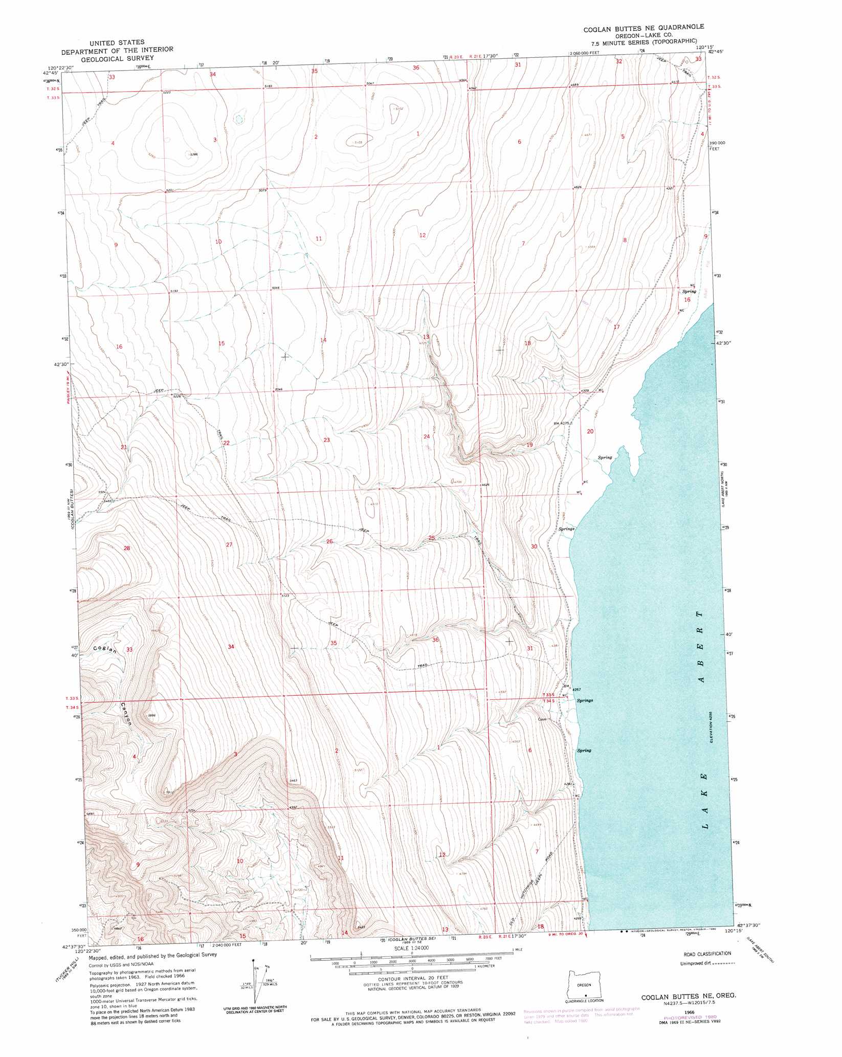
USGS Topo Quad 42120f3 - 1:24,000 scale
| Topo Map Name: | Coglan Buttes Ne |
| USGS Topo Quad ID: | 42120f3 |
| Print Size: | ca. 21 1/4" wide x 27" high |
| Southeast Coordinates: | 42.625° N latitude / 120.25° W longitude |
| Map Center Coordinates: | 42.6875° N latitude / 120.3125° W longitude |
| U.S. State: | OR |
| Filename: | o42120f3.jpg |
| Download Map JPG Image: | Coglan Buttes Ne topo map 1:24,000 scale |
| Map Type: | Topographic |
| Topo Series: | 7.5´ |
| Map Scale: | 1:24,000 |
| Source of Map Images: | United States Geological Survey (USGS) |
| Alternate Map Versions: |
Coglan Buttes NE OR 1966, updated 1967 Download PDF Buy paper map Coglan Buttes NE OR 1966, updated 1980 Download PDF Buy paper map Coglan Buttes NE OR 2011 Download PDF Buy paper map Coglan Buttes NE OR 2014 Download PDF Buy paper map |
1:24,000 Topo Quads surrounding Coglan Buttes Ne
Diablo Peak |
Bull Lake |
Diatomite Reservoir |
Poverty Basin South |
Alkali Lake |
Loco Lake |
Sharp Top |
Biscuit Point |
Sawed Horn |
Coleman Hills |
Paisley |
Coglan Buttes |
Coglan Buttes Ne |
Lake Abert North |
Commodore Ridge |
Morgan Butte |
Tucker Hill |
Coglan Buttes Se |
Lake Abert South |
Cooper Draw |
Shoestring Butte |
Clover Flat |
Valley Falls |
Little Honey Creek |
Drake Peak Ne |
> Back to 42120e1 at 1:100,000 scale
> Back to 42120a1 at 1:250,000 scale
> Back to U.S. Topo Maps home
Coglan Buttes Ne digital topo map on disk
Buy this Coglan Buttes Ne topo map showing relief, roads, GPS coordinates and other geographical features, as a high-resolution digital map file on DVD: