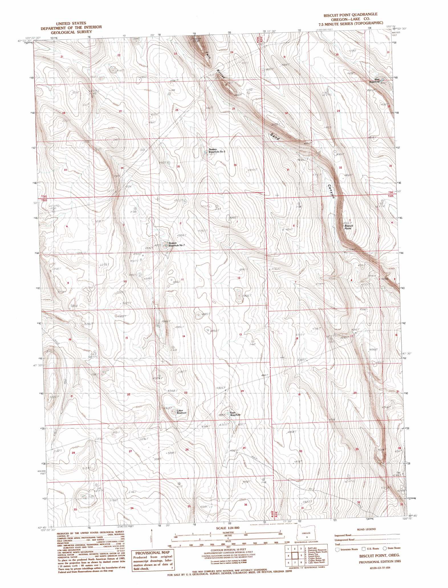
Biscuit Point Topo Map Oregon
To zoom in, hover over the map of Biscuit Point
USGS Topo Quad 42120g3 - 1:24,000 scale
| Topo Map Name: | Biscuit Point |
| USGS Topo Quad ID: | 42120g3 |
| Print Size: | ca. 21 1/4" wide x 27" high |
| Southeast Coordinates: | 42.75° N latitude / 120.25° W longitude |
| Map Center Coordinates: | 42.8125° N latitude / 120.3125° W longitude |
| U.S. State: | OR |
| Filename: | o42120g3.jpg |
| Download Map JPG Image: | Biscuit Point topo map 1:24,000 scale |
| Map Type: | Topographic |
| Topo Series: | 7.5´ |
| Map Scale: | 1:24,000 |
| Source of Map Images: | United States Geological Survey (USGS) |
| Alternate Map Versions: |
Biscuit Point OR 1985, updated 1986 Download PDF Buy paper map Biscuit Point OR 2011 Download PDF Buy paper map Biscuit Point OR 2014 Download PDF Buy paper map |
1:24,000 Topo Quads surrounding Biscuit Point
Saint Patrick Mountain |
Sheep Rock |
Fire Lake |
Poverty Basin North |
Alkali Buttes |
Diablo Peak |
Bull Lake |
Diatomite Reservoir |
Poverty Basin South |
Alkali Lake |
Loco Lake |
Sharp Top |
Biscuit Point |
Sawed Horn |
Coleman Hills |
Paisley |
Coglan Buttes |
Coglan Buttes Ne |
Lake Abert North |
Commodore Ridge |
Morgan Butte |
Tucker Hill |
Coglan Buttes Se |
Lake Abert South |
Cooper Draw |
> Back to 42120e1 at 1:100,000 scale
> Back to 42120a1 at 1:250,000 scale
> Back to U.S. Topo Maps home
Biscuit Point topo map: Gazetteer
Biscuit Point: Reservoirs
Brattain Waterhole Number 5 elevation 1492m 4895′Brattain Waterhole Number 7 elevation 1489m 4885′
Keen Waterhole elevation 1491m 4891′
West Waterhole elevation 1446m 4744′
Biscuit Point: Summits
Biscuit Point elevation 1510m 4954′Twin Buttes elevation 1603m 5259′
Biscuit Point: Valleys
Sand Canyon elevation 1439m 4721′Biscuit Point digital topo map on disk
Buy this Biscuit Point topo map showing relief, roads, GPS coordinates and other geographical features, as a high-resolution digital map file on DVD: