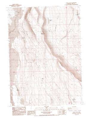
Diablo Peak Topo Map Oregon
To zoom in, hover over the map of Diablo Peak
USGS Topo Quad 42120h5 - 1:24,000 scale
| Topo Map Name: | Diablo Peak |
| USGS Topo Quad ID: | 42120h5 |
| Print Size: | ca. 21 1/4" wide x 27" high |
| Southeast Coordinates: | 42.875° N latitude / 120.5° W longitude |
| Map Center Coordinates: | 42.9375° N latitude / 120.5625° W longitude |
| U.S. State: | OR |
| Filename: | o42120h5.jpg |
| Download Map JPG Image: | Diablo Peak topo map 1:24,000 scale |
| Map Type: | Topographic |
| Topo Series: | 7.5´ |
| Map Scale: | 1:24,000 |
| Source of Map Images: | United States Geological Survey (USGS) |
| Alternate Map Versions: |
Diablo Peak OR 1986, updated 1986 Download PDF Buy paper map Diablo Peak OR 2011 Download PDF Buy paper map Diablo Peak OR 2014 Download PDF Buy paper map |
1:24,000 Topo Quads surrounding Diablo Peak
> Back to 42120e1 at 1:100,000 scale
> Back to 42120a1 at 1:250,000 scale
> Back to U.S. Topo Maps home
Diablo Peak topo map: Gazetteer
Diablo Peak: Basins
Jackings Hole elevation 1333m 4373′Diablo Peak: Cliffs
Diablo Rim elevation 1828m 5997′Diablo Peak: Flats
Murphys Lake elevation 1421m 4662′West Whiskey Lake elevation 1564m 5131′
Diablo Peak: Ranges
Whiskey Hills elevation 1681m 5515′Diablo Peak: Reservoirs
Slim Reservoir elevation 1642m 5387′Diablo Peak: Summits
Diablo Peak elevation 1863m 6112′Fourmile Point elevation 1440m 4724′
Diablo Peak: Wells
Banta Well elevation 1310m 4297′Devil Well elevation 1353m 4438′
Diablo Peak digital topo map on disk
Buy this Diablo Peak topo map showing relief, roads, GPS coordinates and other geographical features, as a high-resolution digital map file on DVD:


