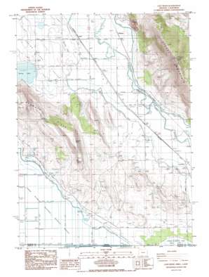
Lost River Topo Map Oregon
To zoom in, hover over the map of Lost River
USGS Topo Quad 42121a6 - 1:24,000 scale
| Topo Map Name: | Lost River |
| USGS Topo Quad ID: | 42121a6 |
| Print Size: | ca. 21 1/4" wide x 27" high |
| Southeast Coordinates: | 42° N latitude / 121.625° W longitude |
| Map Center Coordinates: | 42.0625° N latitude / 121.6875° W longitude |
| U.S. States: | OR, CA |
| Filename: | o42121a6.jpg |
| Download Map JPG Image: | Lost River topo map 1:24,000 scale |
| Map Type: | Topographic |
| Topo Series: | 7.5´ |
| Map Scale: | 1:24,000 |
| Source of Map Images: | United States Geological Survey (USGS) |
| Alternate Map Versions: |
Lost River OR 1986, updated 1986 Download PDF Buy paper map Lost River OR 2011 Download PDF Buy paper map Lost River OR 2014 Download PDF Buy paper map |
1:24,000 Topo Quads surrounding Lost River
> Back to 42121a1 at 1:100,000 scale
> Back to 42120a1 at 1:250,000 scale
> Back to U.S. Topo Maps home
Lost River topo map: Gazetteer
Lost River: Airports
Long Ranch Airstrip elevation 1247m 4091′Lost River: Bridges
Stukel Bridge elevation 1242m 4074′Lost River: Canals
C Canal elevation 1247m 4091′G Canal elevation 1247m 4091′
Lost River: Lakes
Spring Lake elevation 1243m 4078′Lost River: Populated Places
White Lake City (historical) elevation 1247m 4091′Lost River: Post Offices
Colson Post Office (historical) elevation 1247m 4091′Lost River Post Office (historical) elevation 1243m 4078′
Whitelake Post Office (historical) elevation 1247m 4091′
Lost River: Reservoirs
Dehlinger Reservoir elevation 1517m 4977′Lost River: Ridges
Manning Ridge elevation 1270m 4166′Lost River: Summits
Klamath Hills elevation 1566m 5137′Stukel Mountain elevation 1965m 6446′
Lost River digital topo map on disk
Buy this Lost River topo map showing relief, roads, GPS coordinates and other geographical features, as a high-resolution digital map file on DVD:


