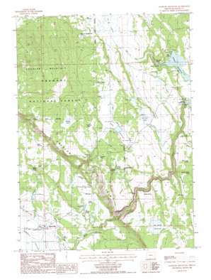
Goodlow Mountain Topo Map Oregon
To zoom in, hover over the map of Goodlow Mountain
USGS Topo Quad 42121b2 - 1:24,000 scale
| Topo Map Name: | Goodlow Mountain |
| USGS Topo Quad ID: | 42121b2 |
| Print Size: | ca. 21 1/4" wide x 27" high |
| Southeast Coordinates: | 42.125° N latitude / 121.125° W longitude |
| Map Center Coordinates: | 42.1875° N latitude / 121.1875° W longitude |
| U.S. State: | OR |
| Filename: | o42121b2.jpg |
| Download Map JPG Image: | Goodlow Mountain topo map 1:24,000 scale |
| Map Type: | Topographic |
| Topo Series: | 7.5´ |
| Map Scale: | 1:24,000 |
| Source of Map Images: | United States Geological Survey (USGS) |
| Alternate Map Versions: |
Goodlow Mountain OR 1988, updated 1988 Download PDF Buy paper map Goodlow Mountain OR 2004, updated 2007 Download PDF Buy paper map Goodlow Mountain OR 2011 Download PDF Buy paper map Goodlow Mountain OR 2014 Download PDF Buy paper map |
| FStopo: | US Forest Service topo Goodlow Mountain is available: Download FStopo PDF Download FStopo TIF |
1:24,000 Topo Quads surrounding Goodlow Mountain
> Back to 42121a1 at 1:100,000 scale
> Back to 42120a1 at 1:250,000 scale
> Back to U.S. Topo Maps home
Goodlow Mountain topo map: Gazetteer
Goodlow Mountain: Basins
Pankey Basin elevation 1437m 4714′Goodlow Mountain: Cliffs
Goodlow Rim elevation 1413m 4635′Goodlow Mountain: Dams
Big Adobe Dam elevation 1474m 4835′Dry Prairie Dam elevation 1479m 4852′
Gerber Dam elevation 1496m 4908′
Miller Diversion Dam elevation 1320m 4330′
Randall Dam Number 3 elevation 1296m 4251′
Goodlow Mountain: Flats
Lockey Flat elevation 1507m 4944′Goodlow Mountain: Lakes
DeVaul Lake elevation 1500m 4921′Goodlow Pond elevation 1492m 4895′
Noble Pond elevation 1518m 4980′
Pankey Lake elevation 1542m 5059′
Goodlow Mountain: Parks
Goodlow Mountain Research Natural Area elevation 1538m 5045′Goodlow Mountain: Populated Places
Haynesville elevation 1273m 4176′Goodlow Mountain: Reservoirs
Big Adobe Reservoir elevation 1475m 4839′Dry Prairie Reservoir elevation 1479m 4852′
Gary Reservoir elevation 1486m 4875′
Gerber Reservoir elevation 1496m 4908′
Hope Reservoir elevation 1400m 4593′
Kent Reservoir elevation 1320m 4330′
Noble Canyon Reservoir elevation 1318m 4324′
Noble Reservoir elevation 1493m 4898′
Noble Reservoir Number One elevation 1329m 4360′
Pankey Reservoir elevation 1458m 4783′
Randall Reservoir Number 3 elevation 1296m 4251′
Goodlow Mountain: Springs
Ben Hall Spring elevation 1484m 4868′Campbell Spring elevation 1269m 4163′
Gillette Spring elevation 1452m 4763′
Harbison Spring elevation 1480m 4855′
House Spring elevation 1322m 4337′
Lewis Spring elevation 1468m 4816′
Linsay Spring elevation 1321m 4333′
Meadow Spring elevation 1316m 4317′
Miller Creek Spring elevation 1504m 4934′
Nail Spring elevation 1292m 4238′
Pankey Springs elevation 1472m 4829′
R N A Spring elevation 1503m 4931′
Schnipps Valley Spring elevation 1493m 4898′
Stan H Spring elevation 1488m 4881′
Stewart Spring elevation 1334m 4376′
Tillie Spring elevation 1486m 4875′
Wilkerson Horse Camp Spring elevation 1511m 4957′
Goodlow Mountain: Streams
Ben Hall Creek elevation 1496m 4908′Cys Branch elevation 1260m 4133′
Dobe Creek elevation 1293m 4242′
Noble Creek elevation 1321m 4333′
Goodlow Mountain: Summits
Goodlow Mountain elevation 1748m 5734′Goodlow Mountain: Valleys
Rock Canyon elevation 1318m 4324′Schnipps Valley elevation 1497m 4911′
Goodlow Mountain digital topo map on disk
Buy this Goodlow Mountain topo map showing relief, roads, GPS coordinates and other geographical features, as a high-resolution digital map file on DVD:


