Riverbed Butte Topo Map Oregon
To zoom in, hover over the map of Riverbed Butte
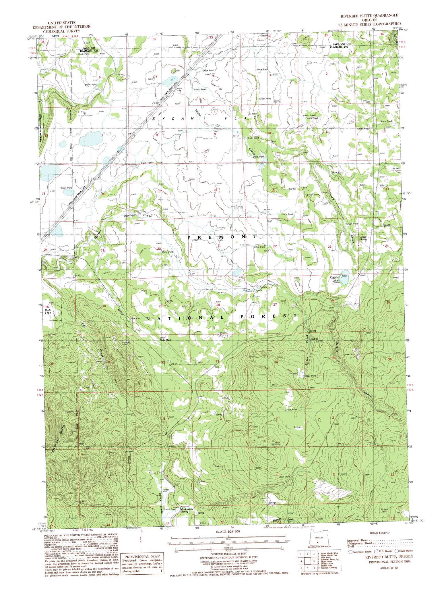
USGS Topo Quad 42121f1 - 1:24,000 scale
| Topo Map Name: | Riverbed Butte |
| USGS Topo Quad ID: | 42121f1 |
| Print Size: | ca. 21 1/4" wide x 27" high |
| Southeast Coordinates: | 42.625° N latitude / 121° W longitude |
| Map Center Coordinates: | 42.6875° N latitude / 121.0625° W longitude |
| U.S. State: | OR |
| Filename: | o42121f1.jpg |
| Download Map JPG Image: | Riverbed Butte topo map 1:24,000 scale |
| Map Type: | Topographic |
| Topo Series: | 7.5´ |
| Map Scale: | 1:24,000 |
| Source of Map Images: | United States Geological Survey (USGS) |
| Alternate Map Versions: |
Riverbed Butte OR 1988, updated 1988 Download PDF Buy paper map Riverbed Butte OR 2004, updated 2007 Download PDF Buy paper map Riverbed Butte OR 2011 Download PDF Buy paper map Riverbed Butte OR 2014 Download PDF Buy paper map |
| FStopo: | US Forest Service topo Riverbed Butte is available: Download FStopo PDF Download FStopo TIF |
1:24,000 Topo Quads surrounding Riverbed Butte
Yamsay Mountain |
Partin Butte |
Thompson Reservoir |
Foster Butte |
Summer Lake |
Hamelton Butte |
Sycan Marsh West |
Sycan Marsh East |
Pole Butte |
Fremont Point |
Silver Dollar Flat |
Riverbed Butte Spring |
Riverbed Butte |
Shake Butte |
Harvey Creek |
Spodue Mountain |
Ponina Butte |
Rodeo Butte |
Sandhill Crossing |
Lee Thomas Crossing |
Beatty |
Ferguson Mountain |
Bly |
Campbell Reservoir |
Gearhart Mountain |
> Back to 42121e1 at 1:100,000 scale
> Back to 42120a1 at 1:250,000 scale
> Back to U.S. Topo Maps home
Riverbed Butte topo map: Gazetteer
Riverbed Butte: Flats
Sycan Flat elevation 1589m 5213′Riverbed Butte: Lakes
Klipple Lake elevation 1636m 5367′Riverbed Butte: Springs
Packsaddle Spring elevation 1555m 5101′Small Spring elevation 1633m 5357′
Riverbed Butte: Streams
Evans Creek elevation 1591m 5219′Riverbed Butte: Summits
Riverbed Butte elevation 1862m 6108′Riverbed Butte: Wells
Dicks Well elevation 1589m 5213′Riverbed Butte digital topo map on disk
Buy this Riverbed Butte topo map showing relief, roads, GPS coordinates and other geographical features, as a high-resolution digital map file on DVD: