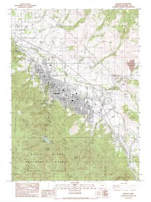
Ashland Topo Map Oregon
To zoom in, hover over the map of Ashland
USGS Topo Quad 42122b6 - 1:24,000 scale
| Topo Map Name: | Ashland |
| USGS Topo Quad ID: | 42122b6 |
| Print Size: | ca. 21 1/4" wide x 27" high |
| Southeast Coordinates: | 42.125° N latitude / 122.625° W longitude |
| Map Center Coordinates: | 42.1875° N latitude / 122.6875° W longitude |
| U.S. State: | OR |
| Filename: | o42122b6.jpg |
| Download Map JPG Image: | Ashland topo map 1:24,000 scale |
| Map Type: | Topographic |
| Topo Series: | 7.5´ |
| Map Scale: | 1:24,000 |
| Source of Map Images: | United States Geological Survey (USGS) |
| Alternate Map Versions: |
Ashland OR 1983, updated 1983 Download PDF Buy paper map Ashland OR 1996, updated 1998 Download PDF Buy paper map Ashland OR 2011 Download PDF Buy paper map Ashland OR 2014 Download PDF Buy paper map |
| FStopo: | US Forest Service topo Ashland is available: Download FStopo PDF Download FStopo TIF |
1:24,000 Topo Quads surrounding Ashland
> Back to 42122a1 at 1:100,000 scale
> Back to 42122a1 at 1:250,000 scale
> Back to U.S. Topo Maps home
Ashland topo map: Gazetteer
Ashland: Airports
Ashland Municipal Airport-Summer Parker Field elevation 575m 1886′Ashland: Areas
Ashland Watershed elevation 1145m 3756′Ashland: Canals
Lower East Lateral elevation 520m 1706′Ashland: Cliffs
Pompadour Bluff elevation 707m 2319′Ashland: Dams
Reeder Gulch Dam elevation 881m 2890′Ashland: Gaps
Coggins Saddle elevation 1299m 4261′Horn Gap elevation 1421m 4662′
Lamb Saddle elevation 1056m 3464′
Ashland: Mines
Lamb Mine elevation 1483m 4865′Skyline Mine elevation 1455m 4773′
Ashland: Parks
Ashland Dog Park elevation 528m 1732′Ashland Research Natural Area elevation 1097m 3599′
Bluebird Park elevation 576m 1889′
Calle Guanajuato elevation 577m 1893′
Clay Steet Park elevation 613m 2011′
Garden Way Park elevation 628m 2060′
Garfield Park elevation 577m 1893′
Glenwood Park elevation 636m 2086′
Hald/Strawberry Park elevation 692m 2270′
Liberty Street Park elevation 694m 2276′
Lithia Park elevation 612m 2007′
North Mountain Park elevation 538m 1765′
Oredson Todd Woods elevation 746m 2447′
Railroad Park elevation 568m 1863′
Scenic Park elevation 565m 1853′
Sherwood Park elevation 611m 2004′
Siskiyou Mountain Park elevation 956m 3136′
Skateboard Park elevation 559m 1833′
Southern Oregon University Nat elevation 763m 2503′
Triangle Park elevation 598m 1961′
Vogel Park elevation 554m 1817′
YMCA Park elevation 597m 1958′
Ashland: Populated Places
Ashland elevation 593m 1945′Ashland: Post Offices
Ashland Post Office elevation 580m 1902′Ashland: Reservoirs
Billings Reservoir elevation 526m 1725′Black Swan Lake elevation 608m 1994′
Corp Reservoirs elevation 656m 2152′
Crowson Reservoir elevation 733m 2404′
Granite Street Reservoir elevation 672m 2204′
La Marre Reservoir elevation 653m 2142′
Lower Reservoir elevation 671m 2201′
Merriman Reservoir elevation 623m 2043′
Meyer Memorial Lake elevation 582m 1909′
Reeder Reservoir elevation 882m 2893′
Ashland: Ridges
Winburn Ridge elevation 1434m 4704′Ashland: Springs
Danns Spring elevation 660m 2165′Hamby Spring elevation 541m 1774′
Jackson Hot Springs elevation 512m 1679′
Lithia Spring elevation 582m 1909′
Sulphur Springs elevation 614m 2014′
Sulphur Springs elevation 576m 1889′
Ashland: Streams
Ashland Creek elevation 524m 1719′Butler Creek elevation 503m 1650′
Clay Creek elevation 557m 1827′
Clayton Creek elevation 625m 2050′
Cove Creek elevation 596m 1955′
East Fork Ashland Creek elevation 886m 2906′
Emigrant Creek elevation 561m 1840′
Gaerky Creek elevation 545m 1788′
Hamilton Creek elevation 557m 1827′
Kitchen Creek elevation 529m 1735′
Neil Creek elevation 562m 1843′
Quartz Creek elevation 881m 2890′
Tolman Creek elevation 600m 1968′
Walker Creek elevation 572m 1876′
Weasel Creek elevation 1025m 3362′
West Fork Ashland Creek elevation 901m 2956′
West Fork Wrights Creek elevation 730m 2395′
Wrights Creek elevation 531m 1742′
Ashland: Summits
Dunn Butte elevation 789m 2588′Ropers Bunion elevation 636m 2086′
Winburn Mountain elevation 1517m 4977′
Ashland: Valleys
Jemmison Gulch elevation 920m 3018′Reeder Gulch elevation 882m 2893′
Roca Canyon elevation 632m 2073′
Wildcat Gulch elevation 512m 1679′
Ashland digital topo map on disk
Buy this Ashland topo map showing relief, roads, GPS coordinates and other geographical features, as a high-resolution digital map file on DVD:


