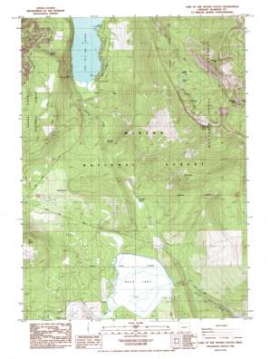
Lake Of The Woods South Topo Map Oregon
To zoom in, hover over the map of Lake Of The Woods South
USGS Topo Quad 42122c2 - 1:24,000 scale
| Topo Map Name: | Lake Of The Woods South |
| USGS Topo Quad ID: | 42122c2 |
| Print Size: | ca. 21 1/4" wide x 27" high |
| Southeast Coordinates: | 42.25° N latitude / 122.125° W longitude |
| Map Center Coordinates: | 42.3125° N latitude / 122.1875° W longitude |
| U.S. State: | OR |
| Filename: | o42122c2.jpg |
| Download Map JPG Image: | Lake Of The Woods South topo map 1:24,000 scale |
| Map Type: | Topographic |
| Topo Series: | 7.5´ |
| Map Scale: | 1:24,000 |
| Source of Map Images: | United States Geological Survey (USGS) |
| Alternate Map Versions: |
Lake of The Woods South OR 1985, updated 1985 Download PDF Buy paper map Lake of The Woods South OR 1998, updated 2000 Download PDF Buy paper map Lake of the Woods South OR 2011 Download PDF Buy paper map Lake of the Woods South OR 2014 Download PDF Buy paper map |
| FStopo: | US Forest Service topo Lake of the Woods South is available: Download FStopo PDF Download FStopo TIF |
1:24,000 Topo Quads surrounding Lake Of The Woods South
> Back to 42122a1 at 1:100,000 scale
> Back to 42122a1 at 1:250,000 scale
> Back to U.S. Topo Maps home
Lake Of The Woods South topo map: Gazetteer
Lake Of The Woods South: Lakes
Avalanche Lake elevation 2073m 6801′Buck Lake elevation 1507m 4944′
Lake of the Woods elevation 1511m 4957′
Lake Waban elevation 1938m 6358′
Weston Lake elevation 1958m 6423′
Lake Of The Woods South: Springs
Crystalline Spring elevation 1607m 5272′Ichabod Spring elevation 1635m 5364′
Muddy Spring elevation 1551m 5088′
Rainbow Springs elevation 1555m 5101′
Lake Of The Woods South: Streams
Cold Creek elevation 1512m 4960′Rainbow Creek elevation 1511m 4957′
Tunnel Creek elevation 1507m 4944′
Lake Of The Woods South: Summits
Burton Butte elevation 1855m 6085′Crater Mountain elevation 2363m 7752′
Greylock Mountain elevation 2348m 7703′
High Knob elevation 1902m 6240′
Whiteface Peak elevation 2338m 7670′
Lake Of The Woods South: Swamps
Desolation Swamp elevation 1547m 5075′Lake Of The Woods South: Trails
Mountain Lakes Trail elevation 1854m 6082′Lake Of The Woods South digital topo map on disk
Buy this Lake Of The Woods South topo map showing relief, roads, GPS coordinates and other geographical features, as a high-resolution digital map file on DVD:


