Butte Falls Topo Map Oregon
To zoom in, hover over the map of Butte Falls
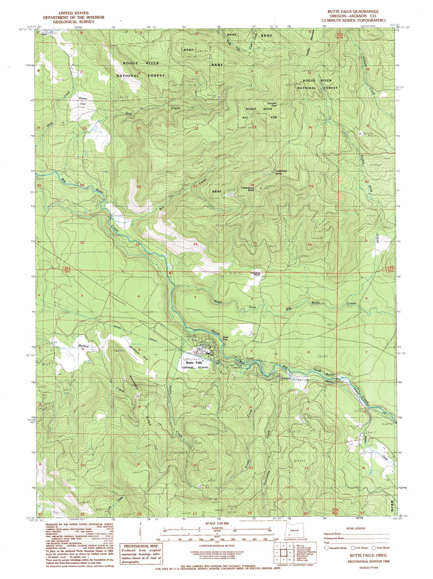
USGS Topo Quad 42122e5 - 1:24,000 scale
| Topo Map Name: | Butte Falls |
| USGS Topo Quad ID: | 42122e5 |
| Print Size: | ca. 21 1/4" wide x 27" high |
| Southeast Coordinates: | 42.5° N latitude / 122.5° W longitude |
| Map Center Coordinates: | 42.5625° N latitude / 122.5625° W longitude |
| U.S. State: | OR |
| Filename: | o42122e5.jpg |
| Download Map JPG Image: | Butte Falls topo map 1:24,000 scale |
| Map Type: | Topographic |
| Topo Series: | 7.5´ |
| Map Scale: | 1:24,000 |
| Source of Map Images: | United States Geological Survey (USGS) |
| Alternate Map Versions: |
Butte Falls OR 1988, updated 1988 Download PDF Buy paper map Butte Falls OR 1997, updated 2000 Download PDF Buy paper map Butte Falls OR 2011 Download PDF Buy paper map Butte Falls OR 2014 Download PDF Buy paper map |
| FStopo: | US Forest Service topo Butte Falls is available: Download FStopo PDF Download FStopo TIF |
1:24,000 Topo Quads surrounding Butte Falls
Ragsdale Butte |
Sugarpine Creek |
Whetstone Point |
Prospect North |
Red Blanket Mountain |
Trail |
Mcleod |
Cascade Gorge |
Prospect South |
Imnaha Creek |
Shady Cove |
Obenchain Mountain |
Butte Falls |
Big Butte Springs |
Rustler Peak |
Eagle Point |
Brownsboro |
Lakecreek |
Willow Lake |
Mount Mcloughlin |
Medford East |
Rio Canyon |
Grizzly Peak |
Robinson Butte |
Brown Mountain |
> Back to 42122e1 at 1:100,000 scale
> Back to 42122a1 at 1:250,000 scale
> Back to U.S. Topo Maps home
Butte Falls topo map: Gazetteer
Butte Falls: Canals
Medford Aqueduct elevation 766m 2513′Butte Falls: Falls
Butte Falls elevation 738m 2421′Butte Falls: Flats
Beekman Flat elevation 785m 2575′Hafer Flat elevation 815m 2673′
Rocky Flat elevation 761m 2496′
Butte Falls: Populated Places
Butte Falls elevation 772m 2532′Butte Falls: Post Offices
Big Butte Post Office (historical) elevation 742m 2434′Butte Falls Post Office elevation 772m 2532′
Butte Falls: Ridges
Beekman Ridge elevation 973m 3192′Butte Falls: Springs
Fredenburg Spring elevation 1225m 4019′Jerry Gotts Spring elevation 1118m 3667′
Butte Falls: Streams
Bowen Creek elevation 782m 2565′Box Creek elevation 648m 2125′
Dog Creek elevation 595m 1952′
Doubleday Creek elevation 757m 2483′
Eighty Acre Creek elevation 804m 2637′
Geppert Creek elevation 719m 2358′
Ginger Creek elevation 735m 2411′
Hukill Creek elevation 719m 2358′
North Fork Big Butte Creek elevation 689m 2260′
Richard Creek elevation 855m 2805′
South Fork Big Butte Creek elevation 679m 2227′
Butte Falls: Summits
Dudley Mountain elevation 1389m 4557′Fredenburg Butte elevation 1271m 4169′
Santiam Peak elevation 1388m 4553′
Butte Falls digital topo map on disk
Buy this Butte Falls topo map showing relief, roads, GPS coordinates and other geographical features, as a high-resolution digital map file on DVD: