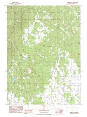
Boswell Mountain Topo Map Oregon
To zoom in, hover over the map of Boswell Mountain
USGS Topo Quad 42122e8 - 1:24,000 scale
| Topo Map Name: | Boswell Mountain |
| USGS Topo Quad ID: | 42122e8 |
| Print Size: | ca. 21 1/4" wide x 27" high |
| Southeast Coordinates: | 42.5° N latitude / 122.875° W longitude |
| Map Center Coordinates: | 42.5625° N latitude / 122.9375° W longitude |
| U.S. State: | OR |
| Filename: | o42122e8.jpg |
| Download Map JPG Image: | Boswell Mountain topo map 1:24,000 scale |
| Map Type: | Topographic |
| Topo Series: | 7.5´ |
| Map Scale: | 1:24,000 |
| Source of Map Images: | United States Geological Survey (USGS) |
| Alternate Map Versions: |
Boswell Mtn OR 1983, updated 1983 Download PDF Buy paper map Boswell Mountain OR 2011 Download PDF Buy paper map Boswell Mountain OR 2014 Download PDF Buy paper map |
1:24,000 Topo Quads surrounding Boswell Mountain
> Back to 42122e1 at 1:100,000 scale
> Back to 42122a1 at 1:250,000 scale
> Back to U.S. Topo Maps home
Boswell Mountain topo map: Gazetteer
Boswell Mountain: Airports
Beagle Sky Ranch Airport elevation 434m 1423′Boswell Mountain: Canals
Patillo Ditches elevation 484m 1587′Boswell Mountain: Dams
Sams Valley Dam elevation 629m 2063′Simpson Dam elevation 696m 2283′
Boswell Mountain: Flats
The Meadows elevation 517m 1696′Boswell Mountain: Mines
Cinnabar Mountain Mine elevation 708m 2322′Mountain King Mine elevation 799m 2621′
War Eagle Mine elevation 688m 2257′
Boswell Mountain: Pillars
Neil Rock elevation 846m 2775′Turtle Rock elevation 705m 2312′
Boswell Mountain: Populated Places
Beagle elevation 430m 1410′Spikenard (historical) elevation 539m 1768′
Boswell Mountain: Post Offices
Beagle Post Office (historical) elevation 430m 1410′Spikenard Post Office (historical) elevation 539m 1768′
Thomas Mill Post Office (historical) elevation 581m 1906′
Boswell Mountain: Reservoirs
Bingham Reservoir elevation 402m 1318′Chirgwin Reservoir elevation 425m 1394′
Coulter Reservoir Number One elevation 693m 2273′
Coulter Reservoir Number Two elevation 701m 2299′
Despain Reservoir elevation 406m 1332′
Gribble Reservoir elevation 642m 2106′
Hunt Reservoir elevation 545m 1788′
Kirkham Reservoir elevation 721m 2365′
Mack Reservoir elevation 432m 1417′
Moore Reservoir elevation 394m 1292′
Price Reservoir elevation 644m 2112′
Sams Valley Reservoir elevation 629m 2063′
Schmidt Reservoirs elevation 425m 1394′
Secluded Lake Reservoir elevation 468m 1535′
Simpson Reservoir elevation 696m 2283′
Boswell Mountain: Springs
Rexrood Springs elevation 570m 1870′Straus Spring elevation 790m 2591′
Boswell Mountain: Streams
Mystery Creek elevation 508m 1666′Peffley Creek elevation 401m 1315′
Short Creek elevation 449m 1473′
Spignet Creek elevation 469m 1538′
Boswell Mountain: Summits
Boswell Mountain elevation 1062m 3484′Chimney Rock Butte elevation 791m 2595′
Cinnabar Mountain elevation 754m 2473′
Hull Mountain elevation 934m 3064′
Boswell Mountain: Valleys
Lucky Hollow elevation 496m 1627′Mill Hollow elevation 548m 1797′
Boswell Mountain digital topo map on disk
Buy this Boswell Mountain topo map showing relief, roads, GPS coordinates and other geographical features, as a high-resolution digital map file on DVD:


