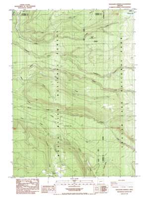
Thousand Springs Topo Map Oregon
To zoom in, hover over the map of Thousand Springs
USGS Topo Quad 42122h3 - 1:24,000 scale
| Topo Map Name: | Thousand Springs |
| USGS Topo Quad ID: | 42122h3 |
| Print Size: | ca. 21 1/4" wide x 27" high |
| Southeast Coordinates: | 42.875° N latitude / 122.25° W longitude |
| Map Center Coordinates: | 42.9375° N latitude / 122.3125° W longitude |
| U.S. State: | OR |
| Filename: | o42122h3.jpg |
| Download Map JPG Image: | Thousand Springs topo map 1:24,000 scale |
| Map Type: | Topographic |
| Topo Series: | 7.5´ |
| Map Scale: | 1:24,000 |
| Source of Map Images: | United States Geological Survey (USGS) |
| Alternate Map Versions: |
Thousand Springs OR 1985, updated 1985 Download PDF Buy paper map Thousand Springs OR 1997, updated 2000 Download PDF Buy paper map Thousand Springs OR 2011 Download PDF Buy paper map Thousand Springs OR 2014 Download PDF Buy paper map |
| FStopo: | US Forest Service topo Thousand Springs is available: Download FStopo PDF Download FStopo TIF |
1:24,000 Topo Quads surrounding Thousand Springs
> Back to 42122e1 at 1:100,000 scale
> Back to 42122a1 at 1:250,000 scale
> Back to U.S. Topo Maps home
Thousand Springs topo map: Gazetteer
Thousand Springs: Lakes
Spruce Lake elevation 1450m 4757′Thousand Springs: Springs
Crater Springs elevation 1626m 5334′Thousand Springs elevation 1488m 4881′
Thousand Springs: Streams
Bert Creek elevation 1149m 3769′Bill Creek elevation 1398m 4586′
Crater Creek elevation 1096m 3595′
Crawford Creek elevation 1190m 3904′
Deer Creek elevation 1187m 3894′
Grouse Creek elevation 1290m 4232′
Little Castle Creek elevation 1567m 5141′
North Fork Castle Creek elevation 1528m 5013′
North Fork Copeland Creek elevation 1521m 4990′
North Fork Little Copeland Creek elevation 1311m 4301′
Thousand Springs: Swamps
Sphagnum Bog elevation 1604m 5262′Thousand Springs: Trails
Copeland Creek Trail elevation 1331m 4366′Thousand Springs digital topo map on disk
Buy this Thousand Springs topo map showing relief, roads, GPS coordinates and other geographical features, as a high-resolution digital map file on DVD:


