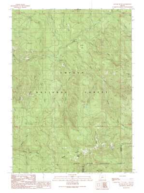
Butler Butte Topo Map Oregon
To zoom in, hover over the map of Butler Butte
USGS Topo Quad 42122h6 - 1:24,000 scale
| Topo Map Name: | Butler Butte |
| USGS Topo Quad ID: | 42122h6 |
| Print Size: | ca. 21 1/4" wide x 27" high |
| Southeast Coordinates: | 42.875° N latitude / 122.625° W longitude |
| Map Center Coordinates: | 42.9375° N latitude / 122.6875° W longitude |
| U.S. State: | OR |
| Filename: | o42122h6.jpg |
| Download Map JPG Image: | Butler Butte topo map 1:24,000 scale |
| Map Type: | Topographic |
| Topo Series: | 7.5´ |
| Map Scale: | 1:24,000 |
| Source of Map Images: | United States Geological Survey (USGS) |
| Alternate Map Versions: |
Butler Butte OR 1989, updated 1990 Download PDF Buy paper map Butler Butte OR 1998, updated 2000 Download PDF Buy paper map Butler Butte OR 2011 Download PDF Buy paper map Butler Butte OR 2014 Download PDF Buy paper map |
| FStopo: | US Forest Service topo Butler Butte is available: Download FStopo PDF Download FStopo TIF |
1:24,000 Topo Quads surrounding Butler Butte
> Back to 42122e1 at 1:100,000 scale
> Back to 42122a1 at 1:250,000 scale
> Back to U.S. Topo Maps home
Butler Butte topo map: Gazetteer
Butler Butte: Arches
Cow Horn Arch elevation 1301m 4268′Butler Butte: Areas
Green Prairie elevation 1161m 3809′Neal Camp Burn elevation 1398m 4586′
Butler Butte: Flats
Squaw Flat elevation 673m 2208′Butler Butte: Gaps
Tucker Gap elevation 1610m 5282′Butler Butte: Ranges
Grassy Range elevation 1572m 5157′Butler Butte: Ridges
Bald Ridge elevation 1610m 5282′Butler Butte: Streams
Black Canyon Creek elevation 512m 1679′Crooked Creek elevation 622m 2040′
Deadhorse Creek elevation 1155m 3789′
Deep Cut Creek elevation 501m 1643′
Donegan Creek elevation 766m 2513′
Eden Creek elevation 597m 1958′
Fawn Creek elevation 817m 2680′
Freezeout Creek elevation 501m 1643′
Luck Creek elevation 593m 1945′
Maverick Creek elevation 802m 2631′
Ralph Creek elevation 533m 1748′
Serviceberry Creek elevation 693m 2273′
Soup Creek elevation 504m 1653′
Squaw Creek elevation 527m 1729′
Tallow Creek elevation 543m 1781′
Twomile Creek elevation 593m 1945′
Whisky Creek elevation 489m 1604′
Butler Butte: Summits
Butler Butte elevation 1679m 5508′Tallow Butte elevation 880m 2887′
Butler Butte: Trails
Billick Burn Trail elevation 829m 2719′Fawn Camp Trail elevation 990m 3248′
North and South Trail elevation 898m 2946′
Butler Butte: Woods
Worlds Tallest Sugarpine elevation 527m 1729′Butler Butte digital topo map on disk
Buy this Butler Butte topo map showing relief, roads, GPS coordinates and other geographical features, as a high-resolution digital map file on DVD:


