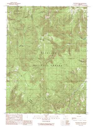
Buckskin Peak Topo Map Oregon
To zoom in, hover over the map of Buckskin Peak
USGS Topo Quad 42123a7 - 1:24,000 scale
| Topo Map Name: | Buckskin Peak |
| USGS Topo Quad ID: | 42123a7 |
| Print Size: | ca. 21 1/4" wide x 27" high |
| Southeast Coordinates: | 42° N latitude / 123.75° W longitude |
| Map Center Coordinates: | 42.0625° N latitude / 123.8125° W longitude |
| U.S. State: | OR |
| Filename: | o42123a7.jpg |
| Download Map JPG Image: | Buckskin Peak topo map 1:24,000 scale |
| Map Type: | Topographic |
| Topo Series: | 7.5´ |
| Map Scale: | 1:24,000 |
| Source of Map Images: | United States Geological Survey (USGS) |
| Alternate Map Versions: |
Buckskin Peak OR 1989, updated 1989 Download PDF Buy paper map Buckskin Peak OR 1996, updated 1999 Download PDF Buy paper map Buckskin Peak OR 2011 Download PDF Buy paper map Buckskin Peak OR 2014 Download PDF Buy paper map |
| FStopo: | US Forest Service topo Buckskin Peak is available: Download FStopo PDF Download FStopo TIF |
1:24,000 Topo Quads surrounding Buckskin Peak
> Back to 42123a1 at 1:100,000 scale
> Back to 42122a1 at 1:250,000 scale
> Back to U.S. Topo Maps home
Buckskin Peak topo map: Gazetteer
Buckskin Peak: Flats
Frantz Meadow elevation 699m 2293′Buckskin Peak: Lakes
Baldface Lake elevation 1132m 3713′Buckskin Peak: Springs
Cedar Springs elevation 1195m 3920′Mud Spring elevation 1146m 3759′
Buckskin Peak: Streams
North Fork Rough and Ready Creek elevation 522m 1712′South Fork Rough and Ready Creek elevation 522m 1712′
Whiskey Creek elevation 723m 2372′
Buckskin Peak: Summits
Buckskin Peak elevation 1198m 3930′Oregon Mountain elevation 1064m 3490′
Our Mountain elevation 1200m 3937′
Buckskin Peak: Trails
Chetco Divide Trail elevation 1112m 3648′Buckskin Peak digital topo map on disk
Buy this Buckskin Peak topo map showing relief, roads, GPS coordinates and other geographical features, as a high-resolution digital map file on DVD:


